Tejgaon Thana
| Tejgaon তেজগাঁও | |
|---|---|
| Thana | |
|
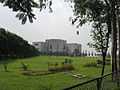
National Parliament, Dhaka, Bangladesh | |
 Tejgaon Location in Bangladesh | |
| Coordinates: 23°45.5′N 90°23.5′E / 23.7583°N 90.3917°ECoordinates: 23°45.5′N 90°23.5′E / 23.7583°N 90.3917°E | |
| Country |
|
| Division | Dhaka Division |
| District | Dhaka District |
| Area | |
| • Total | 2.74 km2 (1.06 sq mi) |
| Population (1991) | |
| • Total | 220,012 |
| • Density | 25,144/km2 (65,120/sq mi) |
| Time zone | BST (UTC+6) |
| Website | Official Map of the Tejgaon Thana |
.jpg)
Tejgaon (Bengali: তেজগাঁও) is a Thana of Dhaka District in the Division of Dhaka, Bangladesh. It is in the centre of Dhaka, the capital of Bangladesh. In 2006, the boundaries of the thana were redrawn when Tejgaon Industrial Area Thana was created out of the former larger area,[1] and again in 2009 when Sher-e-Bangla Nagar Thana was created.[2]
This is an important area of Dhaka city as prime minister's office is located here. It is bounded by Mohakhali to the north, Old Airport Road to the east and Moghbazar-Malibagh to the south and Dhanmondi to the west. It consists of several localities, including Tejgaon Industrial Area, Kawran Bazar, Nakhalpara, Shaheen Bag, Arjat para, East Rajabazar, West Rajabazar, Tejturi Bazar and Tejkunipara.

Geography
Tejgaon is located at 23°45′30″N 90°23′30″E / 23.7583°N 90.3917°E. The total area is 2.74 km².[1]
Demographics
As of 1991 Bangladesh census, Tejgaon has a population of 220012. Males constitute 58.86% of the population, and females 41.14%. This Upazila's eighteen up population is 137475. Tejgaon has an average literacy rate of 68% (7+ years), and the national average of 32.4% literate.[3]
Urban layout
Historically, the area has been a centre of industrial activity in the city. Numerous plants and factories are located in Tejgaon, in such diverse industries as garments, food processing, metal works, pharmaceuticals, etc. Indeed, the names of various places in Tejgaon indicate as much, for example:
- Bangladesh University of Textiles (BUTex)
- Tejgaon College
- Nabisco junction (named after the Nabisco biscuit factory)
- Tibet bus stop (named after a famous cosmetics manufacturer)
- Rahim Metal Mosque.
- Nakhalpara Sapra Mosque
- MP Hostel
- Nakhalpara Hossain Ali High School
- Rose Bud Kindergarten
- Ahsanullah University of Science & Technology
- Dhaka Polytechnic Institute (DPI)
- Technical Teachers Training College (TTTC)
- Govt Science College
- Pan Pacific Shonargaon Hotel
- Bashundhara City
Business

Tejgaon has emerged as an important business district of Dhaka. The first 5 star hotel of Bangladesh, Pan Pacific Hotel Sonargaon, is located at Kawran Bazar, Tejgaon. The main offices of the Daily Prothom Alo, the Daily Star (Bangladesh), The Independent, and several other newspapers are located here. Also, the office and studio of Television channels Ekushey Television, NTV, ATN Bangla, Boishakhi TV, Channel i and Channel 1 are located at Tejgaon. The main campus of Ahsanullah University of Science and Technology is located here as well.
Tejgaon also has the headquarters for the Trading Corporation of Bangladesh.
Shopping mall
Bashundhara City, the largest shopping mall in Bangladesh is located in Panthapath near Kawran Bazar.
It is also the largest shopping mall in South Asia and the 12th largest in the world.
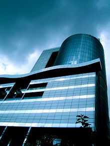
Bashundhara City is 21 stories tall, of which 8 are used for the mall and the remaining floors are used as the corporate headquarters of the Bashundhara Group.
The mall has space for 2,500 retail stores and cafeterias and also possesses a large underground gymnasium, a multiplex styled movie theater and top floor food court along with an indoor theme park. The fully air-conditioned shopping mall with rooftop gardens is considered a modern symbol of the emerging city of Dhaka.
Except this, Farmview Super Market, Saudia Super Market are also well known markets in Dhaka.
Bank
Almost every bank operating in Bangladesh has an outlet in Tejgaon. Foreign banks such as Citi, HSBC and Standard Chartered also have branches here, with HSBC and Standard Chartered having multiple ATM booths within the area. Also local bank like BRAC Bank, United Commercial Bank Limited, AB Bank, Dutch Bangla Bank, Jamuna Bank also have branches here.
Airport
Tejgaon Airport (ICAO: VGTJ) in Dhaka, Bangladesh served as the country's sole international airport prior to the construction of Shahjalal International Airport.
The first RIAF light fighter landed on the under-construction runway of Tejgaon at the beginning of 1943.
Following the transfer of civilian flights to the newly built Shahjalal International Airport in 1981, Tejgaon was taken under the control of the Bangladesh Air Force.
Education
Over the last fifty years a large number of schools, colleges and private universities have been developed around the area. Such as Bangladesh University of Textiles, Dhaka Polytechnic Institute, Govt Science College, Holy Cross College (Dhaka), Tejgaon College, Tejgaon Govt High School, Tejgaon Government Girls' High School, Green University of Bangladesh, B.A.F Shaheen College are the most well known. The National Institute of Ear, Nose and Throat (ENT) is situated here.
Restaurants
There are many well known restaurants present in Tejgaon. Like Star Hotel and Restaurant, Marine Restaurant, Park Town, Yan-Ji Chinese Restaurant, Hiramon Kabab Ghar, Ciao Bistro and Aromaz at Hotel Pan Pacific Shonargaon, Dominous Pizza and Salt Grill Restaurant in Bashundhara City and others.
There are also some bars in Tejgaon. Such as Hotel Red Button and Balcony Bar at Hotel Pan Pacific Shonargaon.
Park and lake
Chandrima Uddan (sometimes called Zia Uddan) is a park situated in the road beside the Jatiyo Sangshad Bhaban, in Dhaka, Bangladesh. The name literally means "Moonlight Park" in Bengali.
The park is notable for being the place where the former Bangladeshi President, Ziaur Rahman was buried. It is connected to the road with a bridge which runs over the Crescent Lake. The park is a very common place to spend leisure time. This park is very popular for morning and evening walk.
Also there is Farmgate Park, which is also a very popular destination for young boys and girls.
Important structures
-
.jpg)
Novo Theatre (Planetarium)
-
.JPG)
Ratna Dip
-

SAARC Foara
-
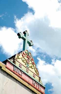
Holy Rosary Church
- Prime Minister's Office
- Jatiyo Sangshad Bhaban
- BhashaniNovo Theatre (Planetarium)
- Holy Rosary Church (Dhaka)
- Bashundhara City
- Bijoy Shoroni Fountain
- SAARC Fountain
- Island of Pearl-Ratna dip in front of Prime Minister Office
- Pan Pacific Shonargaon Hotel
Gallery


See also
References
- ↑ 1.0 1.1 Syed Shabbir Ahmed (2012). "Tejgaon Thana". In Sirajul Islam and Ahmed A. Jamal. Banglapedia: National Encyclopedia of Bangladesh (Second ed.). Asiatic Society of Bangladesh.
- ↑ Shamsun Nahar (2012). "Sher-e-Bangla Nagar Thana". In Sirajul Islam and Ahmed A. Jamal. Banglapedia: National Encyclopedia of Bangladesh (Second ed.). Asiatic Society of Bangladesh.
- ↑ "Population Census Wing, BBS.". Archived from the original on 2005-03-27. Retrieved November 10, 2006.