Tehran
| Tehran تهران | |||||||||
|---|---|---|---|---|---|---|---|---|---|
| Metropolis | |||||||||
| کلانشهر تهران · Tehran Metropolis | |||||||||
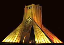
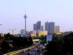
Clockwise from top: Azadi Tower, Shemiran, Ab o Atash Park, Mount Tochal seen from Modarres Expressway, Shams ol Emareh, Ferdows Garden, and Milad Tower seen from Parkway. | |||||||||
| |||||||||
 | |||||||||
 Tehran | |||||||||
| Coordinates: 35°41′46″N 51°25′23″E / 35.69611°N 51.42306°ECoordinates: 35°41′46″N 51°25′23″E / 35.69611°N 51.42306°E | |||||||||
| Country |
| ||||||||
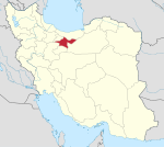
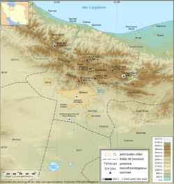
| Province | Tehran | ||||||||
| County |
Tehran Shemiranat | ||||||||
| Bakhsh (District) | Central | ||||||||
| Government | |||||||||
| • Mayor | Mohammad Bagher Ghalibaf | ||||||||
| • City Council | Chairman: Mehdi Chamran | ||||||||
| Area | |||||||||
| • Urban | 686 km2 (265 sq mi) | ||||||||
| • Metro | 13,692 km2 (5,287 sq mi) | ||||||||
| Elevation | 1,200 to 1,980 m (3,900 to 6,470 ft) | ||||||||
| Population (2011) | |||||||||
| • Density | 11,887/km2 (30,790/sq mi) | ||||||||
| • Urban | 8,154,051[1] | ||||||||
| • Metro | 12,183,391[1] | ||||||||
| • Population Rank in Iran | 1st | ||||||||
| Population Data from 2011 Census and Statistical Center of Iran Metro area figure refers to Tehran Province. | |||||||||
| Demonym | Tehrani (en) | ||||||||
| Time zone | IRST (UTC+03:30) | ||||||||
| • Summer (DST) | IRDT (UTC+04:30) | ||||||||
| Area code(s) | 021 | ||||||||
| Website | www.tehran.ir | ||||||||
.jpg)
Tehran (![]() pronunciation ) (Persian: تهران - Tehrān) is the capital of Iran and Tehran Province. With a population of around 8.4 million and 12.7 million (2015) in the wider metropolitan area, Tehran is Iran's largest city and urban area, and the largest city in Western Asia.
pronunciation ) (Persian: تهران - Tehrān) is the capital of Iran and Tehran Province. With a population of around 8.4 million and 12.7 million (2015) in the wider metropolitan area, Tehran is Iran's largest city and urban area, and the largest city in Western Asia.
Until 1796, Tehran was an unimportant village. In 1796, Agha Mohammed Khan chose Tehran as Iran's new capital. Throughout Iran's history, the capital has been moved many times, Tehran is the 32nd national capital of Iran. In pre-Islamic times, part of the area of present-day Tehran was occupied by Rey (which in the Avesta occurs in the form[2] of Rhaga), now a part of the city of Tehran, which took over its role after the destruction of Rey by the Mongols in the early 13th century.
In the 20th and 21st centuries, Tehran has been the subject of mass migration of people from all over Iran.[3] The city is home to many historic mosques as well as several churches, synagogues and Zoroastrian fire temples. However, modern structures, notably Azadi Tower and the Milad Tower, have come to symbolize the city. Tehran is ranked 29th in the world by the population of its metropolitan area.[4] Although a variety of unofficial languages are spoken, roughly 99% of the population understand and speak Persian.
There are plans to relocate Iran's capital from Tehran to another area because Tehran is prone to earthquakes. The majority of the inhabitants of the city are Persians, but there are also populations of other Iranian ethnicities such as Lurs, Armenians,[5] Kurds, and Azeri Turks who speak Persian as of their second language.[6] The majority of people in Tehran identify themselves as Persians.[7][8]
History
Tehran has been hosting communities for over 7,000 years.[9]
An important historical city in the area of modern-day Tehran, now absorbed by it, is known as "Rey", which is etymologically connected to the Old Persian and Avestan "Rhages".[10] The city was a major area of the Iranian speaking Medes and Achaemenids.
In the Zoroastrian Avesta's Videvdad (i, 15), Rhaga is mentioned as the twelfth sacred place created by Ahura-Mazda.[11] In the Old Persian inscriptions (Behistun 2, 10–18), Rhaga appears as a province. From Rhaga, Darius the Great sent reinforcements to his father Hystaspes (Vishtaspa), who was putting down the rebellion in Parthia (Behistun 3, 1–10).[11]
The Damavand mountain located near the city also appears in the Shahnameh as the place where Freydun bounds the dragon-fiend Zahak. Damavand is important in Persian mythological and legendary events.[12] Kyumars, the Zoroastrian prototype of human beings and the first king in the Shahnameh, was said to have resided in Damavand.[12] In these legends, the foundation of the city of Damavand was attributed to him.[12] Arash the Archer, who sacrificed his body by giving all his strength to the arrow that demarcated Iran and Turan, shot his arrow from Mount Damavand.[12] This Persian legend was celebrated every year in the Tiregan festival. A popular feast is reported to have been held in the city of Damavand on 7 Shawwal 1230, or in Gregorian calendar, 31 August 1815. During the alleged feast the people celebrated the anniversary of Zahak's death.[12] In the Zoroastrian legends, the tyrant Zahak is to finally be killed by the Iranian hero Garshasp before the final days.[12]
In some Middle Persian texts, Rey is given as the birthplace of Zoroaster,[13] although modern historians generally place the birth of Zoroaster in Khorasan. In one Persian tradition, the legendary king Manuchehr was also born in Damavand.[12]
During the Sassanid era, Yazdegerd III in 641 issued from Rey his last appeal to the nation before fleeing to Khorasan.[11] Rey was the fief of the Parthian Mihran family, and Siyavakhsh, the son of Mihran the son of Bahram Chobin, resisted the Muslim Invasion.[11] Because of this resistance, when the Arabs captured Rey, they ordered the town to be destroyed and ordered Farrukhzad to rebuild the town.[11]
There is also a temple in Ray, which is said to be one of the temples of Anahita, the Iranian goddess of waters. But after the Muslim invasion, it got dedicated to Bibi Shahr Banou, eldest daughter of Yazdegerd III, and one of the wives of Husayn ibn Ali, the fourth leader of Shia faith.
In the 10th century, Rey was described in details in the work of Islamic geographers.[11] Despite the interest of Baghdad displayed in Rey, the number of Arabs there was insignificant, and the population consisted of Persians of all classes.[11][14] The Oghuz Turks laid Rey to waste in 1035 and in 1042, but the city recovered during the Seljuq dynasty and Khwarazmian era.[11] The Mongols laid Rey to complete waste and according to Islamic historians of the era, virtually all of its inhabitants were massacred.[11] The city is mentioned in later Safavid chronicles[11] as an unimportant city.
The origin of the name "Tehran" is unknown.[15] Tehran was well known as a village in the 9th century, but was less well-known than the city of Rey which was flourishing nearby in the early era. Najm ol Din Razi, known as Daya, gives the population of Rey as 500,000 before the Mongol invasion. In the 13th century, following the destruction of Rey by Mongols, many of its inhabitants escaped to Tehran. In some sources of the early era, the city is mentioned as "Rhages' Tehran". The city is later mentioned in Hamdollah Mostowfi's Nozhat ol Qolub (written in 1340) as a famous village.
-

Toopkhaneh Square in 1911
-

A street in Tehran during the 1930s
-

Tehran City map in 1857
-

A former Parliament Building, built in the 1920s
-
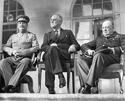
Stalin, Roosevelt, and Churchill at the Tehran Conference
-

Entrance of the Mirror Hall of Golestan Palace
-

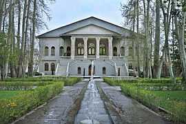
The White House of Pahlavi
-

Pavillion of Ahmad Shah Qajar in Niavaran Palace Complex
-

Azadi square and tower, constructed in 1971
Don Ruy González de Clavijo, a Castilian ambassador, was probably the first European to visit Tehran, stopping in July 1404, while on a journey to Samarkand (now in Uzbekistan), the capital of Timur, who ruled Iran at the time. At that time, the city of Tehran was unwalled.
Early modern era and establishment as the capital
In the early 18th century, Karim Khan of Zand dynasty ordered a palace and a government office to be built in Tehran, possibly to declare the city his capital, but later moved his government to Shiraz. Once again, in 1776, Tehran became the capital of Iran, as done by the Qajar king Agha Mohammad Khan.[16] The capital of Iran has remained Tehran ever since.
Agha Mohammad Khan's choice of his capital was based on a similar concern for control of both the northern and the southern regions.[17] He was aware of the loyalties of the inhabitants of previous capitals, Isfahan and Shiraz, to the Safavid and Zand dynasties, respectively, and was wary of the power of the notables in these cities.[18] He probably viewed Tehrans' lack of a substantial urban structure as a blessing, because it minimized the chances of resistance to his rule by the notables and by the general public.[19] Moreover, the Shah had to remain within close reach of Azarbaijan and Iran's integral Caucasian territories,[20] at that time not yet lost per the Treaty of Gulistan and Treaty of Turkmenchay.
After 50 years of Qajar rule the city still barely had more than 80,000 inhabitants.[21]
Modern era
From the 1920s to 1930s, the city essentially was rebuilt from scratch under the rule of Reza Shah Pahlavi. Reza Shah believed that ancient buildings such as large parts of the Golestan Palace, Tekieh Dowlat, the Toopkhaneh Square, the city fortifications, and the old citadel among others, should not be part of a modern city. They were systematically demolished, and modern buildings in the pre-Islamic Iranian style, such as the National Bank, the Police Headquarters, the Telegraph Office, and the Military Academy, were built in their place. The Tehran Bazaar was divided in half and many historic buildings were demolished, in order to build wide straight avenues in the capital. Many Persian gardens also fell victim to new construction projects.[22]
During the Second World War, Soviet and British troops entered the city. Tehran was the site of the Tehran Conference in 1943, attended by U.S. President Franklin D. Roosevelt, Soviet Premier Joseph Stalin, and British Prime Minister Winston Churchill.
Between the 1960s to 1970s, Tehran was rapidly developing under the reign of Mohammad Reza Pahlavi. Modern buildings altered the face of Tehran and ambitious projects were envisioned for the following decades. The majority of these projects, such as Milad Tower, were continued after the Revolution of 1979, when Tehran's urbanization had reached its peak, and the new government started many other new projects.
During the 1980–88 Iran–Iraq War, Tehran was the target of repeated Scud missile attacks and air strikes.
City development
Up through the 1870s, Tehran consisted of the walled “arg” (royal citadel), the roofed bazaar, and “sharestan” (where the masses resided in three main neighborhoods of Udlajan, Chaleh Meydan, and Sangelaj). The first development plan of Tehran in 1855 emphasized the traditional spatial structure. Architecture, however, found an eclectic expression to reflect the new lifestyle.

The second major planning exercise in Tehran took place under the supervision of Dar ol Fonun. The map of 1878 included new city walls, in the form of a perfect octagon with an area of 19 square kilometers, which mimicked the Renaissance cities of Europe.[23]
As a response to the growing social consciousness of civil rights, on June 2, 1907, the first parliament of Persian Constitutional Revolution passed a law on local governance known as "Baladieh Law". The second and third articles of the law, on "Baladieh Community", or the city council, provide a detailed outline on issues such as the role of the councils in the city, the members' qualifications, the election process, and the requirements to be entitled to vote.
After the First World War, Reza Shah immediately suspended the Baladieh Law of 1907 and the decentralized and autonomous city councils were replaced by centralist/sectoralist approaches of governance and planning.[23]
The changes in the urban fabric started with the street-widening act of 1933 which served as a framework for changes in all other cities. As a result of this act, the traditional texture of the city was replaced with cruciform intersecting streets creating large roundabouts, located on the major public spaces such as the bazaar or the hussainia.
As an attempt to create a network for the easy movement of goods and vehicles in Tehran, the city walls and gates were demolished in 1937 and replaced by wide streets cutting through the urban fabric. The new city map of Tehran in 1937 was heavily influenced by modernist planning patterns of zoning and gridiron network.[23]

The establishment of the planning organization of Iran in 1948 resulted in the first socio-economic development plan to cover 1949 to 1955. These plans not only failed to slow the unbalanced growth of Tehran but with the 1962 land reforms, that Shah called the "White Revolution", Tehran's growth was further accentuated.
To bring back order to the city and resolve the problem of social exclusion, the first comprehensive plan of Tehran was approved in 1968. The consortium of Iranian consultants, Abd ol Aziz Mirza Farmanian, and the American firm of Victor Gruen Associates, identified the city problems to be high density, including expansion of new suburbs, air and water pollution, inefficient infrastructure, unemployment, and rural-urban migration. Eventually, the whole plan was marginalized by the Revolution of 1979 and the subsequent Iran-Iraq War.[23]
Climate


Tehran features a semi-arid climate (Köppen climate classification: BSk). Tehran's climate is largely defined by its geographic location, with the towering Alborz Mountains to its north and the central desert to the south. It can be generally described as mild in the spring and autumn, hot and dry in the summer, and cold in the winter. Because the city is large with significant differences in elevation among various districts, the weather is often cooler in the hilly north than in the flat southern part of Tehran. For instance, the 17.3 km (10.7 mi) Valiasr Street runs from the Tehran's railway station than, 1,117 m (3,665 ft) elevation above sea level, in the south of the city to the Tajrish Square, 1,612 m (5,289 ft) elevation above sea level, in the north. However, the elevation can even rise up to 1,900 m (6,200 ft) at the end of the Velenjak Street in the north of Tehran.
Summer is usually hot and dry with very little rain, but relative humidity is generally low and the nights are cool. Most of the light annual precipitation occurs from late autumn to mid-spring, but no one month is particularly wet. The hottest month is July, mean minimum temperature 26 °C (79 °F); mean maximum temperature 36 °C (97 °F), and the coldest is January, mean minimum temperature −1 °C (30 °F); mean maximum temperature 8 °C (46 °F).[24]
Although Tehran enjoys a more moderate climate than other parts of the country, the weather can sometimes be unpredictably harsh. The record high temperature is 43 °C (109 °F) and the record low is −17 °C (1 °F). On January 5 and 6, 2008, after years of relatively little snow, a wave of heavy snow and low temperatures covered the city in a thick layer of snow and ice, forcing the Council of Ministers to officially declare a state of emergency and closing down the capital on January 6 and 7.[25]
Tehran has seen an increase in relative humidity and annual precipitation since the beginning of the 21st century. This is most likely because of the afforestation projects, which also include expanding parks and lakes. The northern parts of Tehran are still more lush than the southern parts.
Tehran's climate can be described to have some monsoon influences; the summers and winters are very dry, and the springs and falls are rather lush, with the main precipitation occurring at these times.
Circumstances
In February 2005, heavy snow covered all of the parts of the city. Snow depth was 15 cm (6 in) in south part of the city and 100 cm (39 in) in the north of city. A newspaper said it had been the worst weather for 34 years. 10,000 bulldozers and 13,000 municipal workers deployed to keep the main roads open.[26][27]
On February 3, 2014, Tehran reached a heavy snowfall, specifically in the northern parts of the city, with a height of 2 meters. Within the one week successive snowfall roads were made impassable in some areas in north of Tehran along with a temperature variety of -8 °C to -16 °C [28]
On June 3, 2014, a severe thunderstorm with powerful microbursts created a haboob that engulfed the city in sand and dust. Five people were killed and more than 57 injured. This disaster also knocked numerous trees and power lines down. It struck between 5 and 6 PM, plummteing temperatures from 33 °C to 19 °C in just an hour. The dramatic temperature drop was accompanied by wind gusts reaching nearly 118 km/h. [29]
| Climate data for Tehran's Mehrabad Airport, Altitude: 1191 M | |||||||||||||
|---|---|---|---|---|---|---|---|---|---|---|---|---|---|
| Month | Jan | Feb | Mar | Apr | May | Jun | Jul | Aug | Sep | Oct | Nov | Dec | Year |
| Record high °C (°F) | 19.6 (67.3) |
23.0 (73.4) |
28.0 (82.4) |
32.4 (90.3) |
37.0 (98.6) |
41.0 (105.8) |
43.0 (109.4) |
42.0 (107.6) |
38.0 (100.4) |
33.4 (92.1) |
27.0 (80.6) |
23.0 (73.4) |
43 (109.4) |
| Average high °C (°F) | 8.3 (46.9) |
11.1 (52) |
17.2 (63) |
22.8 (73) |
28.5 (83.3) |
34.5 (94.1) |
36.8 (98.2) |
35.9 (96.6) |
31.6 (88.9) |
25.4 (77.7) |
15.8 (60.4) |
10.4 (50.7) |
23.19 (73.73) |
| Average low °C (°F) | 1.2 (34.2) |
3.3 (37.9) |
8.0 (46.4) |
13.4 (56.1) |
18.4 (65.1) |
23.1 (73.6) |
25.7 (78.3) |
24.9 (76.8) |
21.3 (70.3) |
15.9 (60.6) |
8.0 (46.4) |
3.3 (37.9) |
13.88 (56.97) |
| Record low °C (°F) | −15.0 (5) |
−13.0 (8.6) |
−8.0 (17.6) |
−4.0 (24.8) |
2.4 (36.3) |
5.0 (41) |
14.0 (57.2) |
13.0 (55.4) |
9.0 (48.2) |
2.8 (37) |
−7.0 (19.4) |
−13.0 (8.6) |
−15 (5) |
| Average precipitation mm (inches) | 34.6 (1.362) |
32.2 (1.268) |
40.8 (1.606) |
30.7 (1.209) |
15.4 (0.606) |
3.0 (0.118) |
2.3 (0.091) |
1.8 (0.071) |
1.1 (0.043) |
10.9 (0.429) |
26.0 (1.024) |
34.0 (1.339) |
232.8 (9.166) |
| Avg. rainy days | 9.1 | 8.4 | 10.9 | 10.7 | 8.8 | 3.0 | 2.1 | 1.3 | 1.0 | 5.2 | 7.1 | 8.8 | 76.4 |
| Avg. snowy days | 5.1 | 2.9 | 1.1 | 0.1 | 0 | 0 | 0 | 0 | 0 | 0 | 0.4 | 2.7 | 12.3 |
| Average relative humidity (%) | 64 | 56 | 48 | 41 | 33 | 25 | 26 | 26 | 27 | 36 | 49 | 62 | 41.1 |
| Mean monthly sunshine hours | 177 | 185 | 220 | 219 | 285 | 330 | 338 | 341 | 303 | 248 | 198 | 152 | 2,996 |
| Source: [30] | |||||||||||||
| Climate data for Tehran-Shomal (north of Tehran), Altitude: 1548.2 M from: 1988-2005 | |||||||||||||
|---|---|---|---|---|---|---|---|---|---|---|---|---|---|
| Month | Jan | Feb | Mar | Apr | May | Jun | Jul | Aug | Sep | Oct | Nov | Dec | Year |
| Record high °C (°F) | 16.4 (61.5) |
19.0 (66.2) |
23.8 (74.8) |
33.6 (92.5) |
33.6 (92.5) |
37.8 (100) |
39.8 (103.6) |
39.4 (102.9) |
35.6 (96.1) |
31.2 (88.2) |
23.0 (73.4) |
19.0 (66.2) |
39.8 (103.6) |
| Average high °C (°F) | 6.1 (43) |
8.1 (46.6) |
12.9 (55.2) |
19.8 (67.6) |
25.0 (77) |
31.2 (88.2) |
33.9 (93) |
33.5 (92.3) |
29.3 (84.7) |
22.4 (72.3) |
14.3 (57.7) |
8.6 (47.5) |
20.43 (68.76) |
| Average low °C (°F) | −1.5 (29.3) |
−0.2 (31.6) |
4.0 (39.2) |
9.8 (49.6) |
14 (57) |
19.6 (67.3) |
22.6 (72.7) |
21.9 (71.4) |
17.5 (63.5) |
11.6 (52.9) |
5.4 (41.7) |
1.0 (33.8) |
10.48 (50.83) |
| Record low °C (°F) | −11.4 (11.5) |
−11.0 (12.2) |
−8.0 (17.6) |
−1.6 (29.1) |
3.0 (37.4) |
12.0 (53.6) |
15.4 (59.7) |
13.5 (56.3) |
8.8 (47.8) |
2.6 (36.7) |
−5.2 (22.6) |
−9.6 (14.7) |
−11.4 (11.5) |
| Average precipitation mm (inches) | 63.1 (2.484) |
66.5 (2.618) |
83.3 (3.28) |
50.1 (1.972) |
27.1 (1.067) |
4.0 (0.157) |
4.2 (0.165) |
3.2 (0.126) |
3.4 (0.134) |
16.5 (0.65) |
41.3 (1.626) |
66.3 (2.61) |
429 (16.889) |
| Avg. rainy days | 12.3 | 10.9 | 12.3 | 10.0 | 8.9 | 3.3 | 3.4 | 1.6 | 1.3 | 5.8 | 8.6 | 10.7 | 89.1 |
| Avg. snowy days | 8.9 | 6.6 | 2.5 | 0.1 | 0.1 | 0 | 0 | 0 | 0 | 0 | 0.6 | 4.9 | 23.7 |
| Average relative humidity (%) | 67 | 59 | 53 | 44 | 39 | 30 | 31 | 31 | 33 | 44 | 57 | 66 | 46.2 |
| Mean monthly sunshine hours | 137.2 | 151.1 | 186.0 | 219.1 | 279.8 | 328.7 | 336.6 | 336.8 | 300.5 | 246.8 | 169.4 | 134.1 | 2,826.1 |
| Source: [30] | |||||||||||||
-
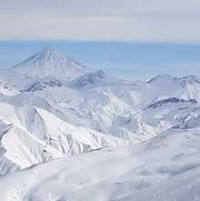
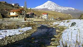
A view of Mount Damavand along 5,670 m altitude as seen from the Dizin Ski Resort
-

The Nation Park in autumn
-

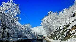
Tehran in winter
-

A stream in Darband
-

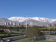
Mount Tochal, seen from Modarres Expressway
Demographics
.png)

The city of Tehran (not to be confused with the larger, Tehran Metropolitan) had a population of approximately 7.8 million in 2006.[31] With its cosmopolitan atmosphere, Tehran is home to diverse ethnic and linguistic groups from all over the country. The native language of the city is the Tehrani accent of Persian language, and the majority of people in Tehran identify themselves as Persians.[8][32] However, historically, the original native dialect of the Tehran–Rey region is not Persian, which is linguistically Southwest Iranian and originates in Fars (Pars) in the south of the country, but a (now extinct) Northwest Iranian dialect belonging to the Central Iran group.[33] and Azeris about 25%[34] to 1/3,[35][36] and other ethnic Minority groups included Kurds, Arabs, Baluch, Armenians, Bakhtiari, Assyrians, Talysh, Georgians, Jews, Circassians, and more. According to a 2010 census conducted by the Sociology Department of Tehran University in many districts of Tehran across various socio-economic classes in proportion to population sizes of each district and socio-economic class, 63% of people in Tehran were born in Tehran, 98% know Persian, 75% identify themselves as ethnic Persian, and 13% have some degree of proficiency in a European language.[37]
Tehran saw a drastic change in its ethno-social composition in the early 1980s. After the political, social and economic consequences of the Revolution of 1979 and the years that followed, some Iranian citizens, mostly Tehranis, left Iran due to the pressures. Many Iranians moved to European countries. The highest Iranian emigrations has been to the United States, France, Germany, Sweden and Canada.
With the start of the Iran–Iraq War (1980–1988) following the Iraqi invasion, a second wave of inhabitants fled the city, especially during Iraqi air offensives on the capital. With most major powers backing Iraq at the time, economic isolation caused even more reasons for the inhabitants to leave the city (and the country). Having left all they had and having struggled to adapt to a new country and build a life, most of them never came back when the war was over. During the war, Tehran also received a great number of migrants from the west and the southwest of the country bordering Iraq.
The unstable situation and the war in neighboring Afghanistan and Iraq prompted a rush of refugees into the country who came in millions, with Tehran being a magnet for modest workers who helped the city to recover from war wounds, charging far less than local construction workers. Many of these refugees are being repatriated with the assistance of UNHCR but there are still sizable groups of Afghan and Iraqi refugees in Tehran who are reluctant to leave, being pessimistic about the situation in their own countries. Afghan refugees are mostly Persian-speaking Hazara or Tajiks, speaking a dialect of Persian, and Iraqi refugees, who are mainly Shia Muslim Mesopotamian Arabic-speakers often of Iranian origin.
The majority of Tehranis are officially Twelver Shia Muslims, which is also the state religion since the Muslim Invasion of Iran. Religious minorities include followers of various sects of Sunni Islam, Mystic Islam, Christianity, Zoroastrianism, Judaism, and some from the Baha'i Faith. Tehran also has very small number of third generation Iranian Sikh community that has a gurudwara visited by Indian Prime Minister in 2012.[38]
Capital relocation
A plan to move the capital has been discussed many times in prior years. In 2010, the government of Iran announced that "for security and administrative reasons" the plan to move the capital from Tehran has been finalized.[39] The Iranian Parliament named Shahroud, Esfahan and Semnan as three of main candidates to replace Tehran as the capital. There are plans to relocate 163 state firms to the provinces and several universities from Tehran to avoid damages from a potential earthquake. Mahmoud Ahmadinejad suggested that 5 million residents should migrate out of Tehran.[39][40] As a starting point, Iranian authorities are relocating all defense-related industries out of the capital.[41]
Throughout Iran's history, the capital has been moved many times. Tehran is the 32nd national capital of Iran.
Location and subdivisions
Tehran county borders Shemiranat County to the north, Damavand County to the east, Eslamshahr, Pakdasht, and Rey counties to the south, and Karaj and Shahriar counties to the west.
| Regions and municipal districts of Tehran | |||||
|---|---|---|---|---|---|
|
-

View of Elahieh and Modares Expressway
-

Streets and alleys of Northern Tehran usually look wider and more lush.
-
Roads of the district of Rudbar e Qasran
-
View of Mount Damavand and Haraz River from Manzariye village, Polur
Northern Tehran
Northern Tehran is a wealthy region of the city. It consists of various smaller districts from northeast to northwest, such as Zaferanie, Jordan, Elahie, Kamranieh, Ajodanie, Farmanie, Darrous, Qeitarie, etc.[42][43] Northern Tehran is known as posh area where many liberal and intellectual Iranians with often secular ideas live.[42][43] However, in recent years, more families from traditional bazaar and government official millionaires are living there.
Shopping
Tehran has a wide range of shopping opportunities, from traditional bazaars to shopping districts and modern shopping malls. The great Bazaar of Tehran and the Tajrish Bazaar are the biggest traditional bazaars in Tehran. Shopping districts such as Valiasr, Shariati, Mirdamad have shopping with a wide range of different shops. Big malls like Tiraje, Hyperstar, and smaller shopping centers like Tandis, Golestan, and Safavie are popular among Tehran's population and visitors.
Most of the international brands and upper class shops are located in the northern and western parts of the city, and the rest of the shops are distributed in all the areas of the city. Tehran's retail business is growing with new malls and shopping centers being built. The biggest malls under construction are the Tehran Mega Mall, Kourosh Mall, and smaller "luxurious" shopping centers like Zafaranie or Farmanie shopping center.
-

Hyper Star Shopping Center
-

Hyper Star Shopping Center
-

Tiraje Shopping Center
-

Tandis Mall in Tajrish
-

Tehran Traditional Bazaar
Administrative subdivisions
Tehran is divided into 22 municipal districts, each with its own administrative center. Each of these municipal districts are further subdivided into municipal regions.
| Municipal districts of Tehran | ||||||||||||||||||||||||||||||||||||||||||||||||||||||||||||||||||||||||||||||||||||||||||||||||||||||||||||||||||||||||||||||||||||||||||||||||||||||||||||||||||||||||||||||||||||||||
|---|---|---|---|---|---|---|---|---|---|---|---|---|---|---|---|---|---|---|---|---|---|---|---|---|---|---|---|---|---|---|---|---|---|---|---|---|---|---|---|---|---|---|---|---|---|---|---|---|---|---|---|---|---|---|---|---|---|---|---|---|---|---|---|---|---|---|---|---|---|---|---|---|---|---|---|---|---|---|---|---|---|---|---|---|---|---|---|---|---|---|---|---|---|---|---|---|---|---|---|---|---|---|---|---|---|---|---|---|---|---|---|---|---|---|---|---|---|---|---|---|---|---|---|---|---|---|---|---|---|---|---|---|---|---|---|---|---|---|---|---|---|---|---|---|---|---|---|---|---|---|---|---|---|---|---|---|---|---|---|---|---|---|---|---|---|---|---|---|---|---|---|---|---|---|---|---|---|---|---|---|---|---|---|---|
|


Food and restaurants
Tehran has many modern and classical restaurants and cafes, serving both traditional Iranian and cosmopolitan cuisine. One of the most popular dishes of the city is the chelow kabab (kabob/kebab is originally a Persian word meaning grilled or roasted meat). Fast food is also popular, especially within the younger generation. Pizza, sandwich and kebab shops make up the majority of food outlets in the city.
-

A restaurant in Darband
-

Romance Cafe, near Ferdowsi Square
-

Shemroon Cafe
-

A restaurant serving Persian and Spanish food in Tehran
Economy

Tehran is the economic center of Iran.[44] About 30% of Iran's public-sector workforce and 45% of large industrial firms are located in the city and almost half of these workers are employed by the government.[45] Most of the remainder of workers are factory workers, shopkeepers, laborers, and transport workers.

Few foreign companies operate in Tehran because of the Iranian government's relations with the west. But before the Revolution of 1979, many foreign companies were active in this region.[46] Today many modern industries of this city include the manufacturing of automobiles, electronics and electrical equipment, weaponry, textiles, sugar, cement, and chemical products. It is also a leading center for the sale of carpets and furniture. There is an oil refinery near Rey, south of the city.
Tehran has four airports. Mehrabad International Airport and Tehran Imam Khomeini International Airport are the two active ones. Doshan Tappeh Air Base is closed, and the former Ghale Morghi Air Base has been converted to an amusement park named Velayat Park.
Tehran relies heavily on private cars, buses, motorcycles, and taxis, and is one of the most car-dependent cities in the world. The Tehran Stock Exchange, which is a full member of the Federation Internationale des Bourses de Valeurs (FIBV) and a founding member of the Federation of Euro-Asian Stock Exchanges, has been one of the world's best performing stock exchanges in recent years.[47]
Transportation
Cars
According to the head of Tehran Municipality's Environment and Sustainable Development Office, Tehran has a capacity almost for 700,000 cars but currently more than 3 million cars are on the roads. The automation industry has recently developed but international sanctions influence the production processes periodically.[48]
-

Traffic jams in Tehran
-

Northern Kordestan Expressway
-

Taxi in Tehran
-

Traffic in Tehran
-

Felestin St.
Airport
Tehran is served by two main airports. Mehrabad Airport, an old airport which doubles as a military base, is used for domestic and charter flights. This airport is located in the western part of the city. Imam Khomeini International Airport located 50 kilometres (31 miles) south of the city, handles all international flights.
Metro

Tehran claims to have one of the cleanest and most convenient metro systems, in terms of accessibility to different parts of the city, in the region. The feasibility study and conceptual planning of the construction were started in the 1970s. In 2001, the first two of the eight projected metro lines were opened. Now, Tehran's metro has five operative lines and is 152 km (94 mi) long, with two other lines under construction.
Train
Tehran also has a central railway station with connecting services round the clock to various cities in the country. A Tehran-Europe train line is also running.
Bus
Tehran's transport system includes conventional buses, trolleybuses and Bus Rapid Transit (BRT). Buses have served the city since the 1920s. There are four bus terminals that also provide connections at low rates. The terminals are located on the south, east, and west, and Bei-haqi Park-Drive.
The trolleybus system opened in 1992, using a fleet of 65 articulated trolleybuses built by Skoda.[49] This was the first trolleybus system in Iran and remains the country's only such system.[49] In 2005, trolleybuses were operating on five routes, all starting at Imam Hossein Square,[50] near Imam Hossein Station of the Tehran Metro Line 2. Two routes running northeastwards operate almost entirely in a segregated busway located in the middle of the wide carriageway (along Damavand Street), stopping only at purpose-built stops located about every 500 metres, effectively making these routes trolleybus-BRT (but they are not called such). The other three trolleybus routes run south from Imam Hossein Square and operate in mixed-traffic. Both route sections are served by limited-stop services and local (making all stops) services.[50] A 3.2-km extension from Shoosh Square to Rah Ahan Square and the railway station there opened in March 2010.[51]
Tehran Bus Rapid Transit was officially inaugurated in 2008 by Tehran's mayor of that time, Mohammad Baqer Qalibaf. BRT has three lines with 60 stations in different areas of the city. As at 2011, BRT had a network of 100 kilometres (62 miles), transporting 1.8 million passengers on a daily basis. The city has also developed a bicycle sharing system which includes 12 stations in one of Tehran's districts.[52]
-

Tehran main railway station
-

An urban bus
-

Rapid Transit Bus at the Azadi terminal


Highways and streets
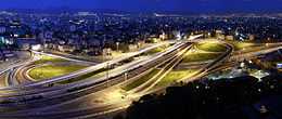
The metropolis of Tehran enjoys a huge network of highways (280 km) and of interchanges, ramps, and loops (180 km). In 2007 there were 130 km (81 mi) of highways and 120 km (75 mi) of ramps and loops under construction.[53]
-

Valiasr Street during Nowruz
-

Hemmat underpass
-

Modarres Expressway

While the center of the city houses the government ministries and headquarters, the commercial centers are more located toward Valiasr Street (formerly known as Pahlavi Street), Taleghani Ave, and Beheshti Ave further north. Although administratively separate, Rey, Shemiran, and Karaj are often considered part of the larger Tehran metropolitan area.
A number of streets in Tehran are names after international figures:
- Henri Corbin Street – downtown Tehran
- Edward Browne Street – near the Tehran University
- Gandhi Street – northern Tehran
- Muhammad Ali Jinnah Expressway – western Tehran
- Iqbal Lahori Street – eastern Tehran
- Patrice Lumumba Street – western Tehran
- Bobby Sands Street – western side of British Embassy
- Simón Bolívar Street – north western Tehran
- Nelson Mandela Boulevard - north of Tehran
Air pollution


Tehran suffers from severe air pollution and the city is often covered by smog, making breathing difficult and causing widespread pulmonary illnesses. It is estimated that about 27 people die each day from pollution-related diseases.[54] According to local officials, 3,600 people died in a single month due to the hazardous air quality.[55] 80% of the city's pollution is due to cars.[56] The remaining 20% is due to industrial pollution. Other estimates suggest that motorcycles alone account for 30% of air and 50% of sound pollution in Tehran.[57]
In 2007, Iran imposed fuel rations but the plan has met little success in reducing the pollution levels. In 2011, with the improvements in the public transport system and the rise in fuel prices due to the new subsidies reform plan, the Government is hoping to be able to improve the problems of pollution and traffic.[52]
The air pollution is due to several different reasons:
- Economical: most Iranian industries are located on the outskirts of Tehran. The city is also overrun with old and aging cars which do not meet today's emission regulations. Furthermore, Iran's busiest airport, Mehrabad International Airport, is located in the west of the city;
- Most people are then obliged to either use private cars or hire taxis. This has created severe traffic congestion;
- Gasoline quality: Due to international sanctions, the Iranian government allowed its refineries (designed to produce petrochemical products) to manufacture sub-par gasoline.[58]
- Geographical: Tehran is bound in the north by the massive Alborz mountain range that is stopping the flow of the humid Caspian wind. As a result, thermal inversion that traps Tehran's polluted air is frequently observed. The lack of humidity and clouds makes Tehran a very sunny city. The UV radiations then combined with the existing pollutants significantly raise the level of the ozone. In fact one of the urban landmarks in central Tehran is a giant air quality gauge.[59] Furthermore, the reportedly poor quality of Iranian-manufactured gasoline may also be contributing to the pollution.[60]
However, the government is engaged in a battle to reduce air pollution. It has, for instance, encouraged taxis and buses to convert from petrol engines to engines that run on compressed natural gas. Furthermore, since 1979 the government of the Islamic Republic of Iran has set up a "Traffic Zone" (Tarhe Trāfik) covering the city center during peak traffic hours. Entering and driving inside this zone is only allowed with a special permit. The government is also trying to raise people's awareness about the hazards of the pollution. One method that is currently being employed is the installation of Pollution Indicator Boards all around the city to monitor the current level of particulate matter (PM10), nitrogen dioxide (NO2), ozone (O3), sulfur dioxide (SO2), and carbon monoxide (CO). The board also displays the Pollutant Standards Index (PSI), which is a general indication of air quality based on the measurements of the above-mentioned five pollutants. The Pollution Indicator Boards classify the level of each pollutant as either safe, hazardous or dangerous.
Education and research
.jpg)
Tehran is the largest and most important educational center of Iran. Today there are a total of nearly 50 major colleges and universities in Greater Tehran.

Since the establishment of Dar ol Fonun in the mid-19th century, Tehran has amassed a large number of institutions of higher education. Some of these institutions have played crucial roles in the unfolding of Iranian political events. Samuel M. Jordan, whom Jordan Avenue in Tehran was named after, was also one of the founding pioneers of the American College of Tehran. Among major educational institutions located in Tehran, University of Tehran, Tehran University of Medical Sciences, Sharif University of Technology are the most prestigious universities of Iran.
Allameh Tabatabaei University, Amirkabir University of Technology (Tehran Polytechnic), K.N.Toosi University of Technology, Shahid Beheshti University (Melli University), Kharazmi University, Iran University of Science and Technology, Iran University of Medical Sciences, Islamic Azad University, Iran Polymer and Petrochemical Institute, Shahed University and Tarbiat Modarres University are other highly ranked universities of Iran located in Tehran.
Tehran is also home to Iran's largest military academy, and several religious schools and seminaries.
Sports
Tehran was the first city in the Middle East to host the Asian Games. The 7th Asian Summer Games in 1974, was held with the participation of 2,363 athletes and officials from 25 countries.
Tehran is also the site of Iran's national football stadium on Azadi Sport Complex with 100,000 seating capacity. Azadi Football Stadium is one of the largest in Western Asia and one of the biggest in the world. Many of the top matches of Iran's Premier League are held here. In 2005, FIFA ordered Iran to limit spectators allowed into Azadi stadium because of a fatal crush and inadequate safety procedures. Other stadiums in Tehran include Shahid Dastgerdi Stadium, Takhti Stadium, and Shahid Shirudi Stadium.
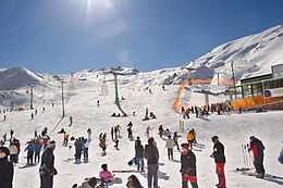
The ski resort of Dizin is situated to the north of Tehran in the Alborz Mountains. Tochal Ski Resort is the world's fifth highest ski resort, at over 3,730 metres (12,240 ft) at its highest "7th station". The resort was completed in 1976 shortly before the overthrowing of the Shah.
Here, one must first ride the 8-kilometre-long (5 mi) gondola lift which covers a huge vertical and is probably the longest line in the world.[61] The 7th station has three slopes. The resort's longest slope is the south side U shaped slope which goes from the 7th station to 5th station. The other two slopes are located on the north side of the 7th station. Here, there are two parallel chair ski lifts that go up to 3,900 metres (12,795 ft) near Tochal's peak (at 4,000 m/13,125 ft), rising higher than the gondola 7th station. This altitude is higher than any of the European resorts.

From the Tochal peak, one has a spectacular view of the Alborz range, including the 5,610-metre-high (18,406 ft) Mount Damavand, a dormant volcano. At the bottom of the lifts in a valley behind the Tochal peak is Tochal Hotel, located at 3,500 metres (11,483 ft) altitude. From there a T lift takes skiers up the 3,800 metres (12,500 ft) of Shahneshin peak, where the third slope of Tochal is.
Tochal 7th station has skiing eight months of the year. But there are also some glaciers and year-round snow fields near Tehran where skiing began in 1938, thanks to the efforts of two German railway engineers. Today, 12 ski resorts operate in Iran, but the most famous are Tochal, Dizin, and Shemshak, all within one to three hours of Tehran.
Football

Tehran is host to five major football clubs in the Iran Pro League, namely:
| Club | Sport | Founded | League | Head Coach |
|---|---|---|---|---|
| Rah Ahan F.C. | Association football | 1937 | Iran Pro League (IPL) | Hamid Estili |
| Esteghlal F.C.[62] | Association football | 1945 | Iran Pro League (IPL) | Amir Ghalenoei |
| Naft Tehran F.C. | Association football | 1950 | Iran Pro League (IPL) | Alireza Mansourian |
| Persepolis F.C.[63] | Association football | 1963 | Iran Pro League (IPL) | Hamid Derakhshan |
| Paykan | Association football | 1967 | Iran Pro League (IPL) | Samad Marfavi |
Tehran is also host to many small clubs:
| Club | Sport | League |
|---|---|---|
| Parseh Tehran F.C. | Association Football | Azadegan League |
| Niroye Zamini F.C. | Association Football | Azadegan League |
| Sanati Kaveh Tehran F.C. | Association Football | 2nd Division |
| Moghavemat Tehran F.C. | Association Football | 2nd Division |
| Oghab F.C. | Association Football | 3rd Division |
| Entezam Tehran F.C. | Association Football | 3rd Division |
| Naftoon Tehran F.C. | Association Football | 3rd Division |
Architecture

Tehran is a relatively old city; as such, it has an architectural tradition unique to itself. Archaeological investigations and excavations in Tehran demonstrate that this area was home to civilizations as far back as 6,000 years BC in the village of Rey which is now incorporated into the city. Tehran served only as a village to a relatively small population for most of its history, but began to take a more considerable role in Iran after it was made the capital in the late 18th century. Despite the occurrence of earthquakes during the Qajar period and before, some buildings still remain from Tehran's era of antiquity.[64] Today Tehran is Iran's primate city, and has the most modernized infrastructure in the country; however, the gentrification of old neighborhoods and the demolition of buildings of cultural significance has caused concerns.[65] The Azadi Tower has been the longstanding symbol of Tehran. It was constructed to commemorate the 2,500th anniversary of the Persian empire, and was originally named "Shahyad Tower"; after the Revolution of 1979, its name changed to "Azadi Tower," meaning "Freedom Tower." The recently constructed Milad Tower may eventually replace the Azadi Tower as Tehran's new symbol. The Milad complex contains the world's sixth tallest tower, several restaurants, a five star hotel, a convention center, a world trade center, and an IT park.[66] Traditionally a low-rise city due to seismic activity in the region, modern high rise developments in Tehran have been undertaken in order to service its growing population. There have been no major quakes in Tehran since 1830.[67]
The tallest residential building in Iran is a 54-story building located north of Youssef Abad district, the Tehran International Tower. It is architecturally similar to Mandalay Bay Resort and Casino on the Las Vegas Strip in the Paradise community of Clark County, Nevada, United States.[68] Appealing to the principle of vertical rather than horizontal expansion of the city, the Tehran International Tower is bound to the north by Youssef Abad, to the South By Hakim Highway, to the east by Kordesstan Highway and to the west by Sheikh Bahai Highway, all of which facilitate access to various parts of the city.[68]
Tourism and attractions
-

Cafeteria of Mellat Park
-

Police Palace (Today, the Building No. 9 of Foreign Ministry)
-

Meydan Mashq Complex
-

Salam Hall at Golestan Palace
-

Glassware and Ceramics Museum
-

Hosseinieh Ershad
-

Ab o Atash (Water and Fire) Park


.JPG)
Tehran, as Iran's showcase and capital city, has a wealth of cultural attractions. The Sun Throne (also known as the Peacock Throne) of the Persian Kings (Shahs) can be found in Golestan Palace. Some well-known museums are National Museum of Iran, Sa'dabad Palaces Complex, Glassware and Ceramics Museum of Iran, The Carpet Museum of Iran, Tehran's Underglass painting Museum, Niavaran Palace Complex, and Safir Office Machines Museum. The Tehran Museum of Contemporary Art features works of famous artists such as Van Gogh, Pablo Picasso and Andy Warhol. The collection of these paintings was selected by former Empress Farah Diba.
Tehran is also home to the Iranian Imperial Crown Jewels, also called the Imperial Crown Jewels of Persia, it is claimed to be the largest, most dazzling and valuable jewel collection in the world. The collection comprises a set of crowns and thrones, some 30 tiaras, numerous aigrettes, jewel-studded swords and shields, a vast amount of precious loose gems, including the largest collections of emeralds, rubies and diamonds in the world. It also includes other items collected by the Shahs of Iran during the 2,500 year existence of the Iranian Kingdom. The Imperial Crown Jewels are still on display in the Iranian Central Bank in Tehran.
Tehran International Book Fair (TIBF) is known to the international publishing world as one of the most important publishing events in Asia.[69]
Recreation

One of the most popular social activities, especially among the younger generation, is cinema. Most cinema theaters are located downtown. The Azadi Cinema was inaugurated in 2008. It is the largest cinema complex in Tehran with ten theaters. The Cinema Farhang in the north is the only official theater that plays foreign films in Tehran.
The Tehran Zoological Garden (Eram Zoo) and Eram City Game are also popular meeting points, especially for families with children. A new larger zoo was also planned for 2010.
Artists often mingle at the House Of Artists. Tehran City Theater was opened in 1962. It is the largest theater in Tehran. Tehran TV 1, Tehran Cinema TV, Omid TV and Tehran Show TV are among the most popular TV stations in Tehran. Tehran TV2, Tehran TV3 and Tehran Sport were planned to be launched in 2012.
The following table shows some places for outdoors activities in Tehran:
| Tochal Ski resort | Darband hiking trail | Chitgar Park | Niavaran Park | Saei Park | Daneshju Park | Goft-o-gu Park |
| Mellat Park | Laleh Park | Jamshidieh Park | Shatranj Park | Darakeh hiking trail | Jahan e Kudak Park | Azadi Sport Complex |
| Enghelab Sports Complex and Golf course | Latyan Lake | Lavizan Forest Park | Vardavard Forest Park | Khajeer National Park | Kavir National Park | Lavizan |
| Tar Lake | Amir Kabir Lake | Lar Protected Natural Habitat | Varjeen Protected Natural Habitat | Pardisan | Tangeh Savashi | Farahzad |
Religious centers
.jpg)
There are many religious centers scattered around the city from old to newly built centers. There are mosques, churches, and synagogues where followers of these religions can practice their faith.
The Friday prayer in Tehran is usually hosted by Tehran University which is led by a Friday prayer leader and on special occasions by the Supreme Leader of Iran. Many religious people participate in the prayers, during which a part of the city comes to a standstill.
Graffiti

Many styles of graffiti are seen in Tehran. Some are slogans painted by governmental organizations, which are mostly about the Revolution of 1979, and some are works of art by citizens, which go with themes like protest, freedom and peace.
During the protests of the Iranian presidential election of 2009, many graffiti works were done by people supporting the Green Movement, and they were removed from the walls by the Basij forces.[70]
In recent years, Tehran Municipality has been using graffiti in order to beautify the city. Also, several festivals were held for the art of graffiti in Tehran. One of them was held in October 2014, and it was organized by the Tehran University of Art.[71]
Events
- The 7th Asian Games were held from September 1, 1974 to September 16, 1974 in Tehran. The Azadi Sport Complex was built for the Games. The Asian Games were hosted in West Asia for the first time. Tehran played host to 3,010 athletes from 25 countries/NOCs, the highest number of participants since the inception of the Games.[72]
- The 1976 AFC Asian Cup was the sixth edition of the Asian Nations Cup, the football (soccer) championship of Asia (AFC). It was hosted by Iran. The field of six teams was split into two groups of three. Iran won their third title in a row, beating Kuwait 1–0 in the final.
- The first West Asian Games was organized in Tehran from 19 to 28 November 1997. The success of the games led to the creation of the West Asian Games Federation (WAGF) and the intention of hosting the games every two years.[73]

Sister cities
| Country | City | State / Province / Region / Governorate | Date | |||
|---|---|---|---|---|---|---|
| France | Paris | Île-de-France | 1950[74] | |||
| South Korea | Seoul | Seoul National Capital Area | 1963[75][74] | |||
| United States | Los Angeles | California | 1972[74][76] | |||
| United Kingdom | London | Greater London | 1993 | |||
| Cuba | Havana | La Habana Province | 2001[74][77] | |||
| South Africa | Pretoria | Gauteng | 2002[74][78] | |||
| Russia | Moscow | Central Federal District | 2004[74][79] | |||
| Venezuela | Caracas | Venezuelan Capital District | 2005[74] | |||
| China | Beijing | 2006[74][80] | ||||
| Brazil | Brasilia | Federal District | 2006[74] | |||
| Tajikistan | Dushanbe | 2006[74] | ||||
| Belarus | Minsk | Minsk Region | 2006[74][81] | |||
| United Arab Emirates | Dubai | Emirate of Dubai | 2012[82] | |||
| Turkey | Ankara | 2013[83] | ||||
Tehran has also signed Mutual Cooperation and Understanding with a number of cities including Baghdad, Kabul, Paris, Milan, and St. Petersburg.[74]
See also
- City Council of Tehran
- International rankings of Iran
- Iran International Exhibitions Company
References
- ↑ 1.0 1.1 جمعیت و خانوار شهرستان های کشور بر اساس سرشماری عمومی نفوس و مسکن 1390 (in Persian). Statistical Center of Iran. Retrieved 23 January 2015.
- ↑ George Erdösy, "The Indo-Aryans of ancient South Asia: Language, material culture and ethnicity", Walter de Gruyter, 1995. p. 165: "Possible western place names are the following: Raya-, which is also the ancient name of Median Raga in the Achaemenid inscriptions (Darius, Bisotun 2.13: "a land in Media called Raga") and modern Rey south of Tehran"
- ↑ "Tehran (Iran) : Introduction – Britannica Online Encyclopedia". Britannica.com. Retrieved 2012-05-21.
- ↑ "World's largest urban areas in 2006 (1)". City Mayors. Retrieved 2010-09-25.
- ↑
- ↑ Mareike Schuppe, "Coping with Growth in Tehran: Strategies of Development Regulation", GRIN Verlag, 2008. pp 13: "Besides Persian, there are Azari, Armenian, Jewish and Persian afghan communities in Tehran. The vast majority of Tehran's residents are Persian-speaking (98.3%)"
- ↑ "Chand Darsad Tehranihaa dar Tehran Bedonyaa Amadand"(How many percent of Tehranis were born in Tehran)-Actual census done by the University of Tehran – Sociology Department, accessed December, 2010
- ↑ 8.0 8.1 Mohammad Jalal Abbasi-Shavazi, Peter McDonald, Meimanat Hosseini-Chavoshi, "The Fertility Transition in Iran: Revolution and Reproduction", Springer, 2009. pp 100–101: "The first category is 'Central' where the majority of people are Persian speaking ethnic Fars (provinces of Fars, Hamedan, Isfahan, Markazi, Qazvin, Qom, Semnan, Yazd and Tehran..."
- ↑ TV, Press. "7,000-year-old human skeleton". http://www.presstv.ir/Detail/2015/01/13/392911/New-skeleton-unearthed-in-south-Tehran''. Retrieved 14 January 2015.
- ↑ Chahryar Adle, Bernard Hourcade, "Téhéran: capitale bicentenaire", Institut français de recherche en Iran, 1992. p. 22
- ↑ 11.0 11.1 11.2 11.3 11.4 11.5 11.6 11.7 11.8 11.9 V. Minorsky, C.E. Bosworth, "Al-Rayy", Encyclopaedia of Islam, New Edition, vol 8:471–473
- ↑ 12.0 12.1 12.2 12.3 12.4 12.5 12.6 A. Tafazolli, "In Iranian Mythology" in Encyclopaedia Iranica
- ↑ Vesta Sarkhosh Curtis, Sarah Stewart, "Birth of the Persian Empire", I.B.Tauris, 2005. p. 37
- ↑ (Bulddan, Yackubl, 276)
- ↑ Behrooz, Samira; Karampour, Katayoun. A Research on Adaptation of Historic Urban Landscapes ; The Case of The Historical City of Tehran. Tehran Historical City Office.
- ↑ "Pivot of the Universe: Nasir Al-Din Shah Qajar and the Iranian Monarchy ...". Retrieved 26 December 2014.
- ↑ "Pivot of the Universe: Nasir Al-Din Shah Qajar and the Iranian Monarchy ...". Retrieved 26 December 2014.
- ↑ "Pivot of the Universe: Nasir Al-Din Shah Qajar and the Iranian Monarchy ...". Retrieved 26 December 2014.
- ↑ "Pivot of the Universe: Nasir Al-Din Shah Qajar and the Iranian Monarchy ...". Retrieved 26 December 2014.
- ↑ "Pivot of the Universe: Nasir Al-Din Shah Qajar and the Iranian Monarchy ...". Retrieved 26 December 2014.
- ↑ "Pivot of the Universe: Nasir Al-Din Shah Qajar and the Iranian Monarchy ...". Retrieved 26 December 2014.
- ↑ Chaichian, Mohammad (2009). Town and Country in the Middle East: Iran and Egypt in the Transition to Globalization. New York: Lexington Books. pp. 95–116. ISBN 9780739126776.
- ↑ 23.0 23.1 23.2 23.3 Vahid Vahdat Zad (2011). "Spatial Discrimination in Tehran’s Modern Urban Planning 1906-1979". Journal of Planning History vol. 12 no. 1 49-62. Retrieved 2013-04-11.
- ↑ "Climate of Tehran". Irantour.org. Retrieved 2010-11-12.
- ↑ Heavy Snowfall in Tehran (in Persian). irna.com
- ↑ Heavy Snowfall in Tehran ( Feb 2005 ). bbc.com
- ↑ Heavy Snowfall in Tehran (In Persian).
- ↑ Rare snow blankets Iran's capital Tehran.
- ↑ Deadly Dust Storm Engulfs Iran's Capital.
- ↑ 30.0 30.1 I.R OF IRAN SHAHREKORD METEOROLOGICAL ORGANIZATION ( IN PERSIAN ). 1988-2005
- ↑
- ↑ "Chand Darsad Tehranihaa dar Tehran Bedonyaa Amadand"(How many percent of Tehranis were born in Tehran)-actual census done by University of Tehran sociology department accessed December, 2010
- ↑ Windfuhr, Gernot L. (1991). "Central Dialects". In Yarshater, Ehsan. Encyclopædia Iranica 5. London and New York: Routledge. pp. 242–252. Retrieved 23 August 2013.
- ↑ "Tehran". Looklex Encyclopaedia. Retrieved 2013-07-04.
- ↑ "Iran-Azeris". Library of Congress Country Studies. December 1987. Retrieved 13 August 2013.
- ↑ "Country Study Guide-Azerbaijanis". STRATEGIC INFORMATION AND DEVELOPMENTS-USA. Retrieved 13 August 2013.
- ↑ "Chand Darsad Tehranihaa dar Tehran Bedonyaa Amadand" (How many percent of Tehranis were born in Tehran), accessed December, 2010
- ↑ Lakshman, Nikhil. "Indian Prime Minister in Tehran". Rediff.com. Rediff.com. Retrieved 3 September 2012.
- ↑ 39.0 39.1 "For Security and Administrative [sic] Reasons: Plan to Move Capital From Tehran Finalized". Payvand.com. Retrieved 2010-09-25.
- ↑ "Iran Moots Shifting Capital from Tehran". Payvand.com. 2006-11-22. Retrieved 2010-09-25.
- ↑ "No Operation". Presstv.com. Retrieved 2010-09-25.
- ↑ 42.0 42.1 Buzbee, Sally. "Tehran: Split Between Liberal, Hard-Line". Associated Press via The Washington Post. Thursday 4 October 2007.
- ↑ 43.0 43.1 Hundley, Tom. "Pro-reform Khatami appears victorious after 30 million Iranians cast votes.." Chicago Tribune. 8 June 2001.
- ↑ "Tehran (Iran) : People – Britannica Online Encyclopedia". Britannica.com. Retrieved 2012-05-21.
- ↑ Anthony H. Cordesman (September 23, 2008). "The US, Israel, the Arab States and a Nuclear Iran. Part One: Iranian Nuclear Programs" (PDF). Center for Strategic and International Studies. Retrieved 2010-09-25.
- ↑ Chaichian, Mohammad (2009). Town and Country in the Middle East: Iran and Egypt in the Transition to Globalization. New York: Lexington Books. pp. 98–103. ISBN 9780739126776.
- ↑ "Iran blocks share price gains". BBC News. 2003-08-06. Retrieved 2012-05-21.
- ↑ "'Tehran's overpopulation will cause ecological ruin'". Payvand.com. 2006-11-22. Retrieved 2010-11-12.
- ↑ 49.0 49.1 Murray, Alan (2000). World Trolleybus Encyclopaedia, pp. 57 and 99. Yateley, Hampshire, UK: Trolleybooks. ISBN 0-904235-18-1.
- ↑ 50.0 50.1 Trolleybus Magazine No. 265 (January–February 2006), pp. 16–17. National Trolleybus Association (UK). ISSN 0266-7452.
- ↑ Trolleybus Magazine No. 298 (July–August 2011), pp. 89–90. National Trolleybus Association (UK).
- ↑ 52.0 52.1 Turquoise Partners: Iran Investment Monthly (February 2011) Retrieved April 30, 2011
- ↑ Tehran. An Educational Website about Tehran
- ↑ Har Ruz 27 Tehrāni be Dalile Āludegiye Hawā mimirand. September 18, 2006
- ↑ Iran smog 'kills 3,600 in month'. BBC News Online. January 9, 2007
- ↑ "Car exhaust fumes blamed for over 80% of air pollution in Tehran". Payvand.com. 2006-11-22. Retrieved 2010-09-25.
- ↑ "Motorcycles Account for 30% of Air Pollution in Tehran". Payvand.com. 2006-11-22. Retrieved 2010-11-12.
- ↑ http://www.youtube.com/watch?v=fZlReBswH0k
- ↑ The Huffington Post, "Tehran Air Pollution Keeps Iran's Capital Shut Down Amid 'Unbreathable' Smog", 12 December 2010
- ↑ The Economist, "The smoggiest of all capitals", 1 January 2011, p. 40.
- ↑ Lines of Telecabin. tochal.org
- ↑ Esteqlal F.C. Official Website. Estqlal F.C.
- ↑ Persepolis F.C. Official Website. Persepolis F.C.
- ↑ Tehran Capital City of Iran. Tehran
- ↑ Urschel, Donna. "The Style of Tehran – Library of Congress". Loc.gov. Retrieved 2012-05-21.
- ↑ Milad Tower Official Website. Milad Tower
- ↑ "Women to blame for earthquakes, says Iran cleric". The Guardian. 2010-04-19.
- ↑ 68.0 68.1 Tehran International Tower Website. Tehran International Tower Website
- ↑ ": Tibf :". Tibf.ir. Retrieved 2012-05-21.
- ↑ Tehran Graffiti War (France 24)
- ↑ Deutsche Welle (Persian)
- ↑ 7th Asian Games. ocasia.org
- ↑ West Asian Games. West Asian Games
- ↑ 74.0 74.1 74.2 74.3 74.4 74.5 74.6 74.7 74.8 74.9 74.10 74.11 "Atlas of Tehran Metropolis". Tehran Municipality. Retrieved 2013-10-14.
- ↑ New Economic Spaces in Asian Cities: From Industrial Restructuring to the Cultural Turn. Routledge and the Taylor & Francis Group. 2012. Retrieved 2013-10-14.
- ↑ "Tehran, Iran". Sister Cities of Los Angeles, Inc. Retrieved 2013-10-14.
- ↑ "Tehran, Havana named sister cities". Payvand.com. 2006-11-22. Retrieved 2011-03-15.
- ↑ "Gulf Region". Dfa.gov.za. Retrieved 2012-05-21.
- ↑ "Тверская 13" 4.12.04. el.mos.ru (in Russian)
- ↑ Goldkorn, Jeremy. "Tehran-Beijing direct flights?". Danwei.org. Retrieved 2012-05-21.
- ↑ "Twin towns and Sister cities of Minsk [via WaybackMachine.com]" (in Russian). The department of protocol and international relations of Minsk City Executive Committee. Archived from the original on 2 May 2013. Retrieved 2013-07-21.
- ↑ "Special Features: Dubai's sister cities". Dubai City Guide. Retrieved 2012-05-21.
- ↑ "Tehran, Ankara to Sign Sister City Agreement Today". FarsNews. Retrieved 2013-12-18.
External links
| Wikimedia Commons has media related to Tehran. |
| Wikivoyage has a travel guide for Tehran. |
- Google Map: Tehran
- Tehran Municipality website
- Tehran Geographic Information Center
- Tehran Traffic Control Center
- Official Tehran Yellow pages (Ketabe Avval)
- Tehranimages. Contemporary photos taken in some of the oldest districts of Tehran.
- Videos
- Tehran's detailed development plan PressTV (2012)
- Tehran today – Part I Part II Part III PressTV (2010)
- Modernized Iranian architecture in Tehran Press TV (2010)
- Tehran's hazardous air quality PressTV (2010)
| Preceded by Shiraz |
Capital of Iran (Persia) 1795–current |
Incumbent |
| ||||||||||||||||||||||||||||||||||||||||||||||||||||||||||||||||||||||||||||||||||||||||||||||||||||||||||||||||||||||||||||||||||||||||||||||||||||||||||||||||||||||||||||||||||||