Tefé
| Tefé | |||
|---|---|---|---|
| Municipality | |||
| Municipality of Tefé | |||
| |||
| Nickname(s): Princesinha do Rio Solimões ( Princess of the Solimões River in Portuguese) | |||
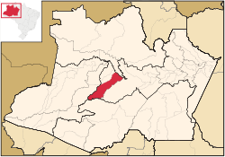 Location in Tefé, Amazonas | |||
 Tefé Location in Brazil | |||
| Coordinates: 03°21′14″S 64°42′39″W / 3.35389°S 64.71083°WCoordinates: 03°21′14″S 64°42′39″W / 3.35389°S 64.71083°W | |||
| Country |
| ||
| Region | North | ||
| State |
| ||
| Founded | 1759 | ||
| Government | |||
| • Mayor | Antenor Moreira Paz (PSD) | ||
| Area | |||
| • Total | 23,704.426 km2 (9,152.330 sq mi) | ||
| Elevation | 75 m (246 ft) | ||
| Population (2014) | |||
| • Total | 62,662 | ||
| • Density | 2.6/km2 (6.8/sq mi) | ||
| Time zone | AST (UTC-4) | ||
| • Summer (DST) | DST no longer used (UTC-4) | ||
| Demonym | tefeense | ||
.svg.png)

Tefé (Teffé in early accounts) is a municipality in the state of Amazonas, northern Brazil. It is located about 525 km by air or 595 km by river to the west of Manaus on the south bank of the Rio Solimões (the upper Amazon), on the lake formed by the mouth of the Tefé River. The nearest large city is Coari, 192 km SE by east of Tefé.
Tefé is the largest town and commercial center of the middle Solimões region. Its population was 61,453 (IBGE 2010) evenly divided between urban and rural, and its area is 23,704 km².[1] There are no roads into Tefé and the only access is by river boat or plane. By fast boat it is about 12 hours from Manaus. TRIP Linhas Aereas operate flights from Manaus to Tefé Airport.
The city is the home of the Territorial Prelature of Tefé. Tefé is also the major starting point for trips into the Mamiraua Reserve.
History
As early as 1620 the Portuguese Carmelites could already boast of converts among the Muras, those natives of the Amazon established around Lake Teffé and on the borders of the neighbouring rivers. Tefé, also called Ega at one time, was the fourth of eight aldeias[2] founded by Carmelite missionaries between 1697 and 1751[Note 1] along the Solimões and Negro Rivers. In 1759 the commandant Joaquim de Mello da Povoas converted the Carmelite mission on Lake Tefé into a town, which he named Ega; it was elevated to a city named Tefé in 1855 (but was known as Tefé before that time). The mission, called Parauarí, was originally established on Ilha dos Veados three leagues from the location on the opposite shore of Lake Tefe, called today by the name of Nogueira. The survivors were taken to its present site by F. Andre da Costa in 1817. It was abandoned due to a smallpox outbreak in the early 18th century and moved across the lake, where it remains today.[Note 2]
In 1910, an apostolic prefecture, the current Prelature of Teffe, was founded by priests of the Congregation of the Holy Spirit.
References
- Bates, Henry Walter (date) Naturalist on the River Amazons
Notes
- ↑ Henry W. Bates in 1851 said the settlement had been inhabited for 170 years, which would place its founding a bit earlier, around 1680.
- ↑ Henry W. Bates gave this description: "[Ega] is built on a small tract of cleared land at the lower or eastern end of the lake...On the opposite shore of the broad expanse stands a small village, called Nogueira".