Tecámac
| Tecámac | |
|---|---|
| Municipality and town | |
|
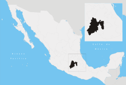
Tecámac Location in Mexico | |
| Coordinates: 19°42′47″N 98°58′06″W / 19.71306°N 98.96833°WCoordinates: 19°42′47″N 98°58′06″W / 19.71306°N 98.96833°W | |
| Country |
|
| State | Mexico (state) |
| Area | |
| • Municipality and town | 153.41 km2 (59.23 sq mi) |
| Elevation | 2,271 m (7,451 ft) |
| Population (2010) | |
| • Municipality and town | 364,579 |
| • Urban | 356,932 |
| Time zone | Central Standard Time (UTC-6) |
| • Summer (DST) | Central Daylight Time (UTC-5) |
Tecámac Municipality is a municipality in Mexico State in Mexico. The municipality covers an area of 153.41 km². The municipal seat lies in the town (locality) of Tecámac de Felipe Villanueva. Its largest town, Ojo de Agua, with a population of 242,283 inhabitants, is the largest locality in Mexico that is not a municipal seat.
As of the 2010 census, the municipality had a total population of 364,579 inhabitants.[1]
Towns and villages
The largest localities (cities, towns, and villages) are:[2]
| Name | 2010 Census Population |
|---|---|
| Ojo de Agua | 242,283 |
| San Martín Azcatepec | 35,390 |
| Los Reyes Acozac | 21,910 |
| Santa María Ajoloapan | 17,784 |
| Tecámac de Felipe Villanueva | 15,911 |
| Fraccionamiento Social Progresivo Santo Tomás Chiconautla | 15,061 |
| Total Municipality | 364,590 |
References
- ↑ "Tecámac". Enciclopedia de los Municipios de México. Instituto Nacional para el Federalismo y el Desarrollo Municipal. Retrieved June 6, 2009.
- ↑ 2010 census tables: INEGI