Tebing Tinggi
| Tebing Tinggi | |
|---|---|
| City | |
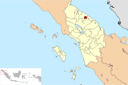 Location of Tebing Tinggi in Indonesia | |
 Tebing Tinggi Location of Tebing Tinggi in Indonesia | |
| Coordinates: 3°19′10″N 99°9′8″E / 3.31944°N 99.15222°ECoordinates: 3°19′10″N 99°9′8″E / 3.31944°N 99.15222°E | |
| Province | North Sumatra |
| Country | Indonesia |
| Area | |
| • Total | 31 km2 (12 sq mi) |
| Population (2010 Census) | |
| • Total | 145,180 |
| • Density | 4,700/km2 (12,000/sq mi) |
| Time zone | WIB (UTC+7) |
| Website | http://www.tebingtinggikota.go.id/ |
Tebing Tinggi Deli or more commonly simply Tebing Tinggi is a chartered city (kota) near the eastern coast of North Sumatra, Indonesia. It has an area of 31 km² and a population at the 2010 National Census of 145,180. It is surrounded by Serdang Bedagai Regency, which has a kecamatan (district) bordering the city named Tebing Tinggi as well. Not to be confused with Tebing Tinggi Island in Riau or the kecamatan Tebing Tinggi in South Sumatra.
Administrative divisions
The city is divided administratively into five districts (kecamatan), tabulated below with their 2010 Census population:[1]
| Name | Population Census 2010[1] |
|---|---|
| Padang Hulu (Upstream Padang) | 26,714 |
| Tebing Tinggi Kota (Tebing Tinggi Town) | 24,040 |
| Rambutan | 31,371 |
| Bajenis | 33,072 |
| Padang Hilir (Downstream Padang) | 30,051 |