Taylor Township, Greene County, Indiana
| Taylor Township | |
|---|---|
| Township | |
|
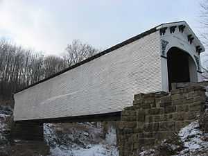
The Richland-Plummer Creek Covered Bridge, a township landmark | |
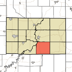 Location in Greene County | |
| Coordinates: 38°56′50″N 86°53′57″W / 38.94722°N 86.89917°WCoordinates: 38°56′50″N 86°53′57″W / 38.94722°N 86.89917°W | |
| Country | United States |
| State | Indiana |
| County | Greene |
| Government | |
| • Type | Indiana township |
| Area | |
| • Total | 42.36 sq mi (109.7 km2) |
| • Land | 42.27 sq mi (109.5 km2) |
| • Water | 0.09 sq mi (0.2 km2) 0.21% |
| Elevation | 663 ft (202 m) |
| Population (2010) | |
| • Total | 1,200 |
| • Density | 28.4/sq mi (11.0/km2) |
| GNIS feature ID | 0453889 |
Taylor Township is one of fifteen townships in Greene County, Indiana, USA. At the 2010 census, its population was 1,200.[1]
Geography
According to the 2010 census, the township has a total area of 42.36 square miles (109.7 km2), of which 42.27 square miles (109.5 km2) (or 99.79%) is land and 0.09 square miles (0.23 km2) (or 0.21%) is water.[1] The streams of Black Ankle Creek, Bogard Creek, Burcham Branch, Clifty Branch, Dowden Branch, Flyblow Branch and Stone Branch run through this township.
Unincorporated towns
(This list is based on USGS data and may include former settlements.)
Adjacent townships
- Richland Township (north)
- Center Township (northeast)
- Jackson Township (east)
- Perry Township, Martin County (south)
- Madison Township, Daviess County (southwest)
- Cass Township (west)
- Washington Township (west)
- Fairplay Township (northwest)
Cemeteries
The township contains four cemeteries: Dowden, Hasler, Smith-Bethel and Taylor Ridge.
Major highways
* Note: Interstate 69 currently ends here.
References
- ↑ 1.0 1.1 "Population, Housing Units, Area, and Density: 2010 - County -- County Subdivision and Place -- 2010 Census Summary File 1". United States Census. Retrieved 2013-05-10.
External links
| |||||||||||||||||||||||||||||