Tattenham Corner
| Tattenham Corner | |
 Tattenham Corner |
|
| Area | 2.45 km2 (0.95 sq mi) |
|---|---|
| Population | 7,274 (2011 census)[1] |
| – density | 2,969/km2 (7,690/sq mi) |
| OS grid reference | TQ2557 |
| Civil parish | n/a |
| District | Reigate and Banstead |
| Shire county | Surrey |
| Region | South East |
| Country | England |
| Sovereign state | United Kingdom |
| Post town | Epsom |
| Postcode district | KT18 |
| Dialling code | 01737 |
| Police | Surrey |
| Fire | Surrey |
| Ambulance | South East Coast |
| EU Parliament | South East England |
| UK Parliament | Epsom and Ewell |
Coordinates: 51°18′32″N 0°14′35″W / 51.309°N 0.243°W

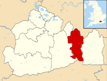
Tattenham Corner, Tattenhams or Great Tattenham and Little Tattenham is a suburban village in Surrey, UK well inside the M25 motorway with housing type, roads and its end-of-line railway station meaning it has a high proportion of Central London commuters. It adjoins the entrance to the Epsom Downs Racecourse and is historically a part of Epsom. The location is west of the A240. The town of Epsom is below the racecourse however is in its own district rather than Reigate and Banstead. Neighbouring villages other than Epsom Downs were formed from Banstead's former common on this widest part of the escarpment of the North Downs: Tadworth, Kingswood and Burgh Heath. Tattenham Corner's long western border adjoins the larger expanse of the racecourse combined with Walton Downs.
History
Tattenham was hillslopes of the North Downs used largely for cattle pasture, sheep farming and wood gathering.[2] By the 1770s, Tattenham Corner was the established name for the top end of the relatively new racecourse.[2] following the setting aside of some of Epsom Downs as a racecourse, and between 1850 and 1950 many new villages were established, much larger today, as water could be successful piped uphill and deeper wells dug than ever before and new railways arrived.[3]
Amenities
The main amenity is a group of largely convenience and regular services shops immediately east of the station, where there is also a branch-level library.
Topography
Tattenham Corner forms almost an exact square, less a small rectangle in the south-west corner forming Burgh Heath (the park). Elevations range between 180m AOD (above sea level) towards its south-west and 140m along most of the northern border. As such it has a sub-locality is within it, Great Burgh, which usually refers only to the former manor site there.
A residential community, Tattenhams have the traditional definition of the established church parish (built and created in 1967) and that as one of the wards of the United Kingdom, which is approximately the same.[4] Lacking street sign settlement names, Tattenham Corner looks somewhat towards these boundaries and somewhat towards other areas that have amenities in common: including for example Banstead Athletc F.C.'s ground is squarely within Tattenham, others with shared amenities are Tadworth, Burgh Heath (its park), Nork and Epsom.[5]
Demography and housing
| Ward | Detached | Semi-detached | Terraced | Flats and apartments | Caravans/temporary/mobile homes/houseboats | Shared between households[1] |
|---|---|---|---|---|---|---|
| Tattenhams | 1,006 | 902 | 585 | 630 | 0 | 0 |
The average level of accommodation in the region composed of detached houses was 28%, the average that was apartments was 22.6%.
| Ward | Population | Households | % Owned outright | % Owned with a loan | hectares[1] |
|---|---|---|---|---|---|
| Tattenhams | 7,370 | 3,123 | 38 | 38 | 245 |
The proportion of households who owned their home outright compares to the regional average of 35.1%. The proportion who owned their home with a loan compares to the regional average of 32.5%. The remaining % is made up of rented dwellings (plus a negligible % of households living rent-free).
Homes, mostly split between the three main types of houses with gardens are predominantly of early twentieth-century origin. The fourth category of homes here, apartments range in date from the late-twentieth to the early twenty-first centuries.
Transport
Tattenham Corner railway station is where Queen Elizabeth II used to be dropped off by the Royal Train on race days, and is closer to the racecourse than Epsom Downs railway station. There are several bus services going through the area, towards Epsom, Sutton or Redhill. In 1993 it was the site of a train crash, where a driver several times over the then legal drink-drive limit failed to stop the train at the buffers, crashing into the station-hut.[6][7]
See also
References
- ↑ 1.0 1.1 1.2 Key Statistics; Quick Statistics: Population Density United Kingdom Census 2011 Office for National Statistics Retrieved 20 December 2013
- ↑ 2.0 2.1 H.E. Malden (editor) (1911). "Parishes: Epsom". A History of the County of Surrey: Volume 3. Institute of Historical Research. Retrieved 29 December 2013.
- ↑ H.E. Malden (editor) (1911). "Parishes: Banstead". A History of the County of Surrey: Volume 3. Institute of Historical Research. Retrieved 29 December 2013.
- ↑ Tattenham Corner, St Mark ('Epsom') The Church of England Retrieved 2013-12-29
C of E compiled parish map - ↑ Grid square map Ordnance survey website
- ↑ http://www.independent.co.uk/news/uk/train-driver-jailed-1449234.html
- ↑ http://www.bbc.co.uk/dna/h2g2/A18132798
External links
![]() Media related to Tattenham Corner at Wikimedia Commons
Surrey portal
Media related to Tattenham Corner at Wikimedia Commons
Surrey portal
| |||||||||||||||||||||||||||||||||||||||||||||||||||||||||||||||||||||