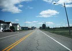
Taschereau, Quebec
| Taschereau | |
|---|---|
| Municipality | |
 | |
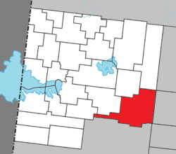 Location within Abitibi-Ouest RCM. | |
 Taschereau Location in western Quebec. | |
| Coordinates: 48°40′N 78°41′W / 48.667°N 78.683°WCoordinates: 48°40′N 78°41′W / 48.667°N 78.683°W[1] | |
| Country |
|
| Province |
|
| Region | Abitibi-Témiscamingue |
| RCM | Abitibi-Ouest |
| Settled | 1911 |
| Constituted | December 27, 2001 |
| Government[2] | |
| • Mayor | Lucien Côté |
| • Federal riding | Abitibi—Témiscamingue |
| • Prov. riding | Abitibi-Ouest |
| Area[2][3] | |
| • Total | 270.40 km2 (104.40 sq mi) |
| • Land | 250.61 km2 (96.76 sq mi) |
| Population (2011)[3] | |
| • Total | 981 |
| • Density | 3.9/km2 (10/sq mi) |
| • Pop 2006-2011 |
|
| • Dwellings | 420 |
| Time zone | EST (UTC−5) |
| • Summer (DST) | EDT (UTC−4) |
| Postal code(s) | J0Z 3N0 |
| Area code(s) | 819 |
| Highways |
|
| Website |
www |
Taschereau is a municipality in northwestern Quebec, Canada in the Abitibi-Ouest Regional County Municipality. It covers 265.62 km² and had a population of 981 as of the Canada 2011 Census.
The municipality was incorporated on December 27, 2001.
Demographics
Population trend:[4]
- Population in 2011: 981 (2006 to 2011 population change: -1.5 %)
- Population in 2006: 996
- Population total in 2001: 1048
- Taschereau (village): 534
- Taschereau (municipality): 514
- Population in 1996:
- Taschereau (village): 641
- Taschereau (municipality): 460 (or 534 when adjusted to 2001 boundaries)
- Population in 1991:
- Taschereau (village): 684
- Taschereau (municipality): 476
Private dwellings occupied by usual residents: 396 (total dwellings: 420)
Mother tongue:[5]
- English as first language: 0%
- French as first language: 100%
- English and French as first language: 0%
- Other as first language: 0%
Municipal council
- Mayor: Jean-Marie Poulin
- Councillors: Jocelyne Deschênes, Tony Gauthier, Céline Lambert, Gratien Landry, Patrick Landry, Normand Plante
References
- ↑ Reference number 61771 of the Commission de toponymie du Québec (French)
- ↑ 2.0 2.1 "Taschereau". Répertoire des municipalités (in French). Ministère des Affaires municipales, des Régions et de l'Occupation du territoire. Retrieved 2011-01-06.
- ↑ 3.0 3.1 "Taschereau census profile". 2011 Census data. Statistics Canada. Retrieved 2011-01-06.
- ↑ Statistics Canada: 1996, 2001, 2006, 2011 census
- ↑ "Taschereau community profile". 2006 Census data. Statistics Canada. Retrieved 2011-01-06.
 |
Authier, Rivière-Ojima | Lac-Chicobi | | |
| Poularies Sainte-Germaine-Boulé |
|
Launay | ||
| ||||
| | ||||
| Rouyn-Noranda | Sainte-Gertrude-Manneville |
| ||||||||||||||||||||||||||