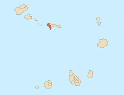
Tarrafal de São Nicolau, Cape Verde (municipality)
Tarrafal de São Nicolau is a concelho (municipality) of Cape Verde. Situated in the western part of the island of São Nicolau, it covers 35% of the island area, and is home to 41% of its population. Its capital is the town Tarrafal de São Nicolau. The municipality consists of one freguesia (civil parish), São Francisco de Assis. The freguesia is subdivided into the following settlements:
History
The municipality was created in 2005, when the older Municipality of São Nicolau was split in two, the western part becoming the Municipality of Tarrafal de São Nicolau and the eastern part becoming the Municipality of Ribeira Brava.
Demography
| Population of Tarrafal de São Nicolau (1940—2010) |
|---|
| 2000[2] |
2010[1] |
| 5211 |
5205 |
References
|
|---|
| | Barlavento Islands | |
|---|
| | Sotavento Islands | |
|---|
|
