Taoyuan District, Kaohsiung
Coordinates: 23°14′20″N 120°50′03″E / 23.238822°N 120.834289°E
| Taoyuan 桃源區 | |
|---|---|
| Mountain Indigenous District | |
| Taoyuan District | |
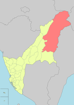 Tauyuan District in Kaohsiung City | |
| Country |
|
| Municipality | Kaohsiung City |
| Boroughs |
List
|
| Government | |
| • Type | District government |
| • District chief | Xie Ying-xiong[1] (KMT) |
| Population (December 2014) | |
| • Total | 4,296 |
Taoyuan District (Chinese: 桃源區; pinyin: Táoyuán Qū, another name is Tauyuan District) is a rural district of Kaohsiung City, Taiwan. It is the largest district in Kaohsiung City by area.
Name
The same Pinyin form, Taoyuan District, exists in two different districts in Taiwan: one is 桃源區 in Kaohsiung, the other is 桃園區 in Taoyuan City. Although the official English name is "Taoyuan District", an English translated form used in Taoyuan District Office, Kaohsiung is "Tauyuan District."
Geography
It is the district that is most mountainous and most distant from the city center. The population density in Taoyuan District is one of the least in Taiwan, but the area of the district is the sixth largest. Both Yushan National Park and Maolin National Scenic Area are situated in this district. Taoyuan District is very mountainous with very little flat land. Laonong River passes through Tauyuan District and is an important water source for Kaoshiung. The climate of the Taoyuan district is tropical monsoon climate. The major populations are Tsou people and Paiwan people of the Taiwanese aborigines.
History
During the period of Japanese rule, Taoyuan was grouped with Namasia District and Maolin District and classified as "Savage Land" (蕃地), which was governed under Kizan District (旗山郡) of Takao Prefecture.
Quick facts
- Area: 928.98 km2.
- Population: 4,296 people (December 2014)
- Divisions: 8 urban villages 39 neighborhoods
- Postal Code: 848
- Households: 1,331
Administrative divisions
- Baoshan Village
- Cinghe Village
- Fushing Village
- Gaojhong Village
- Jianshan Village
- Lafuran Village
- Meishan Village
- Taoyuan Village[2]
Tourist attractions
- Tengjhi National Forest Recreation Area
- Yushan National Park
See also
| Wikimedia Commons has media related to Tauyuan District, Kaohsiung. |
References
External links
| ||||||||||||||||||||||||||||||||||
.svg.png)
| |||||||||||||||||||||||||||||||||||||||||||||||||||||||||||||||||||||||||||||||||||||
