Tanudan, Kalinga
| Tanudan | |
|---|---|
| Municipality | |
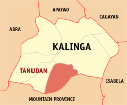 Map of Kalinga showing the location of Tanudan | |
.svg.png) Tanudan Location within the Philippines | |
| Coordinates: 17°18′N 121°14′E / 17.300°N 121.233°ECoordinates: 17°18′N 121°14′E / 17.300°N 121.233°E | |
| Country | Philippines |
| Region | Cordillera Administrative Region (CAR) |
| Province | Kalinga |
| District | Lone District |
| Barangays | 16 |
| Government[1] | |
| • Mayor | Johnwell W. Tiggangay |
| Area[2] | |
| • Total | 307.55 km2 (118.75 sq mi) |
| Population (2010)[3] | |
| • Total | 8,529 |
| • Density | 28/km2 (72/sq mi) |
| Time zone | PST (UTC+8) |
| ZIP code | 3805 |
| Dialing code | 74 |
| Income class | 4th class |
Tanudan is a fourth class municipality in the province of Kalinga, Philippines. According to the 2010 census, it has a population of 8,529 people.[3]
Barangays
Tanudan is politically subdivided into 16 barangays.[2]
- Anggacan
- Anggacan Sur
- Babbanoy
- Dacalan
- Dupligan
- Gaang
- Lay-yasan
- Lower Mangali
- Lower Lubo
- Lower Taloctoc
- Mabaca
- Mangali Centro
- Pangol
- Poblacion
- Upper Lubo
- Upper Taloctoc
Demographics
| Population census of Tanudan | ||
|---|---|---|
| Year | Pop. | ±% p.a. |
| 1990 | 9,323 | — |
| 1995 | 11,243 | +3.57% |
| 2000 | 10,275 | −1.91% |
| 2007 | 8,119 | −3.20% |
| 2010 | 8,529 | +1.81% |
| Source: National Statistics Office[3] | ||
References
- ↑ "Official City/Municipal 2013 Election Results". Intramuros, Manila, Philippines: Commission on Elections (COMELEC). 11 September 2013. Retrieved 2 January 2014.
- ↑ 2.0 2.1 "Province: KALINGA". PSGC Interactive. Makati City, Philippines: National Statistical Coordination Board. Retrieved 2 January 2014.
- ↑ 3.0 3.1 3.2 "Total Population by Province, City, Municipality and Barangay: as of May 1, 2010". 2010 Census of Population and Housing. National Statistics Office. Retrieved 2 January 2014.
External links
- Philippine Standard Geographic Code
- Philippine Census Information
- Local Governance Performance Management System
 |
Tabuk | | ||
| Lubuagan Tinglayan |
|
Paracelis, Mountain Province | ||
| ||||
| | ||||
| Barlig, Mountain Province | Natonin, Mountain Province |
| ||||||||||||||||||