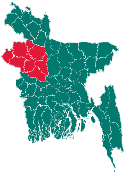
Tanore Upazila
| Tanore তানোর | |
|---|---|
| Upazila | |
 Tanore Location in Bangladesh | |
| Coordinates: 24°36′10″N 88°34′50″E / 24.6028°N 88.5806°ECoordinates: 24°36′10″N 88°34′50″E / 24.6028°N 88.5806°E | |
| Country |
|
| Division | Rajshahi Division |
| District | Rajshahi District |
| Area | |
| • Total | 295.39 km2 (114.05 sq mi) |
| Population (2001) | |
| • Total | 173,495 |
| • Density | 587/km2 (1,520/sq mi) |
| Time zone | BST (UTC+6) |
| Website | Official Map of Tanore |
Tanore (Bengali: তানোর) is an Upazila of Rajshahi District in the Division of Rajshahi, Bangladesh.
Geography
Tanore is located at 24°36′10″N 88°34′50″E / 24.6028°N 88.5806°E. It has 27437 units of house hold and total area 295.39 km². The main river is the Shiba.[1]
Demographics
At the 2001 Bangladesh census, Tanore had a population of 173,495. Males constituted 50.63% of the population, and females 49.37%. Tanore has an average literacy rate of 45.35% (7+ years),.[2]
Administration
'Chairman:' Md.Emran Ali Molla.
Vice Chairman
AL Abdur Rahim
Woman Vice Chairman
Bondona Raani Praamanik. Upazila Nirbahi Officer (UNO) Md.Mehedi-Ul-Sahid.
Administrative
Tanore has 2 Municipalities, 7 Unions/Wards, 211 Mauzas/Mahallas, and 233 villages.
Institutions
Govt. Primary school 49, High school 53, Degree college 06, Dakhil madrasah 24, Alim madrasah 03, Kamil madrasah 01,
See also
References
- ↑ Asadullah Mamun Hasan (2012). "http://www.banglapedia.org/HT/T_0056.htm". In Sirajul Islam and Ahmed A. Jamal. Banglapedia: National Encyclopedia of Bangladesh (Second ed.). Asiatic Society of Bangladesh.
- ↑ "www. dcrajshahi.gov.bd". Retrieved February 5, 2011.
| |||||||||||||||||||||||||||||||||||||||||
