Tama River


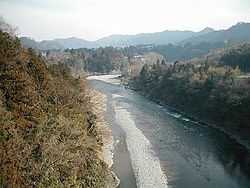
The Tama River (多摩川 Tama-gawa) is a major river in Yamanashi, Kanagawa and Tokyo Prefectures on Honshū, Japan. It is officially classified as a Class 1 river by the Japanese government. Its total length is 138 kilometres (86 mi), and the total of the river's basin area spans 1,240 square kilometres (480 sq mi).
The river flows through Tokyo, on the dividing line between Tokyo and Kanagawa. In the city, its banks are lined with parks and sports fields, making the river a popular picnic spot.
Course
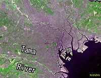
Its source is located at Mt. Kasadori in Koshu in Yamanashi Prefecture. From there, it flows eastward into mountainous western Tokyo, where the Ogōchi Dam forms Lake Okutama. Below the dam, it takes the name Tama and flows eastwards through Chichibu Tama Kai National Park towards Ōme, Tokyo. It then flows southeast between Tama Hills and Musashino Terrace. At Hamura is the source of the historic Tamagawa Aqueduct built by the Tamagawa brothers in 1653 to supply water to Edo (present day Tokyo). Further downstream, the river forms the boundary between Tokyo and the city of Kawasaki in Kanagawa Prefecture. Its mouth on the heavily industrialised Tokyo Bay is next to Haneda Airport.
Flooding
Tama River is very prone to flooding, and has wreaked havoc on surrounding areas throughout history. On occasions the river even changed its course after massive floods, sometimes dividing pre-existing settlements in two. As a result, there are several locations where the place names on opposing sides of the river are the same, such as Todoroki. The current course was set as a result of a 1590 flood.
Levees have been in place for hundreds of years, but floodwaters have breached them numerous times in history. Extensive engineering projects in the early 20th Century have dramatically reduced the amount of flood damage, although a 1974 typhoon caused floodwaters to burst a levee in Komae, washing away 19 houses.
The levees have not been breached since 1974. Projects to further upgrade the levees have been underway since 1990.
As with most major rivers in Japan, the levees are built some distance away from the river itself to accommodate the extra floodwater. The open expanse between the levees and the river in the middle is covered in grass and shrubbery, forming a useful belt of greenery and wide open space which is used as playing fields in many places.
Wildlife
Rapid post-war urbanization of surrounding areas took its toll on Tama River, whose water quality in the urban areas plummeted from 1950's onwards rendering it uninhabitable for most species. Pollution control measures and the river's official designation as a wildlife protection zone have now led to the return of many species.
Carp, rainbow trout, cherry salmon, iwana (char), ugui (big-scaled redfin) and ayu all inhabit Tama River in sufficient numbers for limited commercial fishing to take place in upstream areas. Recent moves to fit weirs with fish ladders have resulted in a steep increase in the numbers of ayu migrating upstream. Other fish such as loach inhabit the river, as do crabs, turtles and crayfish.
Kingfishers, white wagtails, spotbills, grey herons, Japanese white-eyes, Mandarin ducks, and black-headed gulls are among birds often seen at the river. Various types of ducks have made a comeback after the 1969 designation of the river as a wildlife protection zone. The expanse of greenery between the levees and the river itself attract additional wildlife.
In the summer of 2002, Tama-chan, a normally arctic male bearded seal first spotted in Tama River, became a major nationwide celebrity.
In recent years the Tama River has been settled by a larger number of non-native species including tropical fish like piranhas. It is assumed that this became possible because of higher water temperature of river due to global warming and waste water from sewage treatment plants. Those higher temperature now allow tropical pet fish being abandoned by their owners to survive the cold Japanese winters.[1]

Recreation
Near the outskirts of Tokyo, the river is a popular kayaking spot, with the Japan National Slalom Kayak competitions being held on the Tama River where it passes through Mitake.
This section of river is also a budding white water rafting and hydro-speeding destination being so accessible from Tokyo. Companies operate from early spring until late autumn.
The boulders on the riverbed around Mitake also form one of Tokyo's premier climbing (bouldering) spots. Some of Japan's famous boulder problems can be found here, on boulders such as 'Ninja rock' and 'Deadend'.
Further down, sports fields appear on both banks of the river, with many teams practicing or playing a range of sports here on a regular basis, including baseball, soccer and rugby union. (There is a rugby club named after the river, called Tamariba Club.) There are also many playgrounds, park spaces and golf driving ranges found on the side of the river as it passes through the city.
A bike path and running track travels the length of the river through urban Tokyo, extending to the river mouth in Tokyo bay.
Other names
- Ichinose-gawa (Ichinose River) – its upper stream
- Taba-gawa (Taba River) – its upper stream
- Rokugo-gawa (Rokugo River) – near its mouth
Homeless

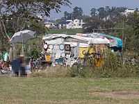
Some homeless people live near the Tama River. [2]
Man-made lakes
- Lake Okutama
- Shiromaru Lake
See also
References
- ↑ "Piranhas stalk Japan river". Al Jazeera English. 18 October 2010. Retrieved 15 August 2014 – via YouTube.
- ↑ 河川の利用と管理・よくあるお問合せ・ホームレス対策について(京浜河川事務所) (Japanese)
External links
35°31′18″N 139°47′54″E / 35.521784°N 139.798333°ECoordinates: 35°31′18″N 139°47′54″E / 35.521784°N 139.798333°E (mouth)
| Wikimedia Commons has media related to Tama River. |