Takum
| Takum Ikam | |
|---|---|
| LGA and town | |
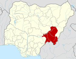
 Takum Location in Nigeria | |
| Coordinates: 7°15′N 9°59′E / 7.250°N 9.983°ECoordinates: 7°15′N 9°59′E / 7.250°N 9.983°E | |
| Country |
|
| State | Taraba State |
| Government | |
| • Type | Local Government |
| Area | |
| • Total | 2,503 km2 (966 sq mi) |
| Population (2006 census) | |
| • Total | 135,349 |
| Time zone | WAT (UTC+1) |
| 3-digit postal code prefix | 671 |
| ISO 3166 code | NG.TA.TA |
Takum is a Local Government Area in Taraba State, Nigeria. Its headquarters are in the town of Takum, it is created out of Wukari local government, at7°16′00″N 9°59′00″E / 7.26667°N 9.98333°E. Takum borders the Republic of Cameroon in the south, Ussa Local Government to the west, Donga Local government to the north, District within Takum are Abuja, kwambai, jenuwa, Rogo, Dutse, Tikari, Kashimbila, Bete, Chanchanji, Bika.
The ethnic tribes in Takum are kuteb, Chamba, Ichen, Hausa, Tiv
It has an area of 2,503 km² and a population of 135,349 at the 2006 census.
The postal code of the area is 671.[1]
References
- ↑ "Post Offices- with map of LGA". NIPOST. Retrieved 2009-10-20.
| |||||||||||||