Takhtamukaysky District
| Takhtamukaysky District Тахтамукайский район (Russian) Тэхъутэмыкъуай район (Adyghe) | |
|---|---|
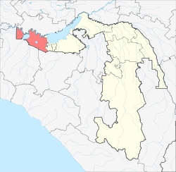 Location of Takhtamukaysky District in the Republic of Adygea | |
| Coordinates: 44°55′02″N 38°59′46″E / 44.91722°N 38.99611°ECoordinates: 44°55′02″N 38°59′46″E / 44.91722°N 38.99611°E | |
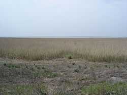 Shapsug Reservoir near the settlement of Druzhny in Takhtamukaysky District | |
 | |
|
| |
| Location | |
| Country | Russia |
| Federal subject | Republic of Adygea[1] |
| Administrative structure (as of June 2012) | |
| Administrative center | aul of Takhtamukay[1] |
| Inhabited localities: | |
| Urban-type settlements | 2 |
| Rural localities | 25 |
| Municipal structure (as of December 2010) | |
| Municipally incorporated as | Takhtamukaysky Municipal District[2] |
| Municipal divisions:[2] | |
| Urban settlements | 2 |
| Rural settlements | 5 |
| Local government: | |
| Head[3] | Azmet Skhalyakho[3] |
| Statistics | |
| Area | 440 km2 (170 sq mi) |
| Population (2010 Census) | 69,662 inhabitants[4] |
| - Urban | 63.2% |
| - Rural | 36.8% |
| Density | 158.32/km2 (410.0/sq mi)[5] |
| Time zone | MSK (UTC+03:00)[6] |
| Established |
September 2, 1924 (first),[7] December 31, 1934 (second),[7] April 25, 1983 (third)[7] |
| Official website | |
| Takhtamukaysky District on WikiCommons | |
Takhtamukaysky District (Russian: Тахтамука́йский райо́н; Adyghe: Тэхъутэмыкъуай район) is an administrative[1] and a municipal[2] district (raion), one of the seven in the Republic of Adygea, Russia. It is located in the west of the republic and borders with Krasnoarmeysky District of Krasnodar Krai and with the territory of the City of Krasnodar in the north, Teuchezhsky District in the east, the territory of the Town of Goryachy Klyuch of Krasnodar Krai in the south, and with Seversky District of Krasnodar Krai in the south and west. The area of the district is 440 square kilometers (170 sq mi). Its administrative center is the rural locality (an aul) of Takhtamukay.[1] District's population: 69,662 (2010 Census);[4] 65,674 (2002 Census);[8] 64,650 (1989 Census).[9] The population of Takhtamukay accounts for 7.5% of the district's total population.[4]
History
The district was first established on September 2, 1924, but was abolished a few years later on February 7, 1929.[7] On December 31, 1934, the district was re-established and existed until February 1, 1963, when it was merged into Teuchezhsky Rural District.[7] The district was again re-established, in its modern form, on April 25, 1983, under the name of Oktyabrsky.[7] It was renamed Takhtamukaysky in 1990.<ref name="ATSChanges>Perepis2002.ru. Изменения в административно-территориальном устройстве субъектов Российской Федерации за 1989-2002 годы (Russian)</ref>
Divisions
Administrative divisions
Takhtamukaysky District has administrative jurisdiction over two urban-type settlements (with six rural localities in their jurisdictions) and nineteen rural localities.
Municipal divisions
Municipally, the district is divided into two urban settlements and five rural settlements:[2]
- Urban settlements
- Enemskoye (Энемское)
- urban-type settlement of Enem
- rural localities under jurisdiction of the urban-type settlement:
- settlement of Druzhny
- aul of Novobzhegokay
- khutor of Novy Sad
- khutor of Supovsky
- Yablonovskoye (Яблоновское)
- urban-type settlement of Yablonovsky
- rural localities under jurisdiction of the urban-type settlement:
- settlement of Novy
- settlement of Perekatny
- Rural settlements
- Afipsipskoye (Афипсипское)
- Administrative center: aul of Afipsip
- other localities of the rural settlement:
- aul of Khashtuk
- settlement of Kubanstroy
- aul of Panakhes
- aul of Pseytuk
- Kozetskoye (Козетское)
- Administrative center: aul of Kozet
- Shendzhiyskoye (Шенджийское)
- Administrative center: aul of Shendzhiy
- other localities of the rural settlement:
- khutor of Krasnoarmeysky
- khutor of Novomogilevsky
- khutor of Staromogilevsky
- Starobzhegokayskoye (Старобжегокайское)
- Administrative center: aul of Starobzhegokay
- other localities of the rural settlement:
- khutor of Khomuty
- settlement of Novaya Adygeya
- Takhtamukayskoye (Тахтамукайское)
- Administrative center: aul of Takhtamukay
- other localities of the rural settlement:
- khutor of Apostolidi
- aul of Natukhay
- settlement of Otradny
- settlement of Prikubansky
- settlement of Sups
References
Notes
- ↑ 1.0 1.1 1.2 1.3 Law #171
- ↑ 2.0 2.1 2.2 2.3 Law #220
- ↑ 3.0 3.1 Official website of Takhtamukaysky District. Azmet Mezbechevich Skhalyakho, Head of Teuchezhsky District (Russian)
- ↑ 4.0 4.1 4.2 Russian Federal State Statistics Service (2011). "Всероссийская перепись населения 2010 года. Том 1" [2010 All-Russian Population Census, vol. 1]. Всероссийская перепись населения 2010 года (2010 All-Russia Population Census) (in Russian). Federal State Statistics Service. Retrieved June 29, 2012.
- ↑ The value of density was calculated automatically by dividing the 2010 Census population by the area specified in the infobox. Please note that this value may not be accurate as the area specified in the infobox does not necessarily correspond to the area of the entity proper or is reported for the same year as the population.
- ↑ Правительство Российской Федерации. Федеральный закон №107-ФЗ от 3 июня 2011 г. «Об исчислении времени», в ред. Федерального закона №248-ФЗ от 21 июля 2014 г. «О внесении изменений в Федеральный закон "Об исчислении времени"». Вступил в силу по истечении шестидесяти дней после дня официального опубликования (6 августа 2011 г.). Опубликован: "Российская газета", №120, 6 июня 2011 г. (Government of the Russian Federation. Federal Law #107-FZ of June 31, 2011 On Calculating Time, as amended by the Federal Law #248-FZ of July 21, 2014 On Amending Federal Law "On Calculating Time". Effective as of after sixty days following the day of the official publication.).
- ↑ 7.0 7.1 7.2 7.3 7.4 7.5 Азаренкова, А. С.; И. Ю. Бондарь, Н. С. Вертышева (1986) [1986]. Основные административно-территориальные преобразования на Кубани (1793–1985 гг.) (in Russian). Краснодарское книжное издательство. p. 180–181.
- ↑ Russian Federal State Statistics Service (May 21, 2004). "Численность населения России, субъектов Российской Федерации в составе федеральных округов, районов, городских поселений, сельских населённых пунктов – районных центров и сельских населённых пунктов с населением 3 тысячи и более человек" [Population of Russia, Its Federal Districts, Federal Subjects, Districts, Urban Localities, Rural Localities—Administrative Centers, and Rural Localities with Population of Over 3,000] (XLS). Всероссийская перепись населения 2002 года [All-Russia Population Census of 2002] (in Russian). Retrieved August 9, 2014.
- ↑ Demoscope Weekly (1989). "Всесоюзная перепись населения 1989 г. Численность наличного населения союзных и автономных республик, автономных областей и округов, краёв, областей, районов, городских поселений и сёл-райцентров" [All Union Population Census of 1989: Present Population of Union and Autonomous Republics, Autonomous Oblasts and Okrugs, Krais, Oblasts, Districts, Urban Settlements, and Villages Serving as District Administrative Centers]. Всесоюзная перепись населения 1989 года[All-Union Population Census of 1989] (in Russian). Институт демографии Национального исследовательского университета: Высшая школа экономики [Institute of Demography at the National Research University: Higher School of Economics]. Retrieved August 9, 2014.
Sources
- Государственный Совет — Хасэ Республики Адыгея. Закон №171 от 5 мая 2000 г. «Об административно-территориальном устройстве Республики Адыгея», в ред. Закона №97 от 6 июня 2012 г. «О внесении изменений в некоторые Законы Республики Адыгея в связи с принятием Закона Республики Адыгея "Об отнесении посёлка городского типа Тульского к категории посёлков — сельских населённых пунктов"». Вступил в силу со дня официального опубликования. Опубликован: "Советская Адыгея", №156-157, 7 августа 2004 г. (State Assembly of the Republic of Adygea. Law #171 of May 5, 2000 On the Administrative-Territorial Structure of the Republic of Adygea, as amended by the Law #97 of June 6, 2012 On Amending Various Laws of the Republic of Adygea Due to the Adoption of the Law of the Republic of Adygea "On Transformation of the Urban-Type Settlement of Tulsky into a Settlement—a Rural Locality. Effective as of the official publication date.).
- Совет Республики Адыгея. Закон №220 от 14 мая 2004 г. «О наделении муниципального образования "Тахтамукайский район" статусом муниципального района, об образовании муниципальных образований в его составе и установлении их границ», в ред. Закона №378 от 30 декабря 2014 г. «О внесении изменений в Закон Республики Адыгея "О наделении муниципального образования "Тахтамукайский район" статусом муниципального района, об образовании муниципальных образований в его составе и установлении их границ"». Вступил в силу со дня официального опубликования. Опубликован: "Советская Адыгея", №93, 14 мая 2004 г. (State Council of the Republic of Adygea. Law #220 of May 14, 2004 On Granting the Municipal Formation of "Takhtamukaysky District" the Status of a Municipal District, on Establishing the Municipal Formations Within Its Borders and on Granting Them the Settlement Status, and on Establishing Their Borders, as amended by the Law #378 of December 30, 2014 On Amending the Law of the Republic of Adygea "On Granting the Municipal Formation of "Takhtamukaysky District" the Status of a Municipal District, on Establishing the Municipal Formations Within Its Borders and on Granting Them the Settlement Status, and on Establishing Their Borders". Effective as of the day of the official publication.).
| ||||||||||||||||||||||||