Tai Po Road
| 大埔公路 Tai Po Road | |
|---|---|
| Route information | |
| Length: |
21.9 km (13.6 mi) 1.6 km (0.99 mi) Tai Wo section 1.1 km (0.68 mi) Yuen Chau Tsai section 3.6 km (2.2 mi) Tai Po Kau section 2.8 km (1.7 mi) Ma Liu Shui section 4.0 km (2.5 mi) Sha Tin section 1.2 km (0.75 mi) Tai Wai section 3.3 km (2.1 mi) Sha Tin Heights section 1.2 km (0.75 mi) Piper's Hill section 3.1 km (1.9 mi) Section in Kowloon |
| Existed: | 1902 – present |
| Major junctions | |
| South end: | Cheung Sha Wan Road at Mong Kok |
|
Castle Peak Road at Sham Shui Po | |
| North end: | Kwong Fuk Road/Nam Wan Road at Tai Po South |
| Tai Po Road (Kowloon portion) | |||||||||||
| Chinese | 大埔道 | ||||||||||
|---|---|---|---|---|---|---|---|---|---|---|---|
| |||||||||||
| Tai Po Road (New Territories portion) | |||||||||||
| Chinese | 大埔公路 | ||||||||||
| |||||||||||

Tai Po Road is the second longest road in Hong Kong (after Castle Peak Road). It spans from Sham Shui Po in Kowloon to Tai Po in the New Territories of Hong Kong. Initially, the road was named Frontier Road.
Location
The road begins at Nathan Road near Sham Shui Po, runs through the valley between Golden Hill and Beacon Hill, and connects to Sha Tin. It then continues northward along Sha Tin Hoi and Tai Po Hoi.
History
Tai Po Road is one of the earliest major roads in the New Territories, built in 1902. In the early 20th century and until the Lion Rock Tunnel, the first road tunnel in Hong Kong, was built in 1967, Tai Po Road was the main road connecting Tai Wai and the New Territories to Kowloon.[1] Before the construction of the Fanling Highway in the 1980s, the road connected Fanling and Sheung Shui.
See also
- List of streets and roads in Hong Kong
- North Kowloon Magistracy, located at No. 292
References
- ↑ Cheng Siu Kei, "Making of a New Town: Urbanisation in Tai Po", Tai Po Book p. 271
External links
| Wikimedia Commons has media related to Tai Po Road. |
- Google Maps of Tai Po Road:
| ||||||||||||||||||||||||||
| ||||||
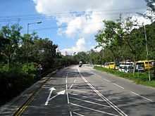
| Tai Po Road — Sha Tin | ||
| Preceded by Shing Mun Tunnel Road |
Tai Po Road — Sha Tin | Succeeded by Tolo Highway |
Coordinates: 22°23′20″N 114°11′37″E / 22.38893°N 114.19353°E