Taganay
| Taganay National Park | |
|---|---|
|
IUCN category II (national park) | |
|
"The river of rocks" in Taganay. | |
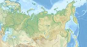 Location of Taganay National Park | |
| Location | Chelyabinsk Region, Zlatoust, Russia |
| Nearest city | Zlatoust |
| Coordinates | 55°15′35″N 59°47′33″E / 55.25972°N 59.79250°ECoordinates: 55°15′35″N 59°47′33″E / 55.25972°N 59.79250°E |
| Area | 568 km2 (219 sq mi) |
| Established | March 5, 1991 |
| http://taganay.ru/ | |

Taganay (Russian: Таганай) is a group of mountain ridges in the Southern Urals, on the territory of Chelyabinsk Oblast, with the highest point rising 1178 m. above sea level. Taganay National Park was established in 1991, with its south-western border reaching down to the outskirts of Zlatoust. Total area of the park is about 568 square kilometres (219 sq mi), with the distance of 52 km (32 mi) from north to south and width of about 10–15 km (6.2–9.3 mi).
Climate and weather
| Climate data for Zlatoust, Russia | |||||||||||||
|---|---|---|---|---|---|---|---|---|---|---|---|---|---|
| Month | Jan | Feb | Mar | Apr | May | Jun | Jul | Aug | Sep | Oct | Nov | Dec | Year |
| Daily mean °F | 3 | 6 | 15 | 32 | 46 | 55 | 60 | 57 | 44 | 32 | 21 | 6 | 32 |
| Average precipitation inches | 1.4 | 1.1 | 1.1 | 1.7 | 2.3 | 3.2 | 4.7 | 3.1 | 2.8 | 2.5 | 1.9 | 1.5 | 27.2 |
| Daily mean °C | −16 | −14 | −9 | 0 | 8 | 13 | 16 | 14 | 7 | 0 | −6 | −14 | 0 |
| Average precipitation mm | 36 | 28 | 28 | 43 | 58 | 81 | 119 | 79 | 71 | 64 | 48 | 38 | 691 |
| Source: [1] | |||||||||||||

Looking south in the direction of Zlatoust.
References
- ↑ "Weatherbase:Historical Weather for Zlatoust, Russia". Retrieved Feb 9, 2011.
External links
| ||||||||