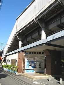
Tōbu-shijō-mae Station

Tōbu-shijō-mae Station
Tōbu-shijō-mae Station (東部市場前駅 Tōbu-shijō-mae-eki) is a railway station on the West Japan Railway Company Kansai Line (Yamatoji Line) in Higashisumiyoshi-ku, Osaka, Osaka Prefecture, Japan.
Layout
2 side platforms serving 2 elevated tracks are located. There is a difficulty of locating elevators (lifts) and escalators for the station structure.
| 1 | ■Yamatoji Line | for Oji, Nara and Takada |
| 2 | ■Yamatoji Line | for Tennoji, JR Namba and Osaka |
Surroundings
- Osaka Municipal Central Wholesale Markets East Wholesale Market
- JR Freight Kudara Kamotsu Terminal
- Kumata Junction (Japan National Route 25 and Imazato-suji)
Bus Stops
- Kumata (Osaka Municipal Transportation Bureau)
- Kudara-ekimae Junction (along Imazato-suji)
- Route 35 for Moriguchi Shako-mae via Subway Imazato
- Route 35B for Subway Imazato
- Route 85 for Namba via Subway Imazato and Tamatsukuri
- West side of Kumata Junction
- Route 1 for Deto Bus Terminal via Hirano-Miyamachi Nichome and Kire-Higashiguchi
- Route 30 for Hirano Kuyakusho-mae via JR Hirano-eki and Subway Hirano
- Route 1 and Route 5 for Abenobashi via Naka-Kuwazu
- Route 30 for Abenobashi via Teradacho
- East side of Kumata Junction
- Route 1 for Deto Bus Terminal via Hirano-Miyamachi Nichome and Kire-Higashiguchi
- Route 1 for Abenobashi via Naka-Kuwazu
- South-west side of Kumata Junction
- Route 6 for Sunjiyata
- Route 6 and Route 26 for Abenobashi via Bishoen
- South side of Kumata Junction
- Route 5 for Miyake-naka
- Route 6 for Sunjiyata
- Route 73 for Deto Bus Terminal via Imagawa Hatchome and Hirano Sports Center
- Route 5 for Abenobashi via Naka-Kuwazu
- Route 73 for Namba via Katsuyama Yonchome and Uehommachi Rokuchome
- Kudara-ekimae Junction (along Imazato-suji)
Stations next to Tobu-shijo-mae
| « | Service | » | ||
|---|---|---|---|---|
| JR West | ||||
| Yamatoji Line | ||||
| Hirano | Local | Tennōji | ||
| Regional Rapid Service: no stop | ||||
| Rapid Service: no stop | ||||
| Yamatoji Rapid Service: no stop | ||||
| ||||||
Coordinates: 34°38′17.33″N 135°32′15.67″E / 34.6381472°N 135.5376861°E