Suva Reka
| Suva Reka/Suhareka | |
|---|---|
| Municipality and city | |
| Theranda/Suhareka Сува Река/Suva Reka | |
 | |
 Suva Reka/Suhareka Location in Kosovo | |
| Coordinates: 42°22′N 20°49′E / 42.367°N 20.817°E | |
| Country | Kosovo[lower-alpha 1] |
| District | District of Prizren |
| Area | |
| • Total | 361 km2 (139 sq mi) |
| Population (2011) | |
| • Total | 59,722 (municipality) |
| • Density | 165.4/km2 (428/sq mi) |
| Time zone | CET (UTC+1) |
| • Summer (DST) | CEST (UTC+2) |
| Area code(s) | +383 |
| Car plates | 04 |
| Website | Municipality of Suhareka |
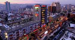
Suva Reka or Suhareka (Albanian: Suhareka; Serbian: Сува Река, Suva Reka, Turkish: Suhareka) also known as Theranda is a town and municipality in the Prizren district of southern Kosovo.[lower-alpha 1] According to the 2011 census, the total population of the municipality is 59,722. Albanians form the absolute majority of the town (98.9%), while other small ethnic groups include Ashkali and Balkan Egyptians, and others.[1]
It is located 18 kilometres (11 miles) from Prizren, and 57 km (35 mi) from Pristina.
Name
The name Suha Reka means "dry river" in Serbian. After the 1999 Kosovo War, Albanians referred to the town as Theranda, the name of the ancient fortress of Theranda, located near Prizren.
Demographics
| Ethnic Composition, Including IDPs | |||||||||||||
| Year/Population | Albanian | % | Serb | % | Roma | % | Total | ||||||
|---|---|---|---|---|---|---|---|---|---|---|---|---|---|
| January 1999 | 80,000 | 95.5 | 3,000 | 3.75 | 700App | 0.75 | ? | ||||||
| January 2001 | 72,000 | 99.3 | 58 | 0.01 | 660 App | 0.57 | ? | ||||||
| Ref: Organization for Security and Co-operation in Europe | |||||||||||||
History
From 1929 to 1941 Suhareka was part of the Vardar Banovina of the Kingdom of Yugoslavia.
International relations
Twin towns – Sister cities
Suhareka is twinned with:
Notes and references
- Notes
- ↑ 1.0 1.1 Kosovo is the subject of a territorial dispute between the Republic of Serbia and the Republic of Kosovo. The latter declared independence on 17 February 2008, but Serbia continues to claim it as part of its own sovereign territory. Kosovo's independence has been recognised by 108 out of 193 United Nations member states.
References
See also
- Suhareka massacre in 1999.
- Camp Casablanca, NATO base
External links
| Wikimedia Commons has media related to Suhareka. |
Coordinates: 42°22′48″N 20°49′19″E / 42.38000°N 20.82194°E
| ||||||||||||||||||||||||||||||||
| | |||||||||
|---|---|---|---|---|---|---|---|---|---|
| Rank | Name | Districts | Pop. | Rank | Name | Districts | Pop. | ||
 Pristina Prizren |
1 | Pristina | Pristina | 208,230 | 11 | Glogovac (Drenas) | Pristina | 60,687 | 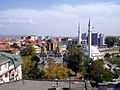 Ferizaj (Uroševac) 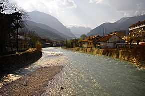 Peć |
| 2 | Prizren | Prizren | 183,810 | 12 | Lipljan | Pristina | 59,773 | ||
| 3 | Ferizaj (Uroševac) | Ferizaj (Uroševac) | 112,657 | 13 | Orahovac | Gjakova | 58,259 | ||
| 4 | Peć | Peć | 98,603 | 14 | Mališevo | Prizren | 57,136 | ||
| 5 | Gjakova | Gjakova | 97,127 | 15 | Skenderaj (Srbica) | Mitrovica | 52,175 | ||
| 6 | Gjilan | Gjilan | 92,369 | 16 | Vitina | Gjilan | 48,288 | ||
| 7 | Podujevo | Pristina | 90,568 | 17 | Deçan | Peć | 40,954 | ||
| 8 | Mitrovica | Mitrovica | 84,949 | 18 | Istok | Peć | 40,388 | ||
| 9 | Vučitrn | Mitrovica | 71,977 | 19 | Klina | Peć | 39,943 | ||
| 10 | Suva Reka | Prizren | 61,976 | 20 | Kamenica | Gjilan | 35,931 | ||