Surxondaryo Region
Coordinates: 38°0′N 67°30′E / 38.000°N 67.500°E
| Surxondaryo (Surkhandarya) Region (سرخاندریا) | |
| Surxondaryo viloyati | |
| Region | |
| Country | Uzbekistan |
|---|---|
| Capital | Termiz |
| Area | 20,100 km2 (7,761 sq mi) |
| Population | 1,925,100 (2005) |
| Density | 96 / km2 (249 / sq mi) |
| ISO 3166-2 | UZ-SU |
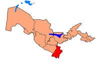 | |
Surxondaryo Region (Uzbek: Surxondaryo viloyati, Сурхондарё вилояти, Persian: سرخاندریا, UniPers: "sorxāndaryā"), old spelling Surkhandarya Region is a viloyat (region) of Uzbekistan, located in the extreme south-east of the country. Established on March 6, 1941, it borders on Turkmenistan, Tajikstan, Afghanistan and Qashqadaryo Region. It covers an area of 20,100 km². The population is estimated at 1,925,100 (end of 2005 data), with 80% living in rural areas.[1] According to official data, 83% of the population are Uzbeks and 1% Tajiks.[2] The highest point of Province and also of Uzbekistan is Khazrati Sulton peak reaching 4,643 m/15,233 ft in Gissar Range.[3]
The regional capital is Termiz with population of 122,900 and the second largest city is Denov (Denau) with 69,500 inhabitants (data for 2005).[1] Other major towns include Boysun, Jarqo‘rg‘on, Qumqo‘rg‘on, Shargun, Sherobod, Sho‘rchi, and Sariosiyo.
The climate is continental, with mild wet winters and hot dry summers. The southern part of the province is in the Badkhiz-Karabil semi-desert ecoregion (PA0808), characterized by a savanna of pistachio and desert sedge. The northern portion is characterized by open woodlands (Gissaro-Alai open woodlands ecoregion, PA1306), with characteristic plants being pistachio, almond, walnut, apple, and juniper. Sagebrush is common at lower elevations [4][5]
Natural resources include petroleum, natural gas, and coal. Light industry, mainly cotton ginning and food processing, is also an important part of the provincial economy, particularly in the production of consumer goods. Agriculture is based primarily on cotton and cereals, supplemented with horticulture and viticulture. Surxondaryo is the country's largest supplier of long-fiber cotton. Livestock accounts for 40% of regional agricultural product.[1] The climatic conditions of this region also make it possible to cultivate subtropical crops such as sugarcane.
The regon has a well-developed transport infrastructure, with 300 km of railways and 2,700 km of surfaced roads.[1] Central Asia's only river port is located at Termez on the Amudarya River.
History
Bitter debates accompanied the Soviet allocation of Surkhandarya Province to the Uzbek SSR rather than the Tajik SSR in 1929, as that province, as well as the areas of Bukhara and Samarkand, had sizeable, if not dominant, Tajik populations.
Districts
The provinces is divided into 14 districts (tumans):[6][7]
| District name | District capital | |
|---|---|---|
| 1 | Angor District | Angor |
| 3 | Boysun District | Boysun |
| 4 | Denov District | Denov (Denau) |
| 5 | Jarkurghon District | Jarkurghon |
| 2,6 | Kizirik District | Sariq |
| 7 | Kumkurghon District | Kumkurghon |
| 8 | Muzrabot District | Khalkobod (Khalkabad) |
| 9 | Oltinsoy District | Qarluq |
| 10 | Sariosiyo District | Sariosiyo |
| 11 | Sherobod District | Sherobod (Shirabad) |
| 12 | Shurchi District | Shurchi |
| 13 | Termiz District | Termiz (Termez) |
| 14 | Uzun District | Uzun |
Agriculture (2005 data)
Agriculture accounts for 42% of total employment in Surxondaryo Region and produces 8% of Uzbekistan’s agricultural output. Agricultural production is 56% crops and 44% livestock (like the country’s average). Milk yields are less than 1,700 kg per cow per year, on a par with the national average.
Main characteristics of agriculture in Surxondaryo Region[1][8]
| Surxondaryo | Percent of national total | |
|---|---|---|
| Sown area | 278,100 ha | 8 |
| Cereals | 45% | 8 |
| Cotton | 45% | 8 |
| Potatoes, vegetables | 5% | 7 |
| Feed crops | 5% | 5 |
| Fruit orchards | 12,600 ha | 6 |
| Vineyards | 8,400 ha | 6 |
| Cattle | 531,100 head | 8 |
| Cows | 241,900 head | 9 |
| Sheep, goats | 1,253,500 head | 11 |
References
- ↑ 1.0 1.1 1.2 1.3 1.4 Statistical Yearbook of the Regions of Uzbekistan 2005, State Statistical Committee, Tashkent, 2006 (Russian).
- ↑ Ethnic composition of the population in Surxondaryo Province
- ↑ Ethnic Atlas of Uzbekistan, Part 1: Ethnic minorities, Open Society Institute, table with number of Tajiks by province (Russian).
- ↑ World Wildlife Fund (2001). "Gissaro-Alai open woodlands". WildWorld Ecoregion Profile. National Geographic Society. Archived from the original on 2010-03-08.
- ↑ World Wildlife Fund (2001). "Badkhiz-Karabil semi-desert". WildWorld Ecoregion Profile. National Geographic Society. Archived from the original on 2010-03-08.
- ↑ Districts and district capitals in Surxondaryo Region.
- ↑ Administrative Map of the Republic of Uzbekistan, State Agency for Land Resources, Geodesy, Cartography, and Land Cadastre, Tashkent, 2007 (Russian).
- ↑ Agriculture in Uzbekistan, State Statistical Committee, Tashkent, 2007 (Russian).
External links
- Map of Surxondaryo Province (Russian).
 |
Qashqadaryo Region | Sughd Region, |
| |
| |
Districts of Republican Subordination, | |||
| ||||
| | ||||
| Lebap Region, |
Balkh Region, |
Khatlon Region, |
| ||||||||