Supramonte
| Supramonte | |
|---|---|
|
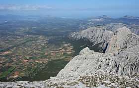
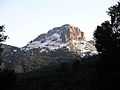
View of Supramonte from Punta Sos Nidos | |
| Highest point | |
| Peak | Monte Corrasi |
| Elevation | 1,463 m (4,800 ft) |
| Geography | |
| Country | Italy |
| State/Province | Sardinia |
| Range coordinates | 40°14′N 9°26′E / 40.24°N 9.43°ECoordinates: 40°14′N 9°26′E / 40.24°N 9.43°E |
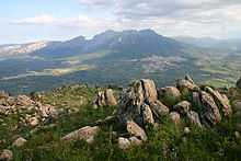
The Supramonte is an area of mountains and highlands located in central-eastern Sardinia, Italy. It lies northeast of the Gennargentu massif, spanning eastwards until it reaches the Tyrrenian See in the Gulf of Orosei. It has an extension of about 35,000 hectares, encompassing most of the territories of the comuni (municipalities) of Baunei, Dorgali, Oliena, Orgosolo, and Urzulei. However, the populated areas of these comuni actually lie at the borders of the Supramonte, which, for the most part, is in fact a largely uninhabited continuum of sharp limestone cliffs and deep, lush canyons.
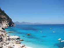
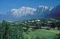
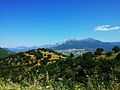
The highest peak is Monte Corrasi (1,463 m), while the average altitude is about 900 m. The Supramonte is characterized by Karstic highlands in which the rivers dug deep ravines and canyons. The rivers actually flow mostly underground, creating several caves, such as the Grotta del Bue Marino, the Grotta di Ispinigoli (with the highest column in Europe, measuring 38 m), and the caves of Sa Oche ("The Voice") and Su Bentu ("The Wind"), or springs, such as the spring of Su Gologone. Other notable places include the plain (campu) of Donanigoro, the sinkhole of Su Sercone, the deep ravine of Gorropu, and the Mesozoic limestone mountain of Monte Novo San Giovanni (1,316 m). The so-called "Supramonte Marino" ("Seaside Supramonte", to distinguish it from the inner "Supramonte Montano", "Mountain Supramonte") lies within the territories of Dorgali and Baunei, bordering the Gulf of Orosei and including several renowned beaches (Cala Luna, Cala Sisine, Cala Mariolu, Cala Goloritzé) often located at the end of deep valleys called codulas.
In prehistoric times, the Supramonte area was more densely inhabited than it is today, as attested by the traces of at least 76 villages, 46 nuraghes, 14 dolmens, 40 Giants' graves, 17 holy wells, and 3 megalithic walls. Notable archeological sites include the village of Serra Orrios (although located slightly north of the northern border of the limestone lands), which counted about 70 circular huts and two megaron-like temples, and the nuraghe village of Tiscali, located in a strategic high position between the valleys of Lanaittu and Oddoene.
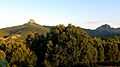
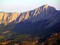
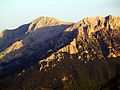
Gallery
-
Supramonte of Orgosolo
-

Supramonte of Oliena - Punta Corrasi
-
Supramonte of Oliena - Punta Cusidore
-
Supramonte of Oliena - Punta Sos Nidos
-
Monte Fumai
-
Mount Corrasi
-
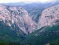
View of the ravine of Gorropu
-
Mount Corrasi
-
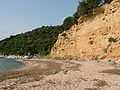
A beach nearby Cala Gonone
-

View of Monte Corrasi from Monte Ortobene
-
Cala Goloritzè
-
View from the pass of Genna Silana
-

Punta sos Nidos
-
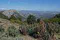
Supramonte landscape
-
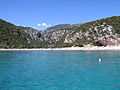
Cala Luna
-
Guthiddai Valley
-
Oliena mountains