Sunk Island
Coordinates: 53°39′09″N 0°05′04″W / 53.652384°N 0.084397°W
Sunk Island is a Crown Estate village and civil parish in the East Riding of Yorkshire, England. It lies 3.5 miles (5.6 km) south of Ottringham and 1-mile (1.6 km) to the north of the Humber Estuary. The Greenwich Meridian passes through the east of the parish.[2]
According to the 2011 UK census, Sunk Island parish had a population of 228,[1] an increase on the 2001 UK census figure of 224.[3]
History

Sunk Island originated as a sand bank in the Humber Estuary; at first it was open sea, then accumulated until visible only at low tides, then at all tides. Colonel Gilby raised the outer banks, making it useful for pasturage, under lease/gift from the crown.[4]
By the reign of Charles I of England, it was said to form a seven acre island, one-and-a-half mile from the mainland.[5] From 1663, the land around it was gradually drained, and by the mid-18th century, the channel separating it from the shore had entirely silted up. It was parished in 1831.[5]
A fort was built at the outbreak of the First World War.
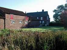
Today, the settlement consists of a church, a few houses and various farms. Cottages were built 1855–7 by Samuel Sanders Teulon.
The parish church of the Holy Trinity, designed by Ewan Christian in the 1870s,[6] is a Grade II listed building.[7]

References
- ↑ 1.0 1.1 "Key Figures for 2011 Census: Key Statistics: Area: Sunk Island CP (Parish)". Neighbourhood Statistics. Office for National Statistics. Retrieved 7 February 2013.
- ↑ "Sunk Island, Greenwich Meridian Marker". The Greenwich Meridian. Retrieved 18 July 2010.
- ↑ "2001 Census: Key Statistics: Parish Headcounts: Area: Sunk Island CP (Parish)". Neighbourhood Statistics. Office for National Statistics. Retrieved 20 May 2008.
- ↑ Philosophical Transactions, vol 30, p. 1015
- ↑ 5.0 5.1 GENUKI. "SUNK ISLAND: Geographical and Historical information from the year 1892.". Retrieved 3 August 2007.
- ↑ Pevsner, Nikolaus; Neave, David (2002) [1972]. Yorkshire: York and the East Riding: The Buildings of England (2nd ed.). Yale University Press. ISBN 0-300-09593-7.
- ↑ Historic England. "Church of the Holy Trinity (1161190)". National Heritage List for England. Retrieved 7 February 2013.
- Gazetteer — A–Z of Towns Villages and Hamlets. East Riding of Yorkshire Council. 2006. p. 10.
External links
| Wikimedia Commons has media related to Sunk Island. |
- Historic England. "Holy Trinity Church (166621)". Images of England.
- Sunk Island Crown Estate
- Sunk Island meridian marker
| ||||||||||||||||||||||||||
