Sultan Bathery
| Sulthan Bathery Sulthan Bathery | |
|---|---|
| Town | |
|
Jain temple at Sultan Bathery | |
 Sulthan Bathery Location in Kerala, India | |
| Coordinates: 11°40′N 76°17′E / 11.67°N 76.28°ECoordinates: 11°40′N 76°17′E / 11.67°N 76.28°E | |
| Country |
|
| State | Kerala |
| District | Wayanad |
| Government | |
| • President | P P Ayyoob |
| Elevation | 907 m (2,976 ft) |
| Population (2001) | |
| • Total | 27,473 |
| • Density | 476/km2 (1,230/sq mi) |
| Languages | |
| • Official | Malayalam, English, Kannada |
| Time zone | IST (UTC+5:30) |
| PIN | 673592 |
| Telephone code | 91 4936 |
| Vehicle registration | KL-73 |
Sulthan Bathery, previously known as Sultan's Battery, is a town in Wayanad district of Kerala, India. It derives its present name from Tipu Sultan of Mysore who killed all the Jain Monks and used the Jain temple as his battery here in the 18th century, hence the name Sultan's Battery. This town was part of Kidanganadu[1] Village, which got its name because the presence of the Kidangans the tribes. Later, it came to be known as Sultan Bathery, the Malayalam version of its name. It is also known as Sultan's Battery of Wayanad district. Though the fort does not remain any more, the place is worth the visit for the famous Jain Temple. The place was previously known by the name of Sulthan's Battery.[2] It is the Taluk headquarters of Sultan Bathery. It lies on the Kozhikode–Kollegal National Highway (NH 766) 98 km from Kozhikode. It is 115 kilometers from Mysore[3] and about 100 kilometers from Ooty (Udagamandalam). It is also connected with Nilambur. The people primarily depend on agriculture for a living.
Sulthan Battery is situated at about 930 metres above mean sea level. One can find beautiful folded hills across the horizon. The climate is pleasant throughout the year. The town has the National Highway 766 passing through it. The town is the centre of tourism in Wayanad District. It has become a very popular destination among tourists from India's software valley of Bangalore.
History
Sultan Bathery is a historical place and its ancient history goes in sync with the history of Wayanad.The recorded history of this district exists only from the 10th century onward. In 930 AD, emperor Erayappa of Ganga Dynasty led his troops to south west of Mysore - an invasion to the prosperous kingdom he had heard of from traders and Jain monks. Mission accomplished and he called the conquered kingdom Bayalnad meaning the land of swamps. After Erayappa, his sons Rachamalla and Battunga fought each other for the new kingdom of their father’s legacy. Rachamalla was killed and Battunga became the undisputed ruler of Bayalnad. In 12th century AD, Gangas were dethroned from Bayalnad by Kadamba dynasty[4] of North Canara.[5] In 1104 AD Vishnuvardhana of Hoysala invaded Bayalnad followed by Vijayanagara dynasty in 16th century. In 1610 AD Udaiyar Raja Wadiyar of Mysore drove out Vijayanagara General and became the ruler of Bayalnad and the Nilgiris. Bayalnad is the present Wayanad. When Wayanad was under Hyder Ali’s rule, the ghat road from Vythiri to Thamarassery invented.[6] Then the British rulers developed this route to Carter road.[7] When Wayanad was under Tipu Sultan's rule British invasion started. Tussle and turbulent times followed. The British claimed Wayanad under 1792 treaty of Srirangapatna citing it was part of Malabar. Tipu Sultan went in appeal before the Governor General. Considering his arguments, relying on the successive Karnatic rule for centuries in Wayanad and its geographical detachment from Malabar, in 1798, Governor General Lord Mornington declared by proclamation[8] that Wayanad had not been ceded to the East India Company by the treaty of 1792. Consequently the British troops withdrew from Wayanad conceding to Tipu’s rule. In 1799, after the fall of Sultan, the British handed over Wayanad by treaty of 1799 to the Raja of Mysore and . But by a supplementary treaty dated 29 December 1803 the East India Company repossessed South Wayanad and thereafter administrated by Col. Arthur Wellesley from Srirangapatna.
The Name
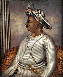
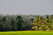
Wayanad was Ruled by Hyder Ali of Mysore. After Hyder Ali, his son Tipu Sultan took control over the territory. He was the man behind the fame of Sultan Bathery. Sultan Bathery was originally called as Hannaredu veethi[9] a kannada word means twelve streets. The name was changed in the 18th century, when Tipu Sultan used the Jain Temple for his armoury (Battery). And thus the town became known as Sultan's Battery, which gradually became Sultan Bathery.[10]
People
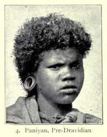
One important characteristic feature of the Sulthan Bathery is the large adivasi population, consisting mainly of Paniyas, Kurumas, Ooralis, Kadans,Kattunaikkans are the different aboriginal tribes. The Kurmas is the most developed among them. They are small land owners, whereas the members of other tribes are mostly labourers. Wayanad district stands first in the case of adivasi population (about 36%) among other districts in the state. Sulthan Bathery has a large settler population. There are people from almost all parts of Kerala who migrated to this fertile land for building up their lives.One Third population of Sulthan bathery is constituted by Muslims. Christians constitute One fifth population. and rest of the population belongs to Hindus. Their hard work and sacrifice helped them to prosper. On the other hand, the last few decades have seen the complete marginalization of the indigenous people.
Education
Many educational institutions including schools, colleges, industrial training centers and teacher training institutes exist in Sulthan Bathery. Wayanad is a single Education District with one Deputy Director of Education, one District Educational Officer (DEO) and three Assistant Educational Officers (AEO).[11][12] Sulthan Bathery taluk is under one AEO. Wayanad District Institute of Education and Training (DIET) is located at Sulthan Bathery. It is one of the three DIETs established in Kerala in the first phase in 1989. Apart from providing teacher education, its activities include academic research and innovations, academic monitoring of schools and material production.[13]
School Education
Many government, aided and unaided schools exist in Sulthan Bathery. They come under different boards of education such as Kerala State Education Board and Central Board of Secondary Education. Some of the schools which follow the state syllabus are listed below:[14]
- Government High Schools
- Sarvajana GVHSS, Sulthan Bathery
- Moolankavu GHSS, Moolankavu
- GVHS&THS, Sulthan Bathery
- Private Aided High Schools
- Assumption HS, Sulthan Bathery
- St. Mary's College HSS, Kuppady
- Private Unaided High Schools
- St. Joseph's English HSS, Sulthan Bathery
- WMO English High school, Sulthan Bathery
- Ideal English School, Sulthan Bathery
- Bhavans Vidya Mandir, Sulthan Bathery
- Green hills public school Moolankavu
College Education
Compared to other districts of Kerala, institutions offering higher education are limited in Wayanad.[15] One of the oldest colleges in Wayanad is St. Mary's College, Sulthan Bathery, established in 1965.[16] This arts and science college is affiliated to University of Calicut. Another arts and science college located here is Don Bosco College. Pazhassi Raja College, Pulpally, established in 1982, is another major college located nearby.[17] Government Engineering College located at Mananthavady is the nearest engineering college. It is affiliated to Kannur University.
Two nursing colleges located at Sulthan Bathery are Assumption School of Nursing and Vinayaka Hospital Collage of Nursing.
Other Educational Institutions
A few distance education centers also exist in the town of Sulthan Bathery. St. Mary's College IGNOU study center offers programs such as Post Graduate Diploma in Rural Development, Post Graduate Diploma in Environmental and Sustainable Development, Diploma in Tourism Studies etc. Another IGNOU study center is at Data Point Computer Academy. It offers programs such as Master of Computer Applications (MCA) and Certificate in Computing (CIC).
Many Teacher Training Colleges (TTC) too are present in Sulthan Bathery. Some of them are Mar Baselios Teacher Training Institute, Valummel Teacher Training Institute, Moolankave and St. George Teacher Training Institute, Pulpally.
Apart from these, some special schools for mentally challenged like St. Gregorios Special School for Mentally Challenged, Kottakkunnu[18] and Mercy Home Sacred Heart Special School for Mentally Retarded exist in Sulthan Bathery. The former is managed by Malankara Orthodox Syrian Church Bathery diocese while the latter is under the District Educational Officer, Wayanad. Other unaided special schools include St. Rossolo's HS for the Deaf, Poomala and WO Blind and Deaf school, Muttil.[19]
Climate
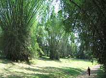
Sulthan Bathery has a salubrious climate. The mean average rainfall in this area is 2322 mm. Lakkidi, Vythiri and Meppadi are the high rainfall areas in Wayanad. The annual rainfall in these areas ranges from 3000 to 4000 mm. High velocity winds are common during the Southwest monsoon and dry winds blow in March–April. High altitude regions experience severe cold. In Wayanad (Ambalavayal) the mean maximum and minimum temperature for the last five years were 29 °C and 18 °C respectively. This place experiences a high relative humidity, which goes even up to 95 per cent during the Southwest monsoon period. Generally the year is classified into four seasons, namely, cold weather (December–February), hot weather (March–May), Southwest monsoon (June–September)and Northeast monsoon (October–November) seasons.
Monthly rainfall
| Month | Jan | Feb | Mar | Apr | May | Jun | Jul | Aug | Sep | Oct | Nov | Dec |
| Rainfall in mm | 13.6 | 13.6 | 13.3 | 118.1 | 58.4 | 607.9 | 378.1 | 626 | 249.9 | 122.4 | 43.3 | 1 |
How To reach
Sultan Battery has a very good road connectivity with south Indian states. The major Road is NH 212 connected to Mysore, Bangalore and Kozhikode, two State highways connected to Ooty and Coimbatore and a state highway connected to Mangalore, Kannur, Thalassery and Kasaragod.
Sulthan Bathery is the biggest transport hub of Wayanad district. It is located near the border with the Karnataka state. There is a major Kerala Transport Depot in Sulthan Bathery. Most of the long distance buses to Kozhikode, Ooty andBangalore start from this depot. The town also has two smaller bus stations for local travellers.
Railway
There are no railway line through Sultan Bathery. Nearest Railway stations are : 1.Kozhikode: 99 km away 2.Mysore: 116 km away. (see also Golden I.T. Corridor)3.Nanjangud:
Air Ways
Nearest airports 1.Calicut International Airport: 120 km away, 2.Coimbatore International Airport, 3.Mysore Airport: 106 km away. 4.Kannur International Airport(under construction at Mattannur):105 km away.
Geography
Sulthan Bathery is located at 11°40′N 76°17′E / 11.67°N 76.28°E.[20] It has an average elevation of 907 m (2,976 ft). more
Politics
Sultan's Battery assembly constituency is part of Wayanad (Lok Sabha constituency).[21] MLA I C BALAKRISHNAN . MP.M I Shanavas
Local administration
Sulthan Bathery is a part of wayanad District panchayath and the headquarters of Sultan Bathery Block panchayat. Sultan Bathery is now declired as Municipality. The total number of wards 23.
KL-73 is the RTO vehicle registration code for Sulthan Bathery Taluk.
Banking
- Sulthan Bathery co-operative Urban Bank
- South Indian Bank
- Union Bank of India
- Kerala Gramin Bank
- Indian Overseas Bank
- State Bank of Travancore
- Catholic Syrian Bank
- Vijaya Bank
- Sulthan Bathery Service Co-operative Bank
- Punjab National Bank
- State Bank Of India
- Federal Bank
- Axis Bank
- ICICI Bank
- HDFC Bank
- Syndicate Bank
- IndusInd Bank
Places of worship
- SulthanBathery Jumaa masjid: This is the biggest jumaa masjid in the town and it can hold more than 1000 worshippers. The masjid is situated near the Sulthan Bathery town bus stand.
- Ganapati Temple: A Hindu temple in the town.
- Jain Temple: This Temple, believed to have been built in the 13th century. This served as a Jain shrine, an important centre for commercial activity and eventually as a battery (ammunition store) for Tipu Sulthan's marching armies and hence the town got its name "Sulthan's Battery".
- Masjid Madeena :A juma masjid in town run by Jama at e Islami Hind (JIH)
- Soonoro Church: St. Mary's Jacobite Syrian Orthodox Church, Sulthan's Bathery is a famous pilgrim centre in Wayanad.
- Masjidul Mnar : A Juma Masjid run by Kerala Nadvathul Mujahideen.
- Shaduli Masjid: The famous juma masjid in the town.
- St. Mary's Orthodox Cathedral, Sulthan Bathery: This is one of the main churches for people who follow the Malankara Orthodox Syrian Church.
- Assumption Church: Is one of the major Christian churches located in the heart of the city.
- Mariyamman Temple: This is the most important temple for the local tribes.Yearly festival in Feb-March which gathers a lot of crowd.
- CSI St.Thomas Church :This church is situated near police station.
- The Pentecostal Mission (TPM): The Faith Home (church) is situated at College Road, Kottakunnu.
- Masjid Jami'a Ideal Cambus, Snehagiri,Sulthan Bathery
- Thalachillan Temple, Sulthan Bathery
- Narasimha temple, Sulthan Bathery
Healthcare
Sultan Bathery has a number of health centers and hospitals both private and government sector.
- Taluk Hospital :General Medicine,ENT,Gynecology,Pediatrics Departments are working now.X Ray, Lab and very good operation theater. 40 bed IP .
- Taluk Ayurveda Hospital :
- Government Homeopathic Hospital :
- Blood Bank :
- Vinayaka Hospital:
- Assumption Hospital :
- M.E.S Hospital :
- Doctors Hospital :
- Alfa Hospital :General Medicine,Gynecology,Pediatrics,Ortho,Physio Therapy, Departments and Casualty 24hrs ..are working now. X Ray, Scanning,Pharmacy 24 hrs Lab and very good operation theater. IP /OP
- Dr Appukuttan Memorial Hospital :
- Anupama Hospital :
- Victory Hospital :
- Vismaya Hospital :
- Karuna Hospital :
- Sarada eye hospital
Shopping
Sultan Bathery is the biggesst shopping paradise in Wayanad. It includes shopping mall ,Textiles, Home Appliances, Electronics, Computers, Electricals, Building Materials, Stationery, Agriculture products, forest products like Honey, Heavy metals, Automobiles, hyper markets.
Tourism
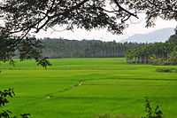
- RARS:The Regional AgriculturalResearch Station located in Ambalavayal town is part of the Kerala Agricultural University. This station conducts research on Spices, tropical and sub tropical fruits, vegetables and hill paddy. RARS also have a nursery with a large collection of rare Roses and ornamental plants. Visitors can purchase seeds and saplings at the sales counter.
- Wayanad Wildlife Sanctuary at Muthanga is contiguous to the protected area network of Nagarhole and Bandipur of Karnataka on the north-east and Muthumalai of Tamil Nadu on south-east. Rich in bio-diversity, the sanctuary is an integral part of the NilgiriBiosphere Reserve, which has been established with the specific objective of conserving the biological heritage of the region.
The sanctuary is rich in flora and fauna. The management lays emphasis on scientific conservation with due consideration for the general life styles of tribals and others who live in and around the forest.
The vegetation is predominantly moist deciduous forest with small stretches of swamps, teak forests, bamboo and tall grass. Amidst such fertile and varied flora, this region hosts several rare herbs and medicinal plants. With numerous watering holes Muthanga has a large population of pachyderms, and has been declared a Project Elephant site. Also Jungle Cats, Panthers, Civet Cat, Monkeys, Wild dogs, Deers, Spotted Bears, Bisons, Gaurs, Cheetah, Wild Bears, Peacock, Owls, Jungle fowls, Woodpeckers, Babblers, Cukoos etc.. can be seen here. The reserve is also home to a small population of Tigers.
|Edakkal Caves
- Edakkal Caves Three caves are located at a height of 1000 mts on Ambukuthi mala near Sulthan Baterhy . The new stone agepictorial writings on the walls of these natural caves at Edakkal are the evidence of the civilizations that existed in the regions in the pre-historic times
. The caves can be accessed only by a 1 km trekking trail from Edakkal.
- Thovarimala. 5 km from Sulthan Bathery; one can go trekking 400 m (1,312 ft) to reach Thovarimala Ezhuthupara where one can see stone age pictorial writings on a rock.
See also
- Tipu sultan
- Jainism in Kerala
- Mysore invasion of Kerala
- Wayanad District
- Kalpetta
- Mananthavady
- Ambalavayal
- Malabar
- Mysore
- Wynad Wildlife Sanctuary
- Sultan Battery Watchtower
References
- ↑ http://asi.nic.in/asi_monu_alphalist_kerala.asp
- ↑ http://sulthanbathery.blogspot.com//
- ↑ "Mysore to sulthan bathery". mysore.ind.in. Retrieved 2013-01-13.
- ↑ The Kadamba kula A history of ancient and medieval Karnatak , By George M. Moraces BX furtado &sons Bombay 1931
- ↑ https://archive.org/details/kadambakula035210mbp
- ↑ Madrass District Gazetteeers, The Nilgiris. By W. Francic. Madras 1908 Pages 90-104
- ↑ Report of the Administration of Mysore 1863-64. British Parliament Library
- ↑ Proclamation No:CLXXXLL , A. Collection of treaties and engagements , By W.Logan, Calicut 1879
- ↑ wynad and it'speoplesc gopalan nair
- ↑ Accounts_and_papers_of_the_House_of_Comm see page 335 wayand report
- ↑ "List of DEO offices, Kerala". General Education Department, Govt. of Kerala. Retrieved 18 July 2012.
- ↑ "List of AEO offices, Kerala". General Education Department, Govt. of Kerala. Retrieved 18 July 2012.
- ↑ "DIET Wayanad". Retrieved 18 July 2012.
- ↑ "List of High Schools in Wayanad" (PDF). General Education Department, Govt. of Kerala. Retrieved 18 July 2012.
- ↑ "Short history of Wayanad" (PDF). Retrieved 18 July 2012.
- ↑ "St. Mary's College, Sulthan Bathery official website". Retrieved 18 July 2012.
- ↑ "Pazhassi Raja college, Pulpally official website". Retrieved 18 July 2012.
- ↑ "Article on St. Gregorios Special School for Mentally Challenged". Indian Orthodox Herald. Retrieved 18 July 2012.
- ↑ "List of Special Schools in Kerala" (PDF). General Education Department, Govt. of Kerala. Retrieved 18 July 2012.
- ↑ Falling Rain Genomics, Inc - Sultans Battery
- ↑ "Assembly Constituencies - Corresponding Districts and Parliamentary Constituencies" (PDF). Kerala. Election Commission of India. Retrieved 2008-10-19.
External links
| Wikimedia Commons has media related to Sultan Bathery. |
| ||||||||||||||||||||