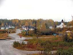
Sultan, Ontario
| Sultan | |
| Settlement | |
 | |
| Country | Canada |
|---|---|
| Province | Ontario |
| Region | Northeastern Ontario |
| District | Sudbury |
| Part | Sudbury, Unorganized, North Part |
| Elevation | 448 m (1,470 ft) |
| Coordinates | 47°35′30″N 82°45′27″W / 47.59167°N 82.75750°WCoordinates: 47°35′30″N 82°45′27″W / 47.59167°N 82.75750°W |
| Area | 2.55 km2 (1 sq mi) |
| Population | 49 (2011) |
| Density | 19 / km2 (49 / sq mi) |
| MP | Carol Hughes |
| - MPP | Michael Mantha |
| Timezone | Eastern Time Zone (UTC-5) |
| - summer (DST) | Eastern Time Zone (UTC-4) |
| Postal code FSA | P0M |
| Area code | 705, 249 |
 Location of Sultan in Ontario
| |
Sultan is an unincorporated community in the Unorganized North Part of Sudbury District in northeastern Ontario, Canada.
The local economy is based primarily on hunting and related tourism. In the past the logging industry formed the mainstay of the economy. Children from Sultan attend school in Chapleau, 68 kilometres (42 mi) away.
The primary access to Sultan by car is by Highway 667 and Sultan Industrial Road, an unpaved logging road connecting to Highway 144. Via Rail's Sudbury – White River train goes through Sultan, providing an alternate transportation route to White River and Sudbury, although the Sultan railway station is a flag stop[1] and consists of only a stop sign.
Sultan was formerly administered by a local services board, which was dissolved in 2008. The community, which holds the status of designated place in Statistics Canada census data, had a reported population of 49 in the Canada 2011 Census.[2]
References
- "Sultan". Geographical Names Data Base. Natural Resources Canada. Retrieved 2011-02-15.
- "Topographic Map sheet 41O10". Atlas of Canada. Natural Resources Canada. 2010-02-04. Retrieved 2011-02-15.
- ↑ "Train station: Sultan (Ontario)". Via Rail. Retrieved 2010-12-30.
- ↑ Statistics Canada. 2012. Sultan, Ontario (Code 350033) and Ontario (Code 35) (table). Census Profile. 2011 Census. Statistics Canada Catalogue no. 98-316-XWE. Ottawa. Released October 24, 2012. http://www12.statcan.gc.ca/census-recensement/2011/dp-pd/prof/index.cfm?Lang=E (accessed April 22, 2013).