Sugarloaf Township, Columbia County, Pennsylvania
| Sugarloaf Township, Columbia County, Pennsylvania | |
|---|---|
| Township | |
|
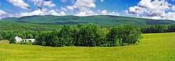
A farm in Sugarloaf Township | |
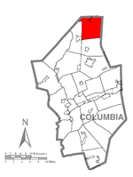 Map of Columbia County, Pennsylvania highlighting Sugarloaf Township | |
 Map of Columbia County, Pennsylvania | |
| Country | United States |
| State | Pennsylvania |
| County | Columbia |
| Settled | 1792 |
| Incorporated | 1812 |
| Area | |
| • Total | 25.9 sq mi (67.0 km2) |
| Population (2000) | |
| • Total | 885 |
| • Density | 34.2/sq mi (13.2/km2) |
| Time zone | Eastern (EST) (UTC-5) |
| • Summer (DST) | EDT (UTC-4) |
| Area code(s) | 570 |
| Website | Sugarloaf Township |
Sugarloaf Township is a township in Columbia County, Pennsylvania, United States. The population was 885 at the 2000 census.
History
The Y Covered Bridge No. 156 was listed on the National Register of Historic Places in 1979.[1]
Geography

According to the United States Census Bureau, the township has a total area of 25.9 square miles (67.0 km²), of which, 25.9 square miles (67.0 km²) of it is land and 0.04 square miles (0.1 km²) of it (0.12%) is water.
Demographics
As of the census[2] of 2000, there were 885 people, 370 households, and 263 families residing in the township. The population density was 34.2 people per square mile (13.2/km²). There were 779 housing units at an average density of 30.1/sq mi (11.6/km²). The racial makeup of the township was 98.98% White, 0.23% African American, 0.45% Native American, 0.11% Asian, 0.11% from other races, and 0.11% from two or more races. Hispanic or Latino of any race were 0.90% of the population.
There were 370 households out of which 23.8% had children under the age of 18 living with them, 59.7% were married couples living together, 7.8% had a female householder with no husband present, and 28.9% were non-families. 24.3% of all households were made up of individuals and 10.3% had someone living alone who was 65 years of age or older. The average household size was 2.39 and the average family size was 2.83.
In the township the population was spread out with 19.2% under the age of 18, 8.1% from 18 to 24, 27.6% from 25 to 44, 25.5% from 45 to 64, and 19.5% who were 65 years of age or older. The median age was 43 years. For every 100 females there were 106.3 males. For every 100 females age 18 and over, there were 108.5 males.
The median income for a household in the township was $35,521, and the median income for a family was $41,250. Males had a median income of $29,615 versus $20,924 for females. The per capita income for the township was $17,444. About 4.8% of families and 5.5% of the population were below the poverty line, including 7.6% of those under age 18 and 2.6% of those age 65 or over.
References
- ↑ "National Register Information System". National Register of Historic Places. National Park Service. 2010-07-09.
- ↑ "American FactFinder". United States Census Bureau. Retrieved 2008-01-31.
| |||||||||||||||||||||||||||||||||
Coordinates: 41°17′30″N 76°22′59″W / 41.29167°N 76.38306°W