Sugar Creek Township, Parke County, Indiana
| Sugar Creek Township | |
|---|---|
| Township | |
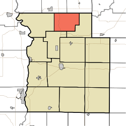 Location in Parke County | |
| Coordinates: 39°55′32″N 87°12′29″W / 39.92556°N 87.20806°WCoordinates: 39°55′32″N 87°12′29″W / 39.92556°N 87.20806°W | |
| Country |
|
| State |
|
| County | Parke |
| Government | |
| • Type | Indiana township |
| Area | |
| • Total | 24.91 sq mi (64.5 km2) |
| • Land | 24.89 sq mi (64.5 km2) |
| • Water | 0.02 sq mi (0.05 km2) 0.08% |
| Elevation | 646 ft (197 m) |
| Population (2010) | |
| • Total | 322 |
| • Density | 12.9/sq mi (5.0/km2) |
| ZIP codes | 47832, 47859, 47952 |
| GNIS feature ID | 0453884 |
Sugar Creek Township is one of thirteen townships in Parke County, Indiana, United States. As of the 2010 census, its population was 322 and it contained 154 housing units.[1] The township includes the north half of Turkey Run State Park.
Geography
According to the 2010 census, the township has a total area of 24.91 square miles (64.5 km2), of which 24.89 square miles (64.5 km2) (or 99.92%) is land and 0.02 square miles (0.052 km2) (or 0.08%) is water.[1]
Unincorporated towns
(This list is based on USGS data and may include former settlements.)
Extinct towns
- Lusks Mills at 39°53′38″N 87°10′53″W / 39.893930°N 87.181400°W
(These towns are listed as "historical" by the USGS.)
Cemeteries
The township contains these two cemeteries: Bristleridge and Cashatt.
Major highways
School districts
- Turkey Run Community School Corporation
Political districts
- State House District 42
- State Senate District 38
References
- "Sugar Creek Township, Parke County, Indiana". Geographic Names Information System. United States Geological Survey. Retrieved 2009-11-01.
- United States Census Bureau 2009 TIGER/Line Shapefiles
- IndianaMap
- ↑ 1.0 1.1 "Population, Housing Units, Area, and Density: 2010 - County -- County Subdivision and Place -- 2010 Census Summary File 1". United States Census. Retrieved 2013-05-10.
External links
- Indiana Township Association
- United Township Association of Indiana
- City-Data.com page for Sugar Creek Township
 |
Millcreek Township, Fountain County | |
Jackson Township, Fountain County | |
| Liberty Township | |
Howard Township | ||
| ||||
| | ||||
| Penn Township | |