Sugar Creek Township, Hancock County, Indiana
| Sugar Creek Township | |
|---|---|
| Township | |
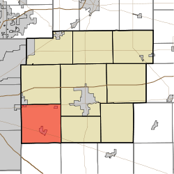 Location in Hancock County | |
| Coordinates: 39°44′22″N 85°53′42″W / 39.73944°N 85.89500°WCoordinates: 39°44′22″N 85°53′42″W / 39.73944°N 85.89500°W | |
| Country | United States |
| State | Indiana |
| County | Hancock |
| Government | |
| • Type | Indiana township |
| Area | |
| • Total | 35.4 sq mi (92 km2) |
| • Land | 35.3 sq mi (91 km2) |
| • Water | 0.1 sq mi (0.3 km2) 0.28% |
| Elevation | 827 ft (252 m) |
| Population (2010) | |
| • Total | 14,920 |
| • Density | 422.7/sq mi (163.2/km2) |
| GNIS feature ID | 0453882 |
Sugar Creek Township is one of nine townships in Hancock County, Indiana, United States. As of the 2010 census, its population was 14,920 and it contained 5,876 housing units.[1]
History
Sugar Creek Township was organized in 1828, and named from its principal stream.[2][3]
Geography
According to the 2010 census, the township has a total area of 35.4 square miles (92 km2), of which 35.3 square miles (91 km2) (or 99.72%) is land and 0.1 square miles (0.26 km2) (or 0.28%) is water.[1] Lakes in this township include Spring Lake. The streams of Palestine Branch and Sugar Run run through this township.
Cities and towns
- Cumberland (southeast quarter)
- Spring Lake
- New Palestine
Unincorporated towns
- Brookville Heights
- Carriage Estates
- Gem
- Philadelphia
- Schildmeier Park
(This list is based on USGS data and may include former settlements.)
Adjacent townships
- Buck Creek Township (north)
- Center Township (northeast)
- Brandywine Township (east)
- Van Buren Township, Shelby County (southeast)
- Moral Township, Shelby County (south)
- Franklin Township, Marion County (southwest)
- Warren Township, Marion County (west)
Cemeteries
The township contains nine cemeteries: Dye, Langenberger, McNamee, New Palestine, Owen, Pitcher, Richmond, Schramm, and Zion Lutheran.
Major highways
-
 U.S. Route 40
 -
 U.S. Route 52
References
- ↑ 1.0 1.1 "Population, Housing Units, Area, and Density: 2010 - County -- County Subdivision and Place -- 2010 Census Summary File 1". United States Census. Retrieved 2013-05-10.
- ↑ Binford, John H. (1882). History of Hancock County, Indiana: From Its Earliest Settlement by the "pale Face," in 1818, Down to 1882. King & Binford. pp. 273–274.
- ↑ Richman, George J. (1916). History of Hancock County, Indiana: Its People, Industries and Institutions. Wm. Mitchell Printing Company. p. 741.
External links
- Indiana Township Association
- United Township Association of Indiana
- Sugar Creek Township, Hancock County, Indiana
| |||||||||||||||||||||||||||||