Suchiate River
| Suchiate River (río Suchiate) | |
|---|---|
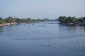 Suchiate River from the border bridge between Ciudad Hidalgo and Ciudad Tecun Uman | |
| Origin |
Guatemala (San Marcos) |
| Mouth | Pacific Ocean |
| Basin countries | Guatemala, Mexico |
| Length | 161 km |
| Source elevation |
3000 m 15°09′47″N 91°57′22″W / 15.163187°N 91.956081°W |
| Mouth elevation | 0 m |
| Basin area | 1400 km² |
The Suchiate River (Spanish: Río Suchiate, Spanish pronunciation: [suˈtʃjate]) is a river that marks the southwesternmost part of the border between Mexico (state of Chiapas) and Guatemala (department of San Marcos). From its sources on the southern slopes of the Tacaná volcano in the Sierra Madre range of Guatemala, the river flows in a south-southwesterly direction to the border with Mexico at Unión Juárez (15°04′14″N 92°03′35″W / 15.070549°N 92.059722°W), past the border towns Talismán and El Carmen, and then Ciudad Tecún Umán and Ciudad Hidalgo (Chiapas) further downstream, where the Puente Rodolfo Robles and a railway bridge cross the river, and on to the Pacific Ocean. Its name comes from the Nahuatl name 'Xochiatl' meaning 'flower-water'.
The pre-Columbian archaeological site of Izapa lies along the river.