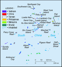
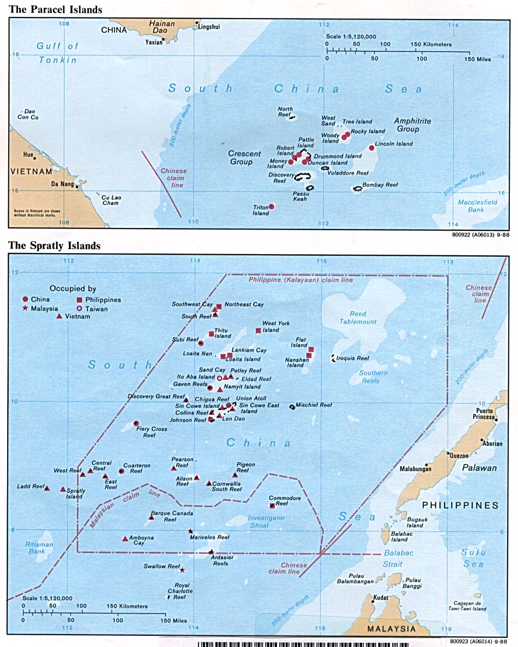
Subi Reef
| Disputed island Other names: Zhubi Reef Chinese: 渚碧礁; pinyin: Zhǔbì Jiāo Tagalog: Zamora Vietnamese: đá Xu Bi | |
|---|---|
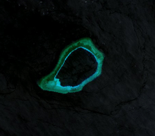 | |
| Landsat 7 Image (April 2000) | |
| Geography | |
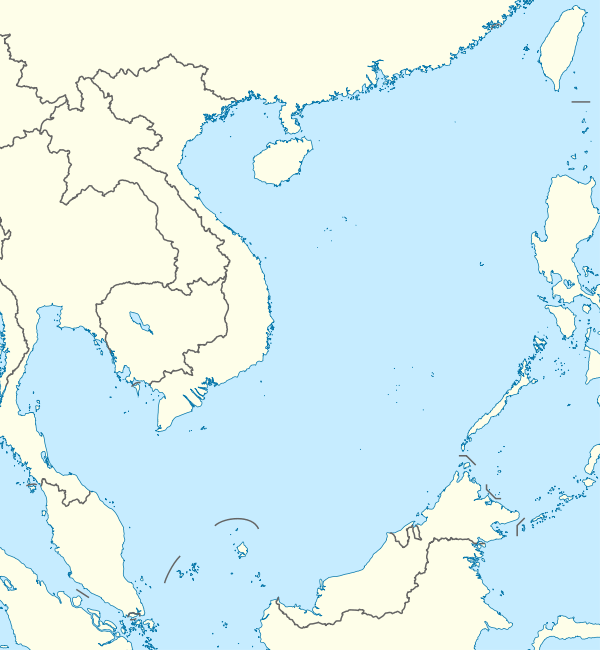 | |
| Location | South China Sea |
| Coordinates | 10°54′48″N 114°03′43″E / 10.9133°N 114.062°ECoordinates: 10°54′48″N 114°03′43″E / 10.9133°N 114.062°E |
| Archipelago | Spratly Islands |
| Administered by | |
| People's Republic of China | |
| Claimed by | |
| People's Republic of China | |
| Philippines | |
| Republic of China (Taiwan) | |
| Vietnam | |
| Part of a series on the |
| Spratly Islands |
|---|
 Spratly Islands military occupations map |
| Related articles |
| Confrontations |
|
Southwest Cay incident (1975) |
| Military occupations |
|
|
Subi Reef 10°54′48″N 114°03′43″E / 10.9133°N 114.062°E, also known as Zhubi Reef (Chinese: 渚碧礁; pinyin: Zhǔbì Jiāo; Tagalog: Zamora; Vietnamese: đá Xu Bi) is a reef in the Spratly Islands of the South China Sea located 16 miles (26 km) southwest of Philippine-occupied Thitu Island.
It is occupied by the PRC, and claimed by ROC, Vietnam and the Philippines.
It currently falls under the jurisdiction of Nansha islands, Sansha city, Hainan province, China.
Topography and features
The atoll measures 5.7 km along its longer southwest-northeast axis, and is up to 3.5 km wide. Its total area including the lagoon and rim of the reef measures 16 km², and the lagoon is up to 22 meters deep.[1]
Naturally above water only at low tide, it surrounds a huge lagoon. The People's Republic of China has constructed a 4-story building, a weather observation station with doppler weather radar, wharfs, and a helipad in the area. A buoyed channel guides ships to the inner lagoon which is 3.7 kilometers in diameter.[2][3][4][5]
Population
There are 200 Chinese troops on the reef.[6]
Ownership disputes
The reef is occupied and controlled by China (PRC)[6] and claimed by Taiwan (ROC), the Philippines, and Vietnam. In July 2012, a large fleet of 30 Chinese fishing vessels arrived at the reef from Hainan.[7][8]
References
- ↑ Atoll Area, Depth and Rainfall: Zhubi
- ↑ Anda, Redempto (17 July 2012). "Government told of China buildup 2 months ago". Philippine Inquirer. Retrieved 29 October 2013.
- ↑ Jingya, Mei (19 July 2012). "China installed radar on Zhubi Reef:Philippine media". Sina English News. Retrieved 29 October 2013.
- ↑ "Digital Gazetteer of the Spratly Islands". www.southchinasea.org. Retrieved 2008-03-22.
- ↑ http://news.qq.com/a/20120725/000453.htm Chinese language page with a collection of 10 photos of the reef and Thitu (Pagasa) Island dated 25 July 2012. Pictures 1,3,4&6 show the buildings on the reef; 5 shows a lighthouse, 7-10 show Pagasa.
- ↑ 6.0 6.1 DJ Sta. Ana (June 13, 2014). "China reclaiming land in 5 reefs?". www.abs-cbnnews.com. Retrieved September 11, 2014.
- ↑ Cunfu, Wang (18 July 2012). "Fishing vessels arrive at Zhubi Reef of south China Sea". Xinhua. Retrieved 29 October 2013.
- ↑ "Fishing vessels arrive at Zhubi Reef of south China Sea". Global Times China. Retrieved 29 October 2013.
External links
- Google map of Subi Reef
- Maps of Paracels and Spratlys
- China Claims Subi Reef of 8 December 2010 and 10 February 2010
| ||||||||||||||||||