Stretton, Queensland
| Stretton Brisbane, Queensland | |||||||||||||
|---|---|---|---|---|---|---|---|---|---|---|---|---|---|
|
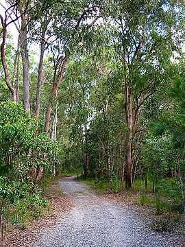
Track into Karawatha Forest at Stretton | |||||||||||||
| Population | 4,067 (2011 census)[1] | ||||||||||||
| Postcode(s) | 4116 | ||||||||||||
| Location | 18 km (11 mi) from Brisbane GPO | ||||||||||||
| LGA(s) | City of Brisbane | ||||||||||||
| State electorate(s) | Electoral district of Stretton | ||||||||||||
| Federal Division(s) | Oxley | ||||||||||||
| |||||||||||||
Stretton is a suburb on the south side of Brisbane, Australia. It is 17 kilometres (11 mi) from the Brisbane Central Business District, and borders the suburbs of Calamvale, Sunnybank Hills, Karawatha, Kuraby, and Drewvale.
History
In the early 19th century, the area and many of today's suburbs around the Sunnybank area were part of a vast area known as Coopers Plains. In 1861, Governor Bowen declared a wide area that included Eight Mile Plains to Stretton as a Brisbane Agricultural Reserve. This agricultural reserve was originally used as a source of timber, but when it was found to be good farming land, settlers quickly turned it into farms that produced sought-after fruit, vegetables, and poultry.
Stretton was gazetted as a suburb of Brisbane in 1972, and was named after George Stretton, a settler, postmaster and hotelier at Browns Plains in the 1870s.[2][3]
Population
More than 65 per cent of households in Stretton are couples with children; 22 per cent are couples without children, and 10 per cent are single-parent households. In 1989 there was controversy regarding the sale of land to Asian investors, and there is a large Asian population in the suburb today. With rare exceptions, the dwellings in Stretton are stand-alone houses — generally modern, brick and tile. Houses in the north-west corner of Stretton include many huge, multi-storey mansions.
Demographics
In the 2011 Census the population of Stretton is 4,067, 51.5% female and 48.5% male.
The median/average age of the Stretton population is 36 years of age, 1 year below the Australian average.
41.6% of people living in Stretton were born in Australia. The other top responses for country of birth were China 7.1%, Taiwan 7%, New Zealand 4.1%, Hong Kong 4%, India 3.1%.
41.4% of people speak English as their first language 16.2% Mandarin, 11.3% Cantonese, 3.3% Vietnamese, 2.9% Hindi, 2.4% Korean.
Affluence
As stated above to the north-west corner of the suburb are large, opulent mansions most exceeding 1000 squares and fetch upwards of $2,000,000 AUD when they hit the market. Kardella Street in the same area is known as the Millionaires Row of Southside Brisbane and is the location for many enormous and luxurious mega mansions with some in excess of 2000 squares and can sell upwards of $5,000,000 AUD and even close to $8,000,000 AUD. Many if not all of the mansions in Stretton sit on 1-acre (4,000 m2) of land and have luxury features such as swimming pools (indoor and out), tennis courts, squash courts etc. 38 Kardella Street has been on and off the market for years and lives to be the largest single family private residence in Southside Brisbane at over 2000 squares of living space with 7 bedrooms, 9 bathrooms and it's luxury and in most cases unique features include indoor swimming pool, tennis court, indoor squash court, recording studio, 10 car garage, 1-acre (4,000 m2) of land and is priced at around $8,000,000 AUD.
Environment
A military map from 1922 shows only four houses in the area that is now Stretton. In the 2006 census, there were 3776 residents, and more areas have been cleared and built on since then.
The northern part of Stretton includes several hills, but the land flattens out towards the south. The southern part has more vegetation, as it joins Karawatha Forest to the south-east and the Calamvale Creek wetlands on the south-west.
Facilities
Stretton is home to Hope Christian Assembly, a multicultural Pentecostal Church affiliated with Australian Christian Churches. Since 1996, it has been pastored by Melvin and Jacqueline Anthony, and holds services at Stretton State College.[4] Stretton State College is located at the southern (Drewvale) end of the suburb.
In addition to small local shops, Calamvale Village on Kameruka Street and Sunnybank Hills Shopping Centre on Hellawell Road ensure this area has all the shopping essentials at hand. If you want to travel further afield, check out Garden City at Upper Mount Gravatt.[5]
References
- ↑ Australian Bureau of Statistics (31 October 2012). "Stretton (Brisbane City) (State Suburb)". 2011 Census QuickStats. Retrieved 28 February 2008.
- ↑ "Stretton". Queensland Places.
- ↑ "Browns Plains" (PDF). Logan City Council Libraries.
- ↑ http://hopechristianassembly.com.au/about-us/
- ↑ http://www.ourbrisbane.com/suburbs/stretton
External links
- University of Queensland: Queensland Places: Stretton
- Critters of Calamvale Creek wildlife of Calamvale and Stretton
- "Stretton". BRISbites. Brisbane City Council. Archived from the original on 19 July 2008.
- "Stretton". Our Brisbane. Brisbane City Council. Archived from the original on 12 February 2008.
Coordinates: 27°37′24″S 153°04′04″E / 27.62333°S 153.06778°E