Stony Brook Branch
| Stony Brook Branch | |
|---|---|
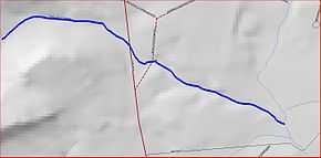 Map of Stony Brook Branch | |
| Origin | 40°21′31″N 74°48′38″W / 40.35861°N 74.81056°W |
| Mouth | 40°21′6″N 74°47′2″W / 40.35167°N 74.78389°W |
| Progression | Stony Brook (Millstone River), Millstone River, Raritan River, Atlantic Ocean |
| Basin countries | United States |
| Mouth elevation | 151 ft (46 m) |
| River system | Raritan River system |
Stony Brook Branch is a tributary of the Stony Brook in Mercer County, New Jersey in the United States.
Course
The Stony Brook Branch starts at 40°21′31″N 74°48′38″W / 40.35861°N 74.81056°W,[1] in Sourland Mountain near Route 31 (Pennington Road). It flows east, crossing Route 31 and Pennington Hopewell Road before draining into the Stony Brook at 40°21′6″N 74°47′2″W / 40.35167°N 74.78389°W.[1]
Sister tributaries
See also
References
- ↑ 1.0 1.1 "GNIS Detail - Stony Brook Branch". USGS. Retrieved 22 July 2010.