Stock Road, Perth
| Stock Road Western Australia | |
|---|---|
 North end South end | |
| Coordinates | 32°1′2.6″S 115°47′31″E / 32.017389°S 115.79194°E |
| General information | |
| Type | Road |
| Length | 13.9 km (9 mi)[1] |
| Route number(s) |
(Leach Highway – Rockingham Road) |
| Major junctions | |
| North end | Page Street, Attadale |
| |
| South end |
|
| Location(s) | |
| Major suburbs | Palmyra, O'Connor, Hamilton Hill, Bibra Lake, Spearwood |
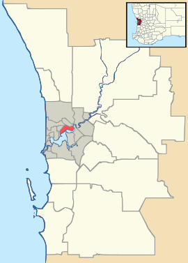
Stock Road is an arterial road in the southern suburbs of Perth, Western Australia.[2] The northern terminus is at Page Street in Attadale, near Point Walter on the Swan River. It runs southwards to Canning Highway and then Leach Highway as a residential road. Beyond Leach Highway, it is part of National Route 1,[3] and continues south as a dual carriageway. It ends at Rockingham Road, which runs south as National Route 1 towards Rockingham, and north-west towards Fremantle.[1]
See also
Australian roads portal
References
- ↑ 1.0 1.1 Google (9 June 2013). "Stock Road". Google Maps. Google. Retrieved 9 June 2013.
- ↑ Greater Perth Street Directory (2012 ed.). Melway Publishing Pty Ltd.
- ↑ Distance book (12 ed.). Main Roads Western Australia. 2012. pp. 4–5. ISBN 0 7309 7657 2. Retrieved 2 January 2014.
| |||||||||||||||||||||||||||||