Steens Mountain
| Steens Mountain | |
|---|---|
 Steens Mountain near Andrews, Oregon. | |
| Elevation | 9,733 ft (2,967 m) NGVD 29[1] |
| Prominence | 4,373 ft (1,333 m)[1] |
| Location | |
 Steens Mountain | |
| Coordinates | 42°38′11″N 118°34′36″W / 42.636418°N 118.576717°WCoordinates: 42°38′11″N 118°34′36″W / 42.636418°N 118.576717°W[1] |
| Topo map | USGS Wildhorse Lake |
| Climbing | |
| Easiest route | Short hike from gravel road |

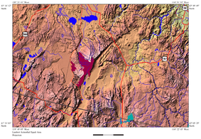
Steens Mountain is a large fault-block mountain in the southeastern part of the U.S. state of Oregon. Located in Harney County, it stretches some 50 miles (80 km) long north to south, and rises from alongside the Alvord Desert at elevation of about 4,200 feet (1,300 m) to a summit elevation of 9,733 feet (2,967 m). It is sometimes confused with a mountain range, but is properly a single mountain.
History
It was called the "Snowy Mountains" by John Work, one of the fur traders who were the first Europeans in the area. In 1860, it was renamed for United States Army Major Enoch Steen, who fought and drove members of the Paiute tribe off the mountain.[2][3]
Geology
The east face of Steens Mountain is made up almost entirely of basalts stacked one upon another. Staggering amounts of lava, with several flows hundreds of feet thick, inundated the region between 17 and 14 million years ago.[4][5][6]
Flora and fauna
Several plant taxa are endemic to Steens Mountain, including Castilleja pilosa var. steenensis, Cirsium peckii, Draba cusickii var. cusickii, Penstemon davidsonii var. praeteritus, and Poa chambersii.[7]
Environmental protection
On October 24, 2000, president Bill Clinton approved the Steens Mountain Cooperative Management and Protective Act. The act was created by local landowners in cooperation with local and national government reperesentatives in response to a proposed National Monument. This act created the Steens Mountain BLM Cooperative Management and Protection Area, a 425,000 acres (1,720 km2) area. This law protects 1,200,000 acres (4,860 km2) from mining, and 100,000 acres (405 km2) from cattle grazing.[8]
Activities
Steens Mountain is also host to Steens Mountain Running Camp, a nationally known[9] cross country training camp that has been held on the mountain since 1975.[10][11]
Other recreational activities enjoyed on and around Steens Mountain are: camping, picknicking, bicycling, hiking, hunting, sightseeing, soaring, and exploring. Along the base of Steens Mountain, there are numerous hot springs, including Hot Lake Springs.[12] Far from city lights, stargazing is also very popular.
See also
References
- ↑ 1.0 1.1 1.2 "Steens Mountain, Oregon". Peakbagger.com. Retrieved 2009-12-27.
- ↑ McArthur, Lewis A.; Lewis L. McArthur (2003) [1928]. Oregon Geographic Names (7th ed.). Portland, Oregon: Oregon Historical Society Press. ISBN 0-87595-277-1.
- ↑ Loy, Willam G.; Stuart Allan; Aileen R. Buckley; James E. Meacham (2001). Atlas of Oregon. University of Oregon Press. p. 25. ISBN 0-87114-101-9.
- ↑ "Southeast Oregon Basin and Range". SummitPost.org. Retrieved 2011-05-07.
- ↑ USGS, Andesitic and basaltic rocks on Steens Mountain
- ↑ GeoScienceWorld, Genesis of flood basalts and Basin and Range volcanic rocks from Steens Mountain to the Malheur River Gorge, Oregon
- ↑ Mansfield, Donald H. (2000). "Introduction". Flora of Steens Mountains. OSU Press. ISBN 978-0-87071-471-9.
- ↑ Karras, Christy (2001-08-16). "Politicians dedicate Steens Mountain preserve". Seattle Post Intelligencer. Retrieved 2008-04-02.
- ↑ "Upcoming Oregon running camps give young runners a new outlook". TrailRunner Magazine. Retrieved 2008-04-01.
- ↑ "Home page". Steens Mountain Running Camp. Retrieved 2008-04-02.
- ↑ "Steens Mountain Running Camp". YouthRunner Magazine. Retrieved 2008-04-02.
- ↑ Alt, D. & Hyndman, D. (1978). Roadside Geology of Oregon. Missoula: Mountain Press Publishing Company.
External links
| Wikimedia Commons has media related to Steens Mountain. |
- "Steens Mountain". Geographic Names Information System. United States Geological Survey.
- "Steens Mountain Wilderness". Wilderness.net. Retrieved 2008-04-02.
- "Virtual aerial image looking south across Steens Mountain and the Alvord Desert". California Geographical Survey. Retrieved 2008-04-02.