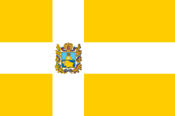
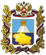
Stavropol Krai
| Stavropol Krai Ставропольский край (Russian) | |||
|---|---|---|---|
| — Krai — | |||
| |||
|
| |||
| |||
|
| |||
| Political status | |||
| Country |
| ||
| Federal district | North Caucasian[1] | ||
| Economic region | North Caucasus[2] | ||
| Established | January 10, 1934 | ||
| Administrative center | Stavropol | ||
| Government (as of August 2010) | |||
| - Governor[3] | Valery Zerenkov[4] | ||
| - Legislature | State Duma[3] | ||
| Statistics | |||
| Area (as of the 2002 Census)[5] | |||
| - Total | 66,500 km2 (25,700 sq mi) | ||
| Area rank | 45th | ||
| Population (2010 Census)[6] | |||
| - Total | 2,786,281 | ||
| - Rank | 14th | ||
| - Density[7] | 41.9/km2 (109/sq mi) | ||
| - Urban | 57.2% | ||
| - Rural | 42.8% | ||
| Time zone(s) | MSK (UTC+03:00)[8] | ||
| ISO 3166-2 | RU-STA | ||
| License plates | 26 | ||
| Official languages | Russian[9] | ||
| Official website | |||

Stavropol Krai (Russian: Ставропо́льский край, tr. Stavropolsky kray; IPA: [stəvrɐˈpolʲskʲɪj kraj]) is a federal subject of Russia (a krai) in the North Caucasian Federal District. Its administrative center is the city of Stavropol. Population: 2,786,281 (2010 Census).[6]
Geography
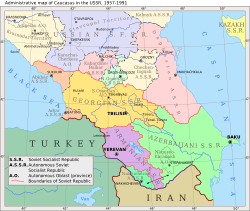
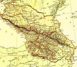
Stavropol Krai encompasses the central part of the Fore-Caucasus and most of the northern slopes of Caucasus Major. It borders on Rostov Oblast, Krasnodar Krai, the Republic of Kalmykia, the Republic of Dagestan, the Chechen Republic, the Republic of North Ossetia–Alania, the Kabardino-Balkar Republic, and the Karachay–Cherkess Republic.
History
December 15, 1936 after the spin-off from the North Caucasus region of Dagestan ASSR and transformed in the Kabardino-Balkar ASSR, North Ossetian and Chechen-Ingush autonomous regions, the center was moved to the edge of the city Voroshilovsk, and the territory is close to the borders of modern Stavropol Territory. On March 13, 1937, after the death of Sergo Ordzhonikidze, to perpetuate the memory of revolutionary North Caucasus region was renamed Ordzhonikidze.
January 12, 1943 by the Decree of the Presidium of the USSR Supreme Soviet, the administrative center of the region, Voroshilovsk was renamed back to Stavropol, and Orkinadze region to Stavropol Krai.
Politics

During the Soviet period, the high authority in the oblast was shared between three persons: The first secretary of the Stavropol CPSU Committee (who in reality had the biggest authority), the chairman of the oblast Soviet (legislative power), and the Chairman of the oblast Executive Committee (executive power). Since 1991, CPSU lost all the power, and the head of the Oblast administration, and eventually the governor was appointed/elected alongside elected regional parliament.
The Charter of Stavropol Krai is the fundamental law of the region. The Legislative Assembly of Stavropol Krai is the province's regional standing legislative (representative) body. The Legislative Assembly exercises its authority by passing laws, resolutions, and other legal acts and by supervising the implementation and observance of the laws and other legal acts passed by it. The highest executive body is the Oblast Government, which includes territorial executive bodies such as district administrations, committees, and commissions that facilitate development and run the day to day matters of the province. The Oblast administration supports the activities of the Governor who is the highest official and acts as guarantor of the observance of the krai Charter in accordance with the Constitution of Russia.
Demographics
Population
According to the 2010 Census, the population of the krai is 2,786,281;[6] up from 2,735,139 recorded in the 2002 Census[10] and further up from 2,410,379 recorded in the 1989 Census.[11] The population of the krai is concentrated in the Kuban River and the Kuma River drainage basin, which used to be traditional Cossack land (see History of Cossacks). The Kuban Cossacks are now generally considered to be ethnic Russians, even though they are still an important minority in their own right in this area. Other notable ethnic groups include the Armenians (mostly Christian Hamsheni) and Pontic Greeks (here usually referred to as Caucasus Greeks) who have been settling in the area as refugees or 'economic migrants' from as early as the fall of the Empire of Trebizond in northeastern Anatolia to the Ottomans in 1461 but especially following the two Russo-Turkish Wars of 1768-74 and 1828-29.
Ethnic groups
The 2010 Census counted thirty-three ethnic groups of more than 2,000 persons each, making this federal subject one of the most multiethnic in Russia. The inhabitants identified themselves as belonging to more than 140 different ethnic groups, as shown in the following table:[6]
| Population | Ethnicity | Percentage of total population |
|---|---|---|
| 2,232,153 | Russians | 80.9% |
| 161,324 | Armenians | 5.9% |
| 49,302 | Dargins | 1.8% |
| 33,573 | Caucasus Greeks | 1.2% |
| 30,879 | Romani people | 1.1% |
| 30,373 | Ukrainians | 1.1% |
| 22,006 | Nogais | 0.8% |
| 15,598 | Karachay | 0.6% |
| 17,800 | Azerbaijanis | 0.6% |
| 15,048 | Turkmens | 0.5% |
| 11,980 | Chechens | 0.4% |
| 11,795 | Tatars | 0.4% |
| 7,988 | Ossetians | 0.3% |
| 10,419 | Turks | 0.4% |
| 7,104 | Belarusians | 0.3% |
| 6,759 | Koreans | 0.2% |
| 55,946 | Others | 2% |
- 26,855 people were registered from administrative databases, and could not declare an ethnicity. It is estimated that the proportion of ethnicities in this group is the same as that of the declared group.[12]
Vital Statistics for 2007: Source
- Birth Rate: 11.22 per 1,000
- Death Rate: 13.32 per 1,000
- Net Immigration: +3.5 per 1,000
- NGR: -0.21% per Year
- PGR: +0.14% per Year
- Vital statistics for 2012
- Births: 34 768 (12.5 per 1000)
- Deaths: 33 356 (12.0 per 1000) [13]
- Total fertility rate:[14]
2009 - 1.45 | 2010 - 1.44 | 2011 - 1.43 | 2012 - 1.52 | 2013 - 1.55 | 2014 - 1.61(e)
Religion

According to a 2012 official survey[15] 46.9% of the population of Stavropol Krai adheres to the Russian Orthodox Church, 7% are unaffiliated generic Christians, 5% are Muslims, 1% adheres to other Orthodox Churches, and 1% of the population adheres to Rodnovery. In addition, 19% of the population deems itself to be "spiritual but not religious", 16% is atheist, and 7.1% follows other religions or did not give an answer to the question.[15]
Administrative divisions
Stavropol Krai is administratively divided into twenty-six districts (raions ) and ten cities/towns. The districts are further subdivided into nine towns of district subordinance, seven urban-type settlements, and 284 rural okrugs and stanitsa okrugs.
Agriculture
Irrigated agriculture is well developed in the region. As of the beginning of 2001, Stavropol Krai had 3,361 km of irrigation canals, of which 959 km were lined (i.e., had concrete or stone walls, rather than merely soil walls, to reduce the loss of water).[17]
Among the major irrigation canals are:[17]
- Nevinnomyssk Canal (Невинномысский канал), the trunk of the Kuban-Yegorlyk Irrigation System.
- The Great Stavropol Canal (Большой Ставропольский канал), transporting water from the Kuban River eastward across the entire krai.
- The Terek-Kuma Canal and Kuma-Manych Canal, transporting water from the Terek River via the Kuma River to the East Manych River.
See also
- North Caucasus Krai
- Fyodor Kulakov, a former Soviet governor of Stavropol Krai who was Brezhnev's apparent heir.
- Stavropol Krai is the birthplace of two General Secretaries of the Communist Party of the Soviet Union: Yuri Andropov (1982–1984) and Mikhail Gorbachev (1985–1991).
Notes
- ↑ Президент Российской Федерации. Указ №849 от 13 мая 2000 г. «О полномочном представителе Президента Российской Федерации в федеральном округе». Вступил в силу 13 мая 2000 г. Опубликован: "Собрание законодательства РФ", №20, ст. 2112, 15 мая 2000 г. (President of the Russian Federation. Decree #849 of May 13, 2000 On the Plenipotentiary Representative of the President of the Russian Federation in a Federal District. Effective as of May 13, 2000.).
- ↑ Госстандарт Российской Федерации. №ОК 024-95 27 декабря 1995 г. «Общероссийский классификатор экономических регионов. 2. Экономические районы», в ред. Изменения №5/2001 ОКЭР. (Gosstandart of the Russian Federation. #OK 024-95 December 27, 1995 Russian Classification of Economic Regions. 2. Economic Regions, as amended by the Amendment #5/2001 OKER. ).
- ↑ 3.0 3.1 Charter, Article 8
- ↑ Official website of the Governor of Stavropol Krai. Biography of Valery Veniaminovich Gayevsky (Russian)
- ↑ Федеральная служба государственной статистики (Federal State Statistics Service) (2004-05-21). "Территория, число районов, населённых пунктов и сельских администраций по субъектам Российской Федерации (Territory, Number of Districts, Inhabited Localities, and Rural Administration by Federal Subjects of the Russian Federation)". Всероссийская перепись населения 2002 года (All-Russia Population Census of 2002) (in Russian). Federal State Statistics Service. Retrieved 2011-11-01.
- ↑ 6.0 6.1 6.2 6.3 Russian Federal State Statistics Service (2011). "Всероссийская перепись населения 2010 года. Том 1" [2010 All-Russian Population Census, vol. 1]. Всероссийская перепись населения 2010 года (2010 All-Russia Population Census) (in Russian). Federal State Statistics Service. Retrieved June 29, 2012.
- ↑ The density value was calculated by dividing the population reported by the 2010 Census by the area shown in the "Area" field. Please note that this value may not be accurate as the area specified in the infobox is not necessarily reported for the same year as the population.
- ↑ Правительство Российской Федерации. Федеральный закон №107-ФЗ от 3 июня 2011 г. «Об исчислении времени», в ред. Федерального закона №248-ФЗ от 21 июля 2014 г. «О внесении изменений в Федеральный закон "Об исчислении времени"». Вступил в силу по истечении шестидесяти дней после дня официального опубликования (6 августа 2011 г.). Опубликован: "Российская газета", №120, 6 июня 2011 г. (Government of the Russian Federation. Federal Law #107-FZ of June 31, 2011 On Calculating Time, as amended by the Federal Law #248-FZ of July 21, 2014 On Amending Federal Law "On Calculating Time". Effective as of after sixty days following the day of the official publication.).
- ↑ Official on the whole territory of Russia according to Article 68.1 of the Constitution of Russia.
- ↑ Russian Federal State Statistics Service (May 21, 2004). "Численность населения России, субъектов Российской Федерации в составе федеральных округов, районов, городских поселений, сельских населённых пунктов – районных центров и сельских населённых пунктов с населением 3 тысячи и более человек" [Population of Russia, Its Federal Districts, Federal Subjects, Districts, Urban Localities, Rural Localities—Administrative Centers, and Rural Localities with Population of Over 3,000] (XLS). Всероссийская перепись населения 2002 года [All-Russia Population Census of 2002] (in Russian). Retrieved August 9, 2014.
- ↑ Demoscope Weekly (1989). "Всесоюзная перепись населения 1989 г. Численность наличного населения союзных и автономных республик, автономных областей и округов, краёв, областей, районов, городских поселений и сёл-райцентров" [All Union Population Census of 1989: Present Population of Union and Autonomous Republics, Autonomous Oblasts and Okrugs, Krais, Oblasts, Districts, Urban Settlements, and Villages Serving as District Administrative Centers]. Всесоюзная перепись населения 1989 года[All-Union Population Census of 1989] (in Russian). Институт демографии Национального исследовательского университета: Высшая школа экономики [Institute of Demography at the National Research University: Higher School of Economics]. Retrieved August 9, 2014.
- ↑ http://www.perepis-2010.ru/news/detail.php?ID=6936
- ↑ http://www.gks.ru/free_doc/2012/demo/edn12-12.htm
- ↑ http://www.gks.ru/wps/wcm/connect/rosstat_main/rosstat/ru/statistics/publications/catalog/doc_1137674209312
- ↑ 15.0 15.1 15.2 Arena - Atlas of Religions and Nationalities in Russia. Sreda.org
- ↑ 2012 Survey Maps. "Ogonek", № 34 (5243), 27/08/2012. Retrieved 24-09-2012.
- ↑ 17.0 17.1 Общая информация О водных ресурсах края (General information about the water resources of the krai), from the regional government site. (Russian)
References
- Государственная Дума Ставропольского края. №6-кз 12 октября 1994 г. «Устав (Основной Закон) Ставропольского края», в ред. Закона №112-кз от 9 декабря 2014 г. «О поправке к Уставу (Основному Закону) Ставропольского края». Опубликован: "Ставропольская правда", №198–199, 14 октября 1994 г. (State Duma of Stavropol Krai. #6-kz October 12, 1994 Charter (Basic Law) of Stavropol Krai, as amended by the Law #112-kz of December 9, 2014 On the Amendment of the Charter (Basic Law) of Stavropol Krai. ).
External links
| Wikimedia Commons has media related to Stavropol Krai. |
| ||||||||||||||||||||||||||||||||||||||||||||||
| ||||||||||