Starkey, Virginia
| Starkey, Virginia | |
|---|---|
| Unincorporated community | |
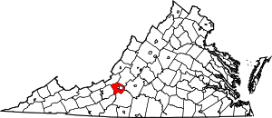
 Location within the Commonwealth of Virginia | |
| Coordinates: 37°12′02″N 79°59′55″W / 37.20056°N 79.99861°WCoordinates: 37°12′02″N 79°59′55″W / 37.20056°N 79.99861°W | |
| Country | United States |
| State | Virginia |
| County | Roanoke |
| Elevation | 1,138 ft (347 m) |
| Time zone | Eastern (EST) (UTC-5) |
| • Summer (DST) | EDT (UTC-4) |
| ZIP code | 24018 |
| Area code(s) | 540 |
| GNIS feature ID | 1495131[1] |
| USGS[2] | |
Starkey is an unincorporated community in southern Roanoke County, Virginia, United States. The community lies south of U.S. 221 near the Blue Ridge Parkway.[3] This is the location of the Starkey School listed on the National Register of Historic Places.
References
- ↑ "US Board on Geographic Names". United States Geological Survey. 2007-10-25. Retrieved 2008-01-31.
- ↑ USGS. "Geographic Names Information System Feature Detail Report: Starkey". Retrieved 2008-08-06.
- ↑ "Google Maps". Retrieved 2008-08-06.
| |||||||||||||||||||||||||