Stapylton County

Stapylton
New South Wales

Location in New South Wales
Lands administrative divisions around Stapylton:
Carnarvon (Qld) Carnarvon (Qld) Marsh (Qld)
Benarba Stapylton Arrawatta
Benarba Courallie Burnett

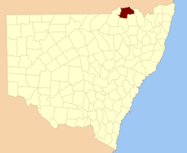
Stapylton County is one of the 141 Cadastral divisions of New South Wales. It is located to the south of the Barwon River and includes part of the Newell Highway.

Stapylton County was named in honour of the geologist Granville William Chetwynd Stapylton (1800-1840).[1]

Parishes

A full list of parishes found within this county; their current LGA and mapping coordinates to the approximate centre of each location is as follows:

Parish LGA Coordinates
Adams Moree Plains Shire 29°04′54″S 149°51′04″E / 29.08167°S 149.85111°E
Bengerang Moree Plains Shire 29°04′54″S 149°31′04″E / 29.08167°S 149.51778°E
Benson Moree Plains Shire 29°13′54″S 149°49′04″E / 29.23167°S 149.81778°E
Blue Nobby Gwydir Shire 29°55′54″S 150°38′04″E / 29.93167°S 150.63444°E
Boggabilla Moree Plains Shire 28°34′54″S 150°17′04″E / 28.58167°S 150.28444°E
Boobera Moree Plains Shire 28°37′54″S 150°08′04″E / 28.63167°S 150.13444°E
Boonal Gwydir Shire 29°45′54″S 150°32′04″E / 29.76500°S 150.53444°E
Boonanga Gwydir Shire 28°50′54″S 150°28′04″E / 28.84833°S 150.46778°E
Booraba Gwydir Shire 29°00′54″S 150°23′04″E / 29.01500°S 150.38444°E
Browne Moree Plains Shire 28°42′54″S 150°13′04″E / 28.71500°S 150.21778°E
Bryanungra Moree Plains Shire 29°05′54″S 149°57′04″E / 29.09833°S 149.95111°E
Canary Moree Plains Shire 28°39′54″S 149°52′04″E / 28.66500°S 149.86778°E
Careunga Moree Plains Shire 29°00′54″S 150°00′04″E / 29.01500°S 150.00111°E
Careunga North Moree Plains Shire 28°54′54″S 149°55′04″E / 28.91500°S 149.91778°E
Carroby Moree Plains Shire 28°38′54″S 150°01′04″E / 28.64833°S 150.01778°E
Cook Moree Plains Shire 28°46′54″S 150°19′04″E / 28.78167°S 150.31778°E
Coolanga Moree Plains Shire 28°49′54″S 150°10′04″E / 28.83167°S 150.16778°E
Coppymurrumbill Moree Plains Shire 28°48′54″S 150°17′04″E / 28.81500°S 150.28444°E
Currumbah Moree Plains Shire 28°53′54″S 150°10′04″E / 28.89833°S 150.16778°E
Denebry Moree Plains Shire 29°12′54″S 150°01′04″E / 29.21500°S 150.01778°E
Douro Moree Plains Shire 29°04′54″S 149°46′04″E / 29.08167°S 149.76778°E
Finley Moree Plains Shire 29°00′54″S 149°46′04″E / 29.01500°S 149.76778°E
Gil Gil Moree Plains Shire 29°08′54″S 150°12′04″E / 29.14833°S 150.20111°E
Goorara Moree Plains Shire 29°04′54″S 149°35′04″E / 29.08167°S 149.58444°E
Gunnyanna Moree Plains Shire 29°01′54″S 149°41′04″E / 29.03167°S 149.68444°E
Harvey Moree Plains Shire 29°16′54″S 150°02′04″E / 29.28167°S 150.03444°E
Holmes Gwydir Shire 28°59′54″S 150°18′04″E / 28.99833°S 150.30111°E
Illingrammindi Moree Plains Shire 28°50′54″S 150°00′04″E / 28.84833°S 150.00111°E
Kinnimo Moree Plains Shire 28°55′54″S 149°42′04″E / 28.93167°S 149.70111°E
Lay Green Moree Plains Shire 29°03′54″S 150°12′04″E / 29.06500°S 150.20111°E
Limebon Moree Plains Shire 28°46′54″S 150°05′04″E / 28.78167°S 150.08444°E
Mayne Moree Plains Shire 28°40′54″S 150°18′04″E / 28.68167°S 150.30111°E
Melleallina Moree Plains Shire 29°10′54″S 149°54′04″E / 29.18167°S 149.90111°E
Merriwa Moree Plains Shire 28°56′54″S 150°24′04″E / 28.94833°S 150.40111°E
Mingan Gwydir Shire 28°51′54″S 150°24′04″E / 28.86500°S 150.40111°E
Mobbindry Moree Plains Shire 28°47′54″S 150°24′04″E / 28.79833°S 150.40111°E
Moppin Moree Plains Shire 29°11′54″S 149°42′04″E / 29.19833°S 149.70111°E
Morella Moree Plains Shire 28°39′54″S 150°15′04″E / 28.66500°S 150.25111°E
Mount Pleasant Moree Plains Shire 29°03′54″S 150°04′04″E / 29.06500°S 150.06778°E
Mungle Gwydir Shire 28°52′54″S 150°16′04″E / 28.88167°S 150.26778°E
Paine Moree Plains Shire 28°59′54″S 150°02′04″E / 28.99833°S 150.03444°E
Paleranga Moree Plains Shire 28°40′54″S 149°45′04″E / 28.68167°S 149.75111°E
Stapylton Gwydir Shire 28°59′54″S 150°30′04″E / 28.99833°S 150.50111°E
Tantarana Moree Plains Shire 29°14′54″S 150°06′04″E / 29.24833°S 150.10111°E
Toongcooma Moree Plains Shire 28°59′54″S 150°13′04″E / 28.99833°S 150.21778°E
Trinkey Moree Plains Shire 28°38′54″S 150°02′04″E / 28.64833°S 150.03444°E
Tubble Gah Gwydir Shire 29°51′54″S 150°37′04″E / 29.86500°S 150.61778°E
Tucka Tucka Gwydir Shire 29°45′54″S 150°37′04″E / 29.76500°S 150.61778°E
Tulloona Moree Plains Shire 28°52′54″S 150°04′04″E / 28.88167°S 150.06778°E
Tun Cooey Moree Plains Shire 29°08′54″S 150°05′04″E / 29.14833°S 150.08444°E
Wallon Moree Plains Shire 29°13′54″S 149°55′04″E / 29.23167°S 149.91778°E
Warra Warrama Moree Plains Shire 29°00′54″S 150°07′04″E / 29.01500°S 150.11778°E
Welbon Moree Plains Shire 29°09′54″S 149°45′04″E / 29.16500°S 149.75111°E
Whalan Moree Plains Shire 28°45′54″S 150°24′04″E / 28.76500°S 150.40111°E
Willimill Moree Plains Shire 28°48′54″S 149°46′04″E / 28.81500°S 149.76778°E
Wonga Moree Plains Shire 28°46′54″S 150°13′04″E / 28.78167°S 150.21778°E
Yooloobil Moree Plains Shire 28°47′54″S 149°54′04″E / 28.79833°S 149.90111°E

References

  1. [acms.sl.nsw.gov.au/item/itemDetailPaged.aspx?itemID=432528 - 58k