Stapeley Hill
Coordinates: 52°34′59″N 3°01′01″W / 52.583°N 3.017°W
Stapeley Hill
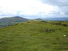
Stapeley Hill is a sacred saddleback hill in South-West Shropshire, near the village of Priestweston.
The Hill is home to Mitchell's Fold and along the path leading from the Fold which crosses Stapeley Common, home to the Cow Stone , or single standing Stone - Menhir and the Stapeley Hill Ring Cairn .
The hill rises to an elevation of 403 metres (1,322 ft) and lies in the civil parish of Chirbury with Brompton.
Notable Resident
Victoria Cross recipient John Doogan farmed here between 1926[1] and 1937.[2]