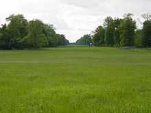
Stansted Park
Stansted Park (including Stansted House) is near the city of Chichester, West Sussex, England. It lies within the parish of Stoughton, near the village of Rowlands Castle over the border in Hampshire.
The Edwardian country house is set in the 1,750-acre (7.1 km2) park, with woodland and open land grazed by deer. Stansted House has Carolean revival decor and is listed Grade II*.[1]
The house began as a hunting lodge in the 11th century. It was built on the present site in 1688 for Richard Lumley, probably to a design by William Talman. The original house was burnt down in 1900, and rebuilt on the exact footprint of the previous building in 1903. The architect was Arthur Conran Blomfield.
It was purchased by Vere Ponsonby, 9th Earl of Bessborough, in 1924. Since 1983 the House and Estate have been owned by Stansted Park Foundation, a charitable trust charged with the preservation of the estate for the benefit of the nation. The trust was set up by Frederick Ponsonby, 10th Earl of Bessborough, who died without a male heir in 1993. The history of Stansted Park since the 12th century is told in Lord Bessborough's book "The Enchanted Forest".

Stansted is open to the public from Easter to September. The park is crossed from west to east by the Monarch's Way long distance footpath.
Church
The Chapel of St Paul was built by Lewis Way, as part of his mission to convert the Jews.[2] The Regency building incorporates earlier structures, and is by an unknown architect. It is Grade I listed.[3] It was an inspiration to the poet John Keats when he was writing The Eve of St. Agnes.[4]
.jpg)
References
- ↑ http://list.english-heritage.org.uk/resultsingle.aspx?uid=1000327
- ↑ Price, Stanley & Munro (2012). The Road to Apocalypse. London: Notting Hill Editions.
- ↑ Church of St Paul, Stoughton, British Listed Buildings
- ↑ "St Paul, Stansted". A church near you. 2010. Retrieved 19 October 2013.
External links
| Wikimedia Commons has media related to Stansted Park. |
Coordinates: 50°53′13″N 0°55′02″W / 50.887058°N 0.917282°W