Stanmore Bay
| Stanmore Bay | |
|---|---|
| Basic information | |
| Local authority | Rodney District |
| Population | 5,007 (2006) |
| Facilities | |
| Surrounds | |
| North | (Whangaparaoa Bay) |
| East | Manly |
| Southeast | Wade Heads |
| Southwest | (Weiti River) |
Gulf Harbour
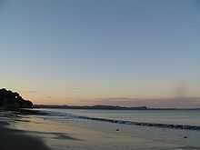
Sunset at Stanmore Bay.

The last rays of the setting sun light up the headland at Stanmore Bay.
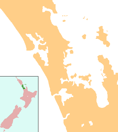
Stanmore Bay is a suburb and beach on the Whangaparaoa Peninsula, in the Auckland Region of New Zealand. The beach is on the northern side of the peninsula.[1]
The population was 5,007 in the 2006 Census, an increase of 405 from 2001.[2]
Education
Whangaparaoa College is a secondary (years 7-13) school with a decile rating of 9 and a roll of 1158.[3] The college opened at the beginning of 2005, incorporating Hibiscus Coast Intermediate School.[4] It was initially called Stanmore Bay Secondary School.[5]
Stanmore Bay School is a contributing primary (years 1-6) school with a decile rating of 8 and a roll of 453.[6] The school celebrated its 25th Jubilee in 2004.[7]
Both schools are coeducational.
Notes
- ↑ Peter Dowling (editor) (2004). Reed New Zealand Atlas. Reed Books. pp. map 11. ISBN 0-7900-0952-8.
- ↑ The population is the sum of the statistical areas of Stanmore Bay West (Quickstats about Stanmore Bay West) and Stanmore Bay East (Quickstats about Stanmore Bay East)
- ↑ "Te Kete Ipurangi - Whangaparaoa College". Ministry of Education.
- ↑ "Education Review Report - Whangaparaoa College". Education Review Office. July 2007. Retrieved 2008-08-27.
- ↑ "Mergers, Closures and New Schools, January 2005 - December 2005" (XLS). Education Counts.
- ↑ "Te Kete Ipurangi - Stanmore Bay School". Ministry of Education.
- ↑ "Stanmore Bay School 25th Jubilee Celebration" ( – Scholar search). Education Gazette New Zealand 83 (8). 10 May 2004.