Stadsbygd
| Stadsbygd | |
|---|---|
| Former Municipality | |
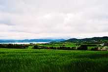
 Stadsbygd in Rissa seen from Hårsaker. Photo: Stian Tørstad | |
| Municipality ID | NO-1625 |
| Adm. Center | Stadsbygd |
| Area[1] | |
| • Total | 137 km2 (53 sq mi) |
| Created as | Formannskapsdistrikt in 1838 |
| Merged into | Rissa and Agdenes in 1964 |
| Stadsbygd Stadsbygda | |
|---|---|
| Village | |
| Nickname(s): Stadsbygda | |
 Stadsbygd Location in Sør-Trøndelag | |
| Coordinates: 63°30′34″N 10°01′09″E / 63.50944°N 10.01917°ECoordinates: 63°30′34″N 10°01′09″E / 63.50944°N 10.01917°E | |
| Country | Norway |
| Region | Trøndelag |
| County | Sør-Trøndelag |
| District | Fosen |
| Municipality | Rissa |
| Elevation[2] | 0.5 m (1.6 ft) |
| Time zone | CET (UTC+01:00) |
| • Summer (DST) | CEST (UTC+02:00) |
| Post Code | 7105 Stadsbygd |
Stadsbygd is a village and former municipality in Sør-Trøndelag county, Norway. The former municipality was located in the present-day municipalities of Rissa and Agdenes. The village is located along the north side of the Trondheimsfjord, northwest of the city of Trondheim.[1] The main church for the area is Stadsbygd Church. The population is 1839 inhabitants.
History
The municipality of Stadsbygd was established on 1 January 1838 (see formannskapsdistrikt). In 1860, the northwestern district of Rissa was separated from Stadsbygd to form a municipality of its own. The split left Stadsbygd with a population of 1,828. On 1 January 1964, the Ingdalen district south of the Trondheimsfjord (population: 171) was merged into the municipality of Agdenes. The rest of Stadsbygd, north of the Trondheimsfjord, (population: 1,616) was merged into the municipality of Rissa.[3]
Notable residents
- Nils Waltersen Aasen, Norwegian inventor
References
- ↑ 1.0 1.1 Store norske leksikon. "Stadsbygd. – kommune" (in Norwegian). Retrieved 2011-01-18.
- ↑ "Stadsbygd" (in Norwegian). yr.no. Retrieved 2011-01-13.
- ↑ Jukvam, Dag (1999). "Historisk oversikt over endringer i kommune- og fylkesinndelingen" (PDF) (in Norwegian). Statistisk sentralbyrå.