St George, Bristol
| St George | |
 Boundaries of St George West and East wards, shown within Bristol. |
|
| Population | 11,348 (East)[1] 10,929 (West)[2] |
|---|---|
| OS grid reference | ST626734 |
| Unitary authority | Bristol |
| Ceremonial county | Bristol |
| Region | South West |
| Country | England |
| Sovereign state | United Kingdom |
| Post town | BRISTOL |
| Postcode district | BS |
| Dialling code | 0117 |
| Police | |
| Fire | |
| Ambulance | |
| EU Parliament | South West England |
| UK Parliament | Bristol East |
Coordinates: 51°27′31″N 2°32′19″W / 51.4586°N 2.5385°W
St. George is a district of Bristol, England on the edge of the inner city.
History
St George was originally in Gloucestershire. It became a civil parish (formally known as Bristol St George) in 1866, and briefly an urban district from 1894 to 1898. The parish and urban district were absorbed into Bristol in 1898.[3]
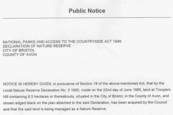
Troopers' Hill is a local landmark, and was a mining area from the early 19th century (coal) until its closure in 1904 when the last fireclay mines were abandoned.[4] It was declared as a Local Nature Reserve (LNR) on 22 June 1995.[5]
- ↑ "St George East". 2001 Census Ward Information Sheet. Retrieved 2007-02-21.
- ↑ "St George West". 2001 Census Ward Information Sheet. Retrieved 2007-02-21.
- ↑ Vision of Britain: St George UD
- ↑ "Friends of Troopers Hill". Retrieved 2009-04-21.
- ↑ "Public Notice". Retrieved 2009-04-21.