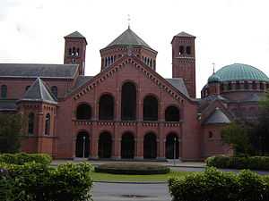
St. Andrew's Abbey (Bruges)

St. Andrew Abbey (Dutch: Sint-Andriesabdij) is a Benedictine Abbey of the Congregation of the Annunciation in Sint-Andries, Bruges, Belgium.
History
The charter of the abbey was signed on 22 February 1100.[1] Count Robert II of Flanders ratified it in June 1100. It was decided to build the abbey on the site of the Church of St. Andrew and St. Anne. The first monks arrived on 17 August 1117. In 1188, the abbey became independent of its mother abbey and a period of prosperity began. It lasted until the fourteenth century. In 1240, after a long dispute between the abbot and the local parish priest, a wall was built in the church to divide it into two.
The abbey was severely damaged during the second half of the fifteenth century during the German occupation. In 1521, Emperor Charles V and his brother Ferdinand came to this monastery.
In the sixteenth century, the abbey was badly damaged and most of the monks had to flee. It was rebuilt in the seventeenth century, but the constant wars and its location outside the walls of Bruges exposed it to further damage.
The abbey was finally destroyed during the French Revolution. A new monastery was built in 1899-1900; Zevenkerken Abbey is part of the Abbey of St. Andrew and is now a prestigious boarding school.
Expansion
In 1929, monks of the St. Andrew's Abbey founded St. Andrew's Priory in China. Until 1953, the monks of the Priory conducted missionary work among the people of China. In 1953, the Communists expelled all foreign priests as well as all religious brothers and sisters. Forced to leave China behind, in 1955 the monks purchased the Hidden Springs Ranch where St. Andrew's Priory is now situated. St. Andrew's Priory thus began its ministry in Valyermo, California, which is located in the high desert of Southern California within the boundaries of the Archdiocese of Los Angeles.
References
- ↑ Galbert (de Bruges), James Bruce Ross (1967). The murder of Charles the Good, count of Flanders: by Galbert of Bruges. Translated with introduction and notes by James Bruce Ross. Harper.
Coordinates: 51°09′35″N 3°09′32″E / 51.15972°N 3.15889°E