Spuyten Duyvil and Port Morris Railroad
Spuyten Duyvil and Port Morris Railroad was a railroad built in what is today the West Bronx and South Bronx in New York City. It ran from the junction between the West Side Line and the Hudson River Railroad near Spuyten Duyvil Creek, then along the Harlem River to the northwestern shore of the East River in what is today the Port Morris section of the Bronx.
History
The Spuyten Duyvil and Port Morris Railroad was built in 1842,[1] and bought by the New York and Harlem Railroad in 1853, as part of a proposal by NY&H Vice President Gouverneur Morris Jr. to integrate it into a new industrial section of the waterfront. In 1864, the entire NY&H including the SD&PM was acquired by the New York Central and Hudson River Railroad and the segment north of Mott Haven Junction became part of the NYC Hudson Division, whereas the remaining Port Morris Branch continued its status as part of the Harlem Division. By 1871 it connected what became the New York and Putnam Railroad to the Hudson River Railroad. When the Harlem River Ship Canal was built, the line was realigned along the north side in Marble Hill, Manhattan. Part of the original segment around Marble Hill became a freight spur leading to the Kingsbridge Freight Station. Today it serves as the segment of the Metro-North Railroad Hudson Line between Mott Haven Junction and the West Side Line. The former Kingsbridge Freight Spur and station has been occupied by the grounds of the John F. Kennedy High School since the 1970s.
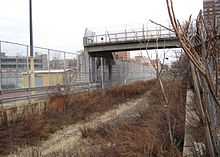
The Port Morris Branch began at a wye north of Melrose Station, then extended southeast through The Hub, through a tunnel under St. Mary's Park,[2] and finally Port Morris along the East River just after crossing a bridge beneath the Harlem River and Port Chester Branch of the New York, New Haven and Hartford Railroad. A connecting wye existed partially beneath the bridge lead to the New Haven Railroad-owned Oak Point Yard as well as the HR&PC itself. The only two stations along this branch were at Westchester Avenue between Brook and St Mary's Avenues and at Port Morris itself across the river from North Brother Island.[3] After the decline in rail service and the increase in poverty and rampant violence from the surrounding neighborhoods, this partly electrified branch was abandoned about 1999.[4] The Oak Point Yard remains just northeast of the site of the port, but an industrial track in the vicinity of the Port Morris station still survives.
Restoration was proposed in 2014, to connect the Metro-North Harlem line to an expanded LaGuardia Airport.[5]
Station list
The entire line is in Bronx County, New York, except for the realigned segment in Marble Hill, Manhattan. All stations between DV interlocking and Mott Haven Junction are read from north to south.
| Station | Miles (km) DV Interlocking |
Date opened |
Date closed |
Current connections / notes |
|---|---|---|---|---|
| For continuing service to Poughkeepsie and points north, see Hudson Line; For Amtrak service to Penn Station, see West Side Line | ||||
| Spuyten Duyvil | c. 1870s | |||
| Original line diverges; Junction with former Kingsbridge Freight Spur | ||||
| Kingsbridge[6] | c. 1870s | c. 1906 | ||
| Bridge under Broadway Bridge and IRT Broadway - Seventh Avenue Line | ||||
| Marble Hill | c. 1906 | Replacemet for Kingsbridge station; | ||
| Junction with Putnam Division (NYC) and original line | ||||
| Fordham Heights[7] | c. 1870s | Pre-1920 | ||
| University Heights | c. 1870s | |||
| Morris Heights | c. 1870s | |||
| Highbridge | c. 1870s | c. 1970s | Metro-North Employees Only. | |
| Sedgwick Avenue.[8] | 1918 | 1958 | Putnam Division and IRT Ninth Avenue Line only. | |
| Mott Haven Junction; SD&PM line turns north along Harlem Line | ||||
| Melrose | c. 1890[9] | |||
| Melrose Wye; Harlem Line diverges | ||||
| Westchester Avenue[10] | ||||
| West Junction with Oak Point Yard | ||||
| Bridge under Harlem River and Port Chester Railroad (NH) | ||||
| East Junction with Oak Point Yard | ||||
| Port Morris[10] | c 1850s | |||
References
| Wikimedia Commons has media related to Port Morris Branch. |
Route map: Bing
- ↑ The Harlem Division (New York Central System Historical Society)
- ↑ Port Morris Branch Tunnel Railway Gazette, Nov 10, 1905
- ↑ 1921 New York Central Map of New York City (Canada Southern Railway Page)
- ↑ Circumferential Subway route Michaelminn.net
- ↑ Leland, John (2014-11-09). "Thinking Big. Then Thinking Bigger.". The New York Times. p. MB1. Retrieved 16 April 2015.
- ↑ BotMultichill (1899). 1899 Home Life Map of New York City ( Manhattan and the Bronx ) - Geographicus - NYC-HomeLife-1899.jpg (map). Retrieved October 18, 2014.
- ↑ BotMultichill (1899). 1899 Home Life Map of New York City ( Manhattan and the Bronx ) - Geographicus - NYC-HomeLife-1899.jpg (map). Retrieved October 18, 2014.
- ↑ New York Central Hudson Division Sedgwick Avenue Station in Forgotten BronxTransit
- ↑ Melrose Station, in the late 1800′s
- ↑ 10.0 10.1 1921 New York Central Map of New York City (Canada Southern Railway Page)
_-_Geographicus_-_NYC-HomeLife-1899.jpg)
| ||||||||||||||||||||||||||