Springfield, Colorado
| Springfield, Colorado | |
|---|---|
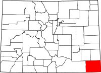
 Location in Baca County and the state of Colorado | |
| Coordinates: 37°24′24″N 102°37′2″W / 37.40667°N 102.61722°WCoordinates: 37°24′24″N 102°37′2″W / 37.40667°N 102.61722°W | |
| Country |
|
| State |
|
| County[1] | Baca County - seat[2] |
| Settled | 1888 |
| Incorporated | January 16, 1889[3] |
| Government | |
| • Type | Statutory Town[1] |
| Area | |
| • Total | 1.1 sq mi (2.9 km2) |
| • Land | 1.1 sq mi (2.9 km2) |
| • Water | 0 sq mi (0 km2) |
| Elevation[4] | 4,360 ft (1,329 m) |
| Population (2010) | |
| • Total | 1,451 |
| • Density | 1,292/sq mi (498.9/km2) |
| Time zone | Mountain (MST) (UTC-7) |
| • Summer (DST) | MDT (UTC-6) |
| ZIP code[5] | 81073 |
| Area code(s) | 719 |
| FIPS code | 08-73330 |
| GNIS feature ID | 0203868 |
| Website | City Website |
Springfield is a Statutory Town that is the county seat and most populous town of Baca County, Colorado, United States.[6] The population was 1,451 at the 2010 census.[7]
History
The town was named for Springfield, Missouri, the origin of early settlers to the town. According to the Plainsman Herald from March 1988, the town was settled in 1888 or 1889 by Frank Pierce Tipton (DPOB 10 December 1852, Gallipolis, Ohio) who had travelled to Springfield from Moulton, Iowa, via Springfield, Missouri, in 1886 or 1887 in a covered wagon. Frank Tipton secured the title to 80 acres (320,000 m2) which was the original town site.
Springfield is school district RE-4..
On May 18, 1977, an F4 tornado struck Springfield causing between 500,000 and 5 million dollars in damage. It tracked from Oklahoma, where damage was estimated between 5,000 and 50,000 dollars.[8] It was the only recorded F4 tornado in Colorado history.[9]
Geography
Springfield is located in north-central Baca County at 37°24′24″N 102°37′2″W / 37.40667°N 102.61722°W (37.406629, -102.617243).[10] It is located 20 miles west of Kansas and 20 miles north of New Mexico.
U.S. Routes 287 and 385 pass through the center of the town, leading north 47 miles (76 km) to Lamar, Colorado, and south 49 miles (79 km) to Boise City, Oklahoma. U.S. Route 160 passes just to the south of the town, leading west 120 miles (190 km) to Trinidad, Colorado, and east 50 miles (80 km) to Johnson City, Kansas.
According to the United States Census Bureau, the town has a total area of 1.1 square miles (2.9 km2), all of it land.[7]
Demographics
As of the census[11] of 2010, there were 1,451 people, 715 households, and 409 families residing in the town. The population density was 1,793.8 people per square mile (693.2/km²). There were 838 housing units at an average density of 962.4 per square mile (371.9/km²). The racial makeup of the town was 94.88% White, 1.15% Native American, 0.19% Asian, 2.56% from other races, and 1.22% from two or more races. Hispanic or Latino of any race were 5.83% of the population.
There were 715 households out of which 23.1% had children under the age of 18 living with them, 44.8% were married couples living together, 9.9% had a female householder with no husband present, and 42.7% were non-families. 38.6% of all households were made up of individuals and 20.6% had someone living alone who was 65 years of age or older. The average household size was 2.10 and the average family size was 2.80.
In the town the population was spread out with 21.4% under the age of 18, 6.7% from 18 to 24, 22.1% from 25 to 44, 23.7% from 45 to 64, and 26.2% who were 65 years of age or older. The median age was 45 years. For every 100 females there were 88.9 males. For every 100 females age 18 and over, there were 86.3 males.
The median income for a household in the town was $28,099, and the median income for a family was $34,107. Males had a median income of $25,385 versus $16,339 for females. The per capita income for the town was $13,890. About 14.4% of families and 16.8% of the population were below the poverty line, including 18.6% of those under age 18 and 17.8% of those age 65 or over.
Government
Mayor: Donald "Dusty" Turner. Town Manager: Merna McGinnis
City Council: Irv Maltbie, Jarod Summers, Marsha Elstob, Kim Shiplett, Travis Huff, Kevin Stolebarger, Dusty Turner.
Education
The Superintendent, and elementary principal is Richard Hargrove, and the High School principal is Kirk Salmela. The town has one library.
See also
- Outline of Colorado
- State of Colorado
- Colorado cities and towns
- Colorado municipalities
- Colorado counties
- Colorado cities and towns
- Springfield Schoolhouse
References
- ↑ 1.0 1.1 "Active Colorado Municipalities". State of Colorado, Department of Local Affairs. Retrieved 2007-09-01.
- ↑ "Colorado County Seats". State of Colorado, Department of Public Health and Environment. Retrieved 2007-12-31.
- ↑ "Colorado Municipal Incorporations". State of Colorado, Department of Personnel & Administration, Colorado State Archives. 2004-12-01. Retrieved 2007-09-02.
- ↑ "US Board on Geographic Names". United States Geological Survey. 2007-10-25. Retrieved 2008-01-31.
- ↑ "ZIP Code Lookup" (JAVASCRIPT/HTML). United States Postal Service. Retrieved 2008-01-04.
- ↑ "Find a County". National Association of Counties. Retrieved 2011-06-07.
- ↑ 7.0 7.1 "Geographic Identifiers: 2010 Demographic Profile Data (G001): Springfield town, Colorado". U.S. Census Bureau, American Factfinder. Retrieved September 26, 2013.
- ↑ http://www.tornadohistoryproject.com
- ↑ http://www.tornadohistoryproject.com/tornado/19770518.40.25
- ↑ "US Gazetteer files: 2010, 2000, and 1990". United States Census Bureau. 2011-02-12. Retrieved 2011-04-23.
- ↑ "American FactFinder". United States Census Bureau. Retrieved 2008-01-31.
External links
| Wikimedia Commons has media related to Springfield, Colorado. |
| |||||||||||||||||