Spodnji Log, Litija
| Spodnji Log | |
|---|---|
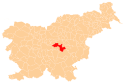
_location_map.svg.png) Spodnji Log Location in Slovenia | |
| Coordinates: 46°5′3.97″N 14°53′29.44″E / 46.0844361°N 14.8915111°ECoordinates: 46°5′3.97″N 14°53′29.44″E / 46.0844361°N 14.8915111°E | |
| Country |
|
| Traditional region | Lower Carniola |
| Statistical region | Central Slovenia |
| Municipality | Litija |
| Area | |
| • Total | 7.59 km2 (2.93 sq mi) |
| Elevation | 232.3 m (762.1 ft) |
| Population (2002) | |
| • Total | 224 |
| [1] | |
Spodnji Log (pronounced [ˈspoːdnji ˈloːk]; German: Unterlog[2]) is a village on the right bank of the Sava River in the Municipality of Litija in central Slovenia. The area is included with the rest of the municipality in the Central Slovenia Statistical Region. Traditionally it was part of the Lower Carniola region.[3]
References
- ↑ Statistical Office of the Republic of Slovenia
- ↑ Leksikon občin kraljestev in dežel zastopanih v državnem zboru, vol. 6: Kranjsko. 1906. Vienna: C. Kr. Dvorna in Državna Tiskarna, p. 92.
- ↑ Litija municipal site