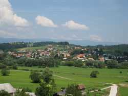
Spodnje Poljčane
| Spodnje Poljčane | |
|---|---|
 | |
_location_map.svg.png) Spodnje Poljčane Location in Slovenia | |
| Coordinates: 46°18′38.85″N 15°35′6.64″E / 46.3107917°N 15.5851778°ECoordinates: 46°18′38.85″N 15°35′6.64″E / 46.3107917°N 15.5851778°E | |
| Country |
|
| Traditional region | Lower Styria |
| Statistical region | Drava |
| Municipality | Poljčane |
| Area | |
| • Total | 1.32 km2 (0.51 sq mi) |
| Elevation | 258.3 m (847.4 ft) |
| Population (2002) | |
| • Total | 577 |
| [1] | |
Spodnje Poljčane is a settlement on the left bank of the Dravinja River in the Municipality of Poljčane in northeastern Slovenia. The area is part of the traditional region of Lower Styria. It is now included with the rest of the municipality in the Drava statistical region.[2]
A Neo-Gothic chapel with a small belfry was built in the settlement in 1938.[3]
References
External links
| ||||||||||||||||||
