Spodnja Gorica
| Spodnja Gorica | |
|---|---|
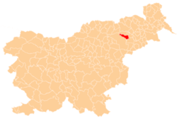
_location_map.svg.png) Spodnja Gorica Location in Slovenia | |
| Coordinates: 46°25′2.13″N 15°41′32.43″E / 46.4172583°N 15.6923417°ECoordinates: 46°25′2.13″N 15°41′32.43″E / 46.4172583°N 15.6923417°E | |
| Country |
|
| Traditional region | Lower Styria |
| Statistical region | Drava |
| Municipality | Rače-Fram |
| Area | |
| • Total | 4.02 km2 (1.55 sq mi) |
| Elevation | 253 m (830 ft) |
| Population (2002) | |
| • Total | 1,000 |
| [1] | |
Spodnja Gorica is a settlement in the Rače-Fram municipality in northeastern Slovenia. It lies on the flatlands on the right bank of the river Drava to the south of Rače. The area is part of the traditional region of Lower Styria. The municipality is now included in the Drava statistical region.[2]
The village chapel was built in 1924.[3] Traces of Neolithic, Bronze Age and Roman period settlements have been identified at excavations in the area of the village.[4]
References
- ↑ Statistical Office of the Republic of Slovenia
- ↑ Rače-Fram Municipality site
- ↑ Slovenian Ministry of Culture register of national heritage reference number ešd 24944
- ↑ Slovenian Ministry of Culture register of national heritage reference number ešd 15552 & 15555
External links
| ||||||||||||||||||