Spitak
- For the nearby village, see Spitak (village).
Coordinates: 40°50′14″N 44°16′03″E / 40.83722°N 44.26750°E
| Spitak Սպիտակ | |
|---|---|
 | |
 Spitak | |
| Coordinates: 40°50′14″N 44°16′03″E / 40.83722°N 44.26750°E | |
| Country | Armenia |
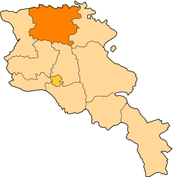
| Marz (Province) | Lori |
| Founded | 17th century |
| Government | |
| • Mayor | Gagik Sahakyan |
| Area | |
| • Total | 5.6 km2 (2.2 sq mi) |
| Elevation | 1,250 m (4,100 ft) |
| Population (2009) | |
| • Total | 15,100 |
| • Density | 2,700/km2 (7,000/sq mi) |
| Time zone | (UTC+4) |
| Website | official website |
Spitak (Armenian: Սպիտակ) is a town in the Lori Province at the northern part of Armenia. It was almost entirely destroyed as a result of the devastating 1988 earthquake, and was subsequently rebuilt in a slightly different location. Currently, the town has 15,100 inhabitants.
The word "spitak" means "white" in the Armenian.
Spitak was formerly known as Amamth and Hamamlu.
Gallery
-

Holy Resurrection Church of Spitak
-

The metallic church in Spitak cemetery
-

Spitak central square
-

Spitak town
See also
- 1988 Spitak earthquake
References
- Spitak at GEOnet Names Server
- Report of the results of the 2001 Armenian Census, National Statistical Service of the Republic of Armenia
- World Gazeteer: Armenia – World-Gazetteer.com