Spicers Peak
| Spicers Peak | |
|---|---|
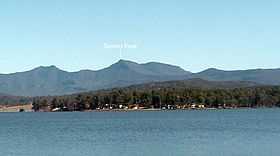 Main Range with Spicers Peak indicated | |
| Elevation | 1,205 m (3,953 ft) |
| Location | |
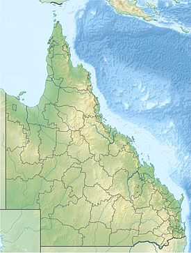 Spicers Peak South East Queensland | |
| Range | Main Range |
| Coordinates | 28°04′59″S 152°19′44″E / 28.08306°S 152.32889°ECoordinates: 28°04′59″S 152°19′44″E / 28.08306°S 152.32889°E |
Spicers Peak is a mountain in Australia. It lies roughly 120 km west of Brisbane in the middle of the Main Range National Park. It is just south of Cunninghams Gap and Mount Mitchell. Its summit height is approximately 1,205 metres (3953 ft).
The only known track to the summit is through private land. You can gain access with The Scenic Rim Trail by Spicers that provides a guided walk to the summit . The upper section of the Peak displays views as far back as Brisbane and encompasses a world heritage listed rainforest.
The name was given to the mountain by Allan Cunningham after Peter Spicer who was the Superintendent of convicts.[1] Spicer had noted the peak while searching for escaped convicts.
The peak is located just to the south of Spicers Gap which was once the main route between Brisbane and the Darling Downs.
See also
References
- ↑ "Main Range National Park: Nature, culture and history". Department of Environment and Resource Management. 1 April 2011. Retrieved 29 June 2011.