Spice Valley Township, Lawrence County, Indiana
| Spice Valley Township | |
|---|---|
| Township | |
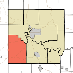 Location in Lawrence County | |
| Coordinates: 38°45′11″N 86°37′29″W / 38.75306°N 86.62472°WCoordinates: 38°45′11″N 86°37′29″W / 38.75306°N 86.62472°W | |
| Country |
|
| State |
|
| County | Lawrence |
| Government | |
| • Type | Indiana township |
| Area | |
| • Total | 71.25 sq mi (184.5 km2) |
| • Land | 70.34 sq mi (182.2 km2) |
| • Water | 0.91 sq mi (2.4 km2) 1.28% |
| Elevation | 650 ft (198 m) |
| Population (2010) | |
| • Total | 2,423 |
| • Density | 34.4/sq mi (13.3/km2) |
| ZIP codes | 47421, 47446, 47452, 47470 |
| GNIS feature ID | 0453863 |
Spice Valley Township is one of nine townships in Lawrence County, Indiana, United States. As of the 2010 census, its population was 2,423 and it contained 1,137 housing units.[1]
Geography
According to the 2010 census, the township has a total area of 71.25 square miles (184.5 km2), of which 70.34 square miles (182.2 km2) (or 98.72%) is land and 0.91 square miles (2.4 km2) (or 1.28%) is water.[1]
Unincorporated towns
- Bryantsville at 38°46′07″N 86°34′23″W / 38.768662°N 86.57305°W
- Georgia at 38°42′36″N 86°34′20″W / 38.710052°N 86.572215°W
- Huron at 38°43′20″N 86°40′14″W / 38.722273°N 86.670552°W
- Moorestown at 38°43′07″N 86°36′57″W / 38.718663°N 86.615828°W
- Williams at 38°48′16″N 86°38′50″W / 38.804495°N 86.647219°W
(This list is based on USGS data and may include former settlements.)
Cemeteries
The township contains these eight cemeteries: Brunner, Bryantsville, Burton, Cox, Georgia, Grodey, Huron and Tincher.
Major highways
Lakes
- Half Moon Lake
School districts
- Mitchell Community Schools
- North Lawrence Community Schools
Political districts
- Indiana's 4th congressional district
- State House District 62
- State Senate District 44
References
- "Spice Valley Township, Lawrence County, Indiana". Geographic Names Information System. United States Geological Survey. Retrieved 2009-10-08.
- United States Census Bureau 2008 TIGER/Line Shapefiles
- IndianaMap
- ↑ 1.0 1.1 "Population, Housing Units, Area, and Density: 2010 - County -- County Subdivision and Place -- 2010 Census Summary File 1". United States Census. Retrieved 2013-05-10.
External links
- Indiana Township Association
- United Township Association of Indiana
- City-Data.com page for Spice Valley Township
 |
Mitcheltree Township, Martin County | Indian Creek Township | | |
| |
Marion Township | |||
| ||||
| | ||||
| Halbert Township, Martin County | Northwest Township, Orange County | Orangeville Township, Orange County |